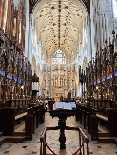
LOCATION: The Clarendon Way is a modern long‑distance footpath, devised in the 1980s by Hampshire and Wiltshire councils as a way of linking two of England’s great medieval centres: Winchester and Salisbury and starts/ends at their cathedrals.
I completed the walk in May 2026, and detailed it along with the stopover at The Boot Inn, Houghton.
DISTANCE: 26 miles / 42 km
SUMMARY: The Clarendon Way isn’t a medieval pilgrimage route — at least not in the formal, waymarked sense — but it does follow the natural corridor that medieval travellers, clergy, and royal messengers would have used between Winchester and Salisbury.
The modern Clarendon Way is a late‑20th‑century creation, stitched together from older paths to give a coherent cathedral‑to‑cathedral trail.
While not a rediscovered pilgrimage in the mould of the Camino or the Pilgrims’ Way, I suppose the route feels like a pilgrimage because:
-
Winchester was a major religious centre
-
Salisbury (Old Sarum, then the new cathedral) was another
-
Clarendon Palace sat between them as a royal administrative hub (it's little more than a field grazed by alpacas today!); and
-
The chalk ridge between the two cities has been a natural east–west corridor for centuries.
PUBS: In Houghton, The Boot Inn was my mid-point evening stop, with a garden that backs on to the River Test. Excellent pub, and handy for Stockbridge where I stayed overnight on this 2 day walk.
Broughton is another good mid-point, with the Tally Ho!, a community-run pub, and The Greyhound Broughton both very good, plus a brilliant village-run shop & cafe connected to the village hall.
Having had breakfast at the village shop in Broughton, lunch on Day 2 towards Salisbury was at The Lord Nelson at Middle Winterslow - great menu, and a pint of Directors!