

The George at Nunney, Nunney
Easy walking East Mendips trail past Nunney's Castle & Ducks, 3 miles

Try this Pub & Walk
The countryside south of Bath is yet another gorgeous slice of Somerset.
There’s money around — The Pig and Babington House see to that. I felt under-dressed just driving past.
Yet Nunney has its own quiet charm. There’s a hint of France about it — not quite baguette‑under‑the‑arm, but something more subtle.
The moated castle in the middle of the village helps. It looks like someone took the Bastille, shrank it in the wash, and plonked it down in Somerset.
The cottages and houses in the village, many of them several centuries old, have been restored with that enviable combination of sensitivity and expense that makes you mutter “must be nice inside” under your breath.
This circular pub walk from The George at Nunney is a gentle one, following Nunney Brook for half its length before looping back along the field edges to the northeast. As you leave the village it offers little glimpses of the village’s medieval past.
The highlight of my walk here was a pair of mad hares boxing in the March sunshine. It was a life affirming moment to witness. Naturally, they scarpered the moment I reached for my camera.
About The George at Nunney


Last visit: March 2026
The inn stands directly opposite Nunney Castle—a 14th-century moated fortress that dominates the old village.
It sits on the other side of Nunney Brook to The George and makes a distinctive backdrop to the beer garden. You can sit with a drink looking across at a medieval ruin reflected in a moat. Surely few pubs have such a theatrical setting.
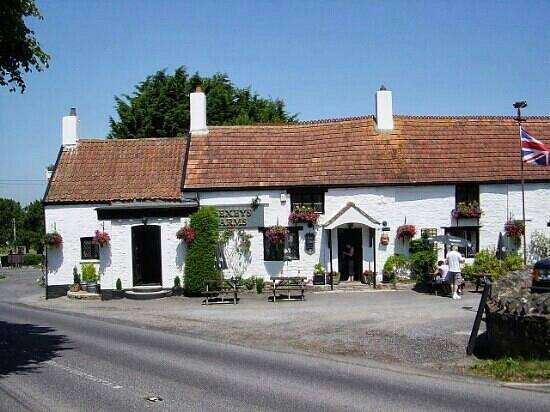
The George at Nunney must have been an old coaching Inn when it opened a few hundred years ago. You can imagine the horses, traps & carriages heading down Church Street, turning through its arch into what is now the pub car park.
I've never seen a pub sign straddling a street as it does here, like something out of a Western movie. This metal beam is one of the most striking and unusual features of The George.
Today it simply holds the pub sign—but in the 18th century, it served a far darker purpose.
According to local lore, this was the “hanging beam” used to dispatch the condemned after travelling judges held court inside the inn. The beam is real, listed, and part of the building’s official heritage.
Regardless of your criminal record, they still offer rooms today, at reasonable rates, and reasonably priced food too. There's a modern feel inside, although all the old features are there such as exposed stone walls, wooden floors, beamed ceilings and open fires. But it's almost entirely set up for diners rather than drinkers.
I liked it, and loved the village. The highlight was those hares!
Pub Key Information
| WEBSITE | https://www.thegeorgeinnnunney.com/ |
| ADDRESS | Church Street, Nunney, BA11 4LW |
| PHONE | 01373 836458 |
| WHAT3WORDS | ///cleansed.caravan.skillet |
| PARKING | Pub car park is Through the archway a little way along from the pub's front door. Street parking beyond the Church, and on the other side of Nunney Brook for the Castle. |
| LOCATION | Just West of Frome. Easy access from the A361 Frome to Shepton Mallet road. |
| HANDY FOR | East Mendip Way. The route follows a section of the Macmillan Way. |
Walk Overview
This peaceful, 3-mile route takes in some of the highlights of the village of Nunney, including the Market Cross, Nunney Castle, and Nunney Brook where ducks frequent the sloping stone banks that once served as the washing location for the clothiers in the village.
I witnessed the remarkable sight of Hares boxing in the March sunshine on this walk, an absolute privilege.
It's a simple walk in two parts: the first half follows the bank of Nunney Brook, returning to the village via fields for the second half.


Walk Key Information
| START/FINISH | The George, Church Street, Nunney, BA11 4LW. 01373 836458 |
| PARKING | Pub car park is through the archway a little way along from the pub's front door. Street parking beyond the Church, and on the other side of Nunney Brook for the Castle. |
| GRID REFERNCE | ST 737 457 |
| WHAT3WORDS | ///cleansed.caravan.skillet |
| DISTANCE/TIME | 3 miles / 5 km; approx 1 1/4 hours |
| ASCENT | 200 feet / 60 metres |
| PATHS/TERRAIN | The route is mainly grassy & sticky/muddy after rain, initially following the course of Nunney Brook, where tree roots are exposed, then onto paths along field margins on the way back to the village. |
| DIFFICULTY | Easy |
| PUBLIC TRANSPORT | 162 service between Frome & Shepton Mallett calls at Nunney Monday to Friday. Runs every couple of hours. |
| TOILETS | The George |
| OTHER PUBS TO VISIT | The White Hart Inn, Trudoxhill; The Talbot Inn, Mells; Seymour Arms, Witham Friary is a historic gem. Plenty of options in Frome. |
Walk Instructions: Choose what works for you
There are multiple ways to consume the route described below.
- Either follow the online Walk Directions below, or download and print a copy of the route.
- If you have the OS Maps App, you can follow a saved route directly in the OS App.
- Or download the GPX file for use with your chosen GPS-based tracker App, like Strava. Upload the file when you Create a New Route in the App.

Walk Directions
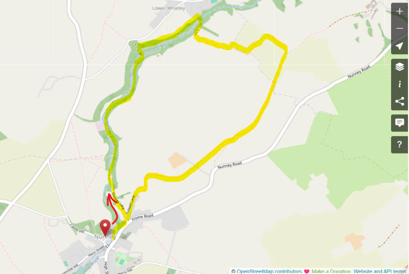
- Looking at The George, turn left down Church Street. You’ll soon pass the 13th Century All Saints Church, and a squadron of Mallards parked on the bank of Nunney Brook on the opposite side of the road. Study the Market Cross.
- Turn left signposted Donkey Lane and continue until this tarmac lane approaches Combe Farm. You’ll pick up a public footpath to the right-hand side, heading into a grassy area amongst trees.
- This leads to a path that follows Nunney Brook away from the village through its wooded valley. It’s been a dry few days as I walk this path and it’s still ‘sticky’ under foot. After heavy rain it would be very muddy, but I can see alternative paths created further away from the bank for such times.
- This path continues to its first crossing point over the Nunney Brook. Take this left hand turn over the little bridge and you’ll quickly spy a public footpath signposted to your right, now on the other side of the Brook. Take this path.
- Continue through this wooded valley. Eventually, the path takes you up a slope to an old stone bridge over the Brook. Follow this path over the bridge, then round to your right, uphill to some gates. You’re leaving the valley now and heading into fields to start the return journey to the village.
- You’ll see the footpath through a gate to your left. Follow the field boundary by the right-hand hedge/edge to the gate at the other end of this field #1.
- Through the gate into field #2 you cross to the left-hand hedge and continue a short way slightly uphill to a kissing gate through to the field #3.
- Bear right through this gate – the footpath is clearly visible – to the top of the field, then turning left to follow the hedge line across this field. You come to a boundary of multiple fields. You’re turning right in front of the tree stump in the picture, slightly downhill, following the hedge line of field #4.
- At the bottom of this field, cross a drainage ditch to bear right following a clearly marked path across the next field #5, now slightly uphill. Cross into field #6. Continue to the top end of this field.
- There are two gates here. You need the one on the left-hand side. Go straight on with the hedge on your right now, in penultimate field #7.
- Use a pair of kiss gates as you cross a farm driveway into field #8, the last field! You’ll soon see that the footpath enters a wooded passage between the fields.
- Follow this eventually turning right. Continue to the end of this section, exiting through a metal kiss gate to your right. This leads eventually back onto a tarmac drive to signal the arrival back in the village. Follow this Fulwell Lane as it rejoins Donkey Lane, then back onto Church Street.
- Finish the walk with a visit to Nunney Castle.
Additional Notes
The Castle that came down twice!
Nunney Castle is an oddity, and it rewards a moment's thought before you walk away from it.
Most English village castles occupy the high ground — the hill, the ridge, something defensible. This one sits in the lowest part of the village, next to the brook, surrounded by its moat.
The reason is that the church had already claimed the elevated position by the time Sir John de la Mare decided to build his castle, in 1373. So he took the low-lying site instead, dug a moat that is said to be among the deepest in England, and built something that looked like nothing else in Somerset.
De la Mare had made his fortune in France — not heroically on the battlefield, but practically, by capturing wealthy French noblemen during the Hundred Years War and ransoming them back to their families. He came home rich, sought royal favour from Edward III, and built himself a castle that made his wealth visible.
What he built was unmistakably French in character: four round corner towers capped with conical roofs, prominent machicolations, a tall elegant keep that Nikolaus Pevsner would later call the most impressive castle in Somerset. Whether he was consciously imitating the French designs he'd seen on his travels, or whether the resemblance is coincidence, apparently remains a matter of academic debate. What's certain is that standing before it in an English village, it still looks slightly out of place — which is presumably what Sir John intended.
The castle stood for nearly three centuries before its only siege. By the 1640s it was owned by Colonel Richard Prater, a Catholic and a Royalist, who garrisoned it as the Civil War turned against the King.
In September 1645, a Parliamentary army under Fairfax and Cromwell swept through Somerset — taking Sherborne, Cary and Shepton Mallet — before arriving at Nunney. Prater refused to surrender. He raised a flag bearing a Catholic crucifix so large it was reportedly taken to London and presented to Parliament as a trophy.
The castle's walls, eight feet thick but never designed to withstand artillery, lasted two days. A single cannon ball breached the north wall, the garrison surrendered, and Parliament had the castle scuppered to prevent its further use. The fireplaces were stripped out and installed in cottages around the village, where some reportedly remain.
After that, the castle did what ruined castles do: it decayed slowly and picturesquely. The walls still stood, the moat stayed full, the village built itself around it over the following centuries.
Then, on Christmas Day 1910 — 265 years after the siege — the north wall finally came down completely, collapsing into the moat. The castle had been damaged twice: once in a morning's bombardment in 1645, and once by the quiet persistence of time.
Before you leave the village, it's worth stepping into All Saints Church, just across from the pub. Sir John de la Mare is still there, lying in effigy in stone, six centuries after he built the strange French-looking castle on the low ground at the end of the lane. He looks composed. He has a moat.
Other Pub Walks to try in Somerset

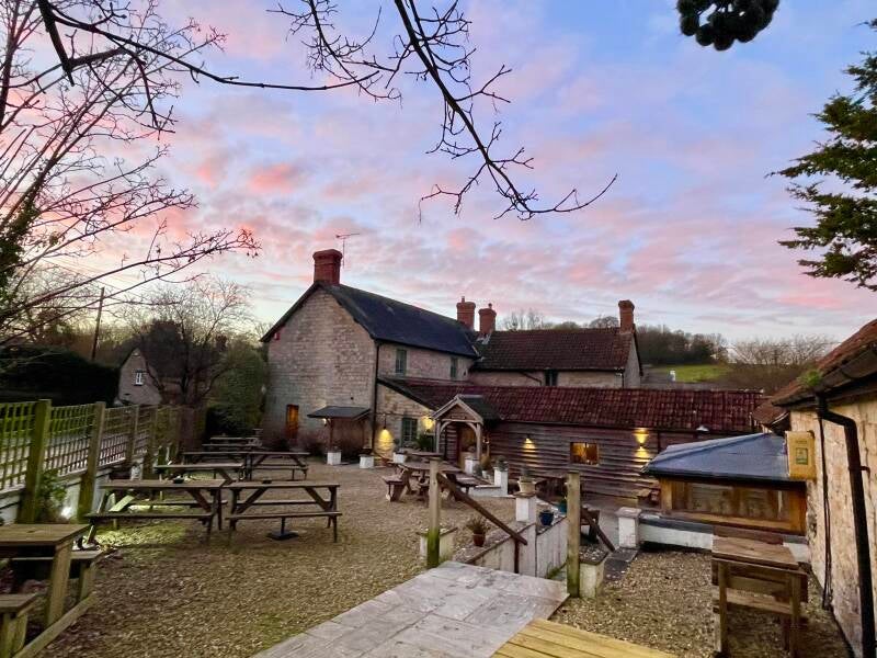
Forest & farmland tracks near Taunton and an award-winning country pub.
5.5 miles