The Shipwrights Arms, Helford
Helford Pub Walk – From Shipwrights to Scientists: A River of Discovery, 5.2 miles

Try this Pub & Walk
Reaching the quiet village of Helford on the southern bank of the Helford River requires commitment. You can cross the water by small ferry from Helford Passage, or take the winding lanes around Helston and Culdrose before descending through some of Cornwall’s most rural countryside. It is not a place you pass through by accident.
Yet those who make the journey discover one of Cornwall’s most remarkable landscapes.
The Helford is not a dramatic Atlantic coastline of towering cliffs and crashing waves. It is something much more intimate: a drowned river valley where woodland, creeks, farmland and tidal waters combine to create a landscape that has shaped human activity for thousands of years.
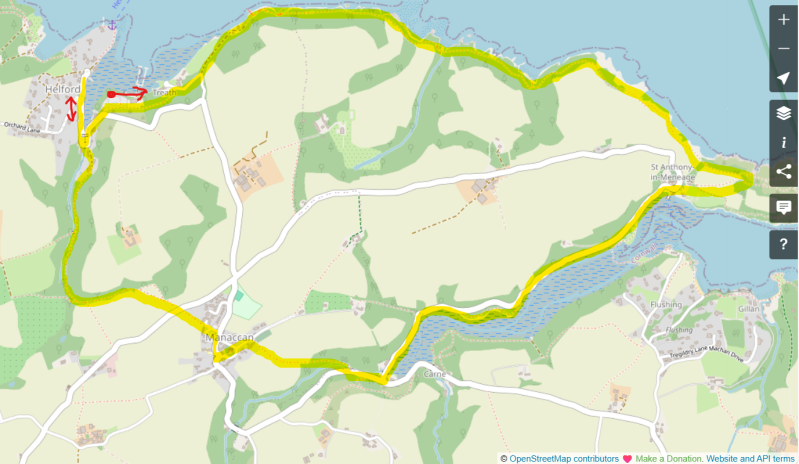
This circular walk explores that relationship between people and place. From Helford, the route follows the coast path eastwards towards St Anthony-in-Meneage and Gillan Harbour, before climbing through the countryside around Manaccan and returning through the ancient woodland of Under Wood.
Along the way, stories emerge everywhere: a church linked to medieval sailors, a Royalist stronghold from the Civil War, the discovery of the element titanium, ancient woodland, hidden creeks and the extraordinary ecology of the Helford River itself.
Afterwards, The Shipwrights Arms provides the perfect place to reflect on a landscape where boats, people and the river have always been intertwined. It's one of Cornwall's most atmospheric waterside inns.
About The Shipwrights Arms, Helford


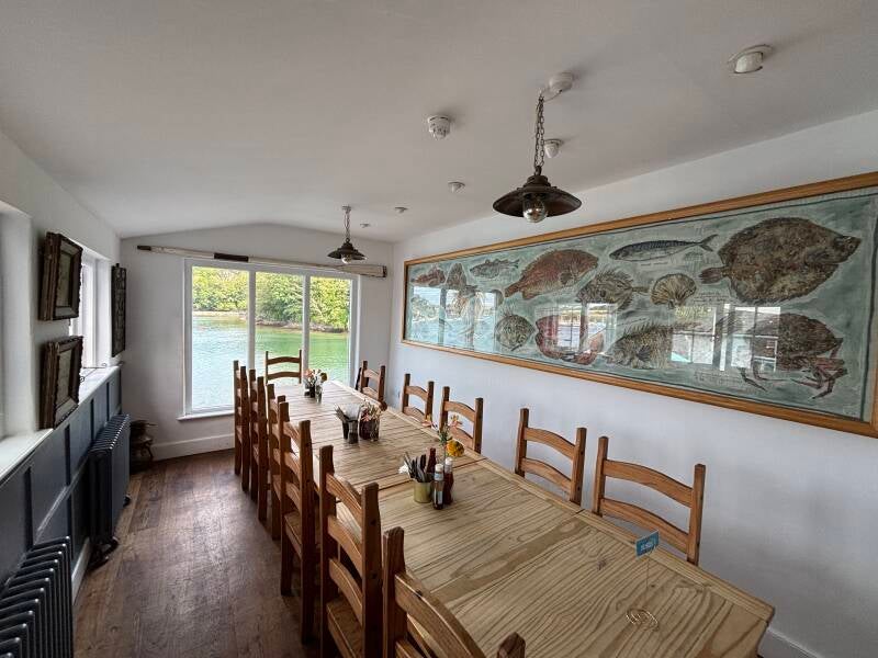

Last visit: July 2026
The Shipwrights Arms is exactly the kind of pub you hope to discover at the end of a walk like this.
Standing beside the Helford River, overlooking one of Cornwall’s most beautiful estuaries, it feels connected to the landscape around it. The name itself tells a story. Shipwrights were the skilled craftsmen who built and repaired boats, and in a river community shaped by maritime trade, ferries and fishing, it is a name that belongs here.
Today, the pub combines that heritage with a more modern role as a destination for locals and visitors alike. Following its change of ownership, with investment from Rufus Taylor, son of Queen drummer Roger Taylor, the pub has been carefully developed while retaining its connection with the village and the river that surrounds it.
The attraction is not celebrity association, however. It is the setting, the atmosphere and the experience.
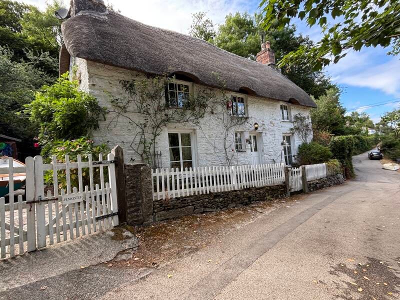
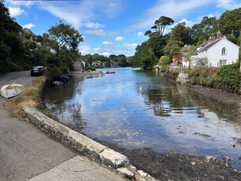
The Shipwrights Arms makes the most of its extraordinary position, with views across the Helford and a waterside setting that encourages visitors to slow down and enjoy where they are. The gallery images tell the story clearly: this is a pub designed around its location, where the river is part of the experience rather than simply a backdrop.
It feels like a natural meeting point after exploring the Helford landscape — somewhere to enjoy good food, a drink and the satisfaction of having discovered somewhere special.
Pub Key Information
| WEBSITE | https://www.shipwrights-helford.co.uk/ |
| ADDRESS | The Shipwrights Arms, Helford, TR12 6JX |
| PHONE | 01326 231 235 |
| WHAT3WORDS | ///touchy.untruth.hotspots |
| PARKING | Use the village car park on the right at the entrance to the village and walk the last 500 metres. |
| LOCATION | Helford lies on the southern bank of the Helford River, to the east of Helston. |
| HANDY FOR | The Lizard; South and West Cornwall |
Walk Overview
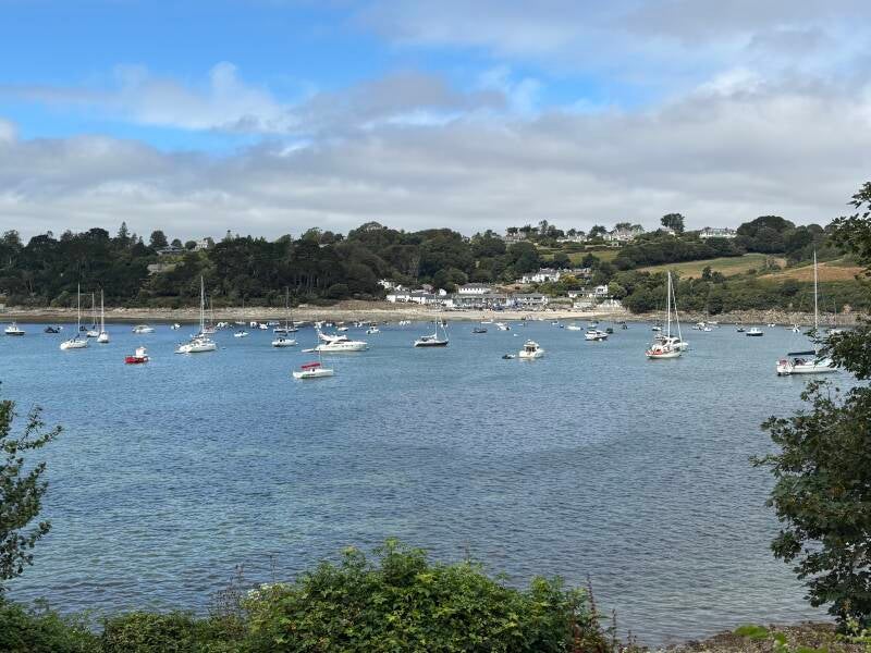
This circular walk explores one of Cornwall’s most quietly remarkable landscapes, where the Helford River has shaped settlement, industry and nature for centuries.
Leaving Helford, the route follows the coast path eastwards through the sheltered landscape of Bosahan and Ponsence Coves before reaching St Anthony-in-Meneage and Gillan Harbour. Here, ancient woodland, tidal creeks and maritime history come together, with the route continuing inland towards Manaccan — a village with an unexpected place in scientific history.
The return journey passes through peaceful countryside and the beautiful wooded valley of Under Wood before descending back towards the Helford River.
Along the way, the stories gradually emerge: medieval sailors, Civil War loyalties, estate landscapes, the discovery of titanium and the remarkable ecology of one of Cornwall’s most protected estuaries.
A walk that rewards curiosity as much as effort.




Walk Key Information
| START/FINISH | Helford village car park. The coast path towards St Anthony-in-Meneage starts at the entrance to the car park. |
| PARKING | Large payable car park is well signposted as you enter Helford from the south. |
| GRID REFERENCE | SW 759 261 for the car park. |
| WHAT3WORDS | ///cupboards.hopes.listen for the entrance to the car park. |
| DISTANCE/TIME | 5.2 miles / 8 km; approx 2.5 hours |
| ASCENT | 840 feet / 260 metres |
| PATHS/TERRAIN | Quiet lanes, woodland paths, field paths some with livestock. |
| DIFFICULTY | Easy to moderate. |
| PUBLIC TRANSPORT | Some bus services between Helston and St Keverne cover Helford and Manaccan. Services from Falmouth and Helston cover Helford Passage on the other side of the River Helford, connected via a passenger ferry service. |
| TOILETS | At the car park at Helford; the walk passes near to the New Inn at Manaccan. The unexpected cafe at St Anthony-in-Meneage might also have a loo. |
| OTHER PUBS TO VISIT | The New Inn at Manaccan, a community-owned pub. Across the Helford River by passenger ferry is the Ferry Boat Inn at Helford Passage. You may have passed The Prince of Wales at Newtown St Martin a few miles outside Helford. |
Walk Instructions: Choose what works for you
There are multiple ways to consume the route described below.
- Either follow the online Walk Directions below, or download and print a copy of the route.
- If you have the OS Maps App, you can follow a saved route directly in the OS App.
- Or download the GPX file for use with your chosen GPS-based tracker App, like Strava. Upload the file when you Create a New Route in the App.

Walk Directions
- Large parking area and public toilets on the way into Helford. There’s an entrance to Helford Sailing Club here too. The Coast Path footpath Eastward towards St Anthony-in-Meneage runs just the other side of the hedge on the lane that leads to the sailing club. Access to the footpath is near the car park entrance.
- After this short initial section, the path drops out of the wooded area and onto a tarmac lane. Turn right and head gently uphill to rejoin the footpath straight ahead at the top. The coast path signposts are clearly visible.
- The route is straightforward for most of the way, running through woodland almost entirely from here to St Anthony-in-Meneage. This narrow strip of ancient woodland separates the coast from fields above the estuary. You’ll notice that an incredible number of trees have been blown down in winter storms, but the path maintainers have re-routed where necessary.
- The coast path has permissive rights across one section - the land of the Bosahan Estate where it crosses behind Bosahan Cove and Ponsence Cove, hidden gem beaches which the estate also owns. The estate used to open its exotic gardens to the public, but not currently.
- At one point the path drops down onto the beach through undergrowth, and almost immediately routes back off the beach through more undergrowth. It’s certainly manageable. Turn left to continue on the path, before the ‘Bosahan Estate Private Woodland’ sign.
- The path emerges into fields on the approach to the headland above St Anthony, called Dennis Head. The ‘Little Dennis’ hill fort was here, especially significant for Cornish Royalists in the times of the Civil War.
- There’s an option to follow a signpost diagonally and downhill across a field in the direction of St Anthony’s Church.
- Go through a farm gate to exit the field and make your way downhill towards the creek. Visit St Anthony Church, if open. It includes a wooden carving of the Last Supper, and a cat flap! There’s a small cafe on the beach, and a boatyard.
- Follow the quiet road alongside Gillen Creek away from the village, with the church on your right. This is a peaceful area.
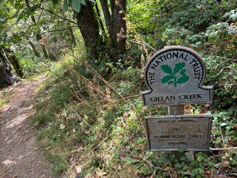
- Continue until a coast path footpath & National Trust sign guides you down towards the Creek. It’s a pretty woodland path that avoids section of the lane, rejoining it until you reach the end of the creek, past Carne Mill.
- At a junction, turn right for Manaccan.
- And this is where I saw the kingfisher, quick as a flash, fishing the stream on your right-hand side as you walk up the road!!! Brilliant.
- Ahead you come to a footbridge over the stream, that leads into woodland. Follow this path until it emerges into fields, following the clear path along the field boundary.
- Emerge onto a road in the village of Manaccan, and turn left towards the Church. The entrance to the Church Yard is immediately ahead of you. When you enter the Church itself, you’ll be amazed to discover that Titanium was initially found at Manaccan in 1791! Information inside the church shares the story, which I’ve also referenced in the Notes section.
- Continue through the church yard to the exit on the other side and proceed to the road. The New Inn pub is to the left. Our route continues gently uphill to the right, passing Manaccan Primary School.
- Take a left hand turn in front of the bus stop, on Minster Meadow. Pay attention here – the footpath runs alongside a wooden garden fence to the left of the hedge in front of you, then enters a field beyond, leaving the village.
- The path through the field is clear. It emerges onto a road, it’s quiet but take care. Cross straight over and go left slightly to find a passage into the next field on the other side of the road. Go straight across this field, then bear left to follow the clear field path diagonally into the field’s corner.
- The field path exits into woodland on what feels like an ancient track with granite slab steps and field barriers. This is Under Wood, and it leads all the way back to Helford.
- The path finally arrives at village houses, and exits the woodland onto a concrete driveway, steeply downhill so take care.
- At the bottom, with the creek in front of you, bear left to follow the village road all the way to The Shipwrights Arms. The car park is a few hundred metres the other way.
Additional Notes
The Helford River – A Landscape Shaped by Water
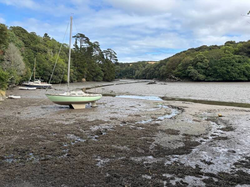
At first glance, the Helford appears to be a beautiful Cornish river. In reality, it is something much more unusual: a ria, a drowned river valley created when rising sea levels flooded an ancient landscape after the last Ice Age.
The result is a sheltered marine environment where wooded valleys, tidal creeks and open water meet. The Helford is not simply a river flowing towards the sea; it is a network of channels and inlets where the sea reaches deep inland.
That geography explains everything about this landscape.
The sheltered waters created safe anchorages for boats, encouraged fishing and boatbuilding, and allowed communities to develop along its banks. The same conditions that attracted people centuries ago now support an exceptional variety of wildlife.
The Helford Voluntary Marine Conservation Area forms part of the wider River Fal and River Helford Special Area of Conservation. The estuary and surrounding coastline are protected because of their scientific importance, scenic beauty and role as a habitat for marine life and birds.
This is a landscape where human history and natural history are inseparable.
Little Dennis – A Royalist Stronghold Above the Helford
The headland above St Anthony-in-Meneage, marked on modern maps as Little Dennis, carries a much older name: Dinas.
The Cornish/Celtic word dinas means a fortified place, and the location explains why. From this high point there are commanding views over the entrance to the Helford River and towards the approaches from Falmouth. In an age when rivers were important routes for trade, communication and military movement, this was a strategically valuable position.
The headland was already fortified in prehistoric times, with evidence of an Iron Age settlement, but it gained renewed importance during the English Civil War.
Cornwall was one of the strongest Royalist counties in England, and when the county declared for King Charles I, local landowners played an important role in defending the cause. Sir Richard Vyvyan of Trelowarren, one of Cornwall’s leading Royalists, strengthened the fortification at Dinas at his own expense.
It was not a great fortress like Pendennis Castle at Falmouth, but it was a local defensive position created by a community determined to support the Crown.
Standing on the headland today, the geography explains its importance. Behind lies the countryside of the Meneage; ahead lies the entrance to the river and the open sea. As Royalist resistance weakened elsewhere, places like Dinas represented the shrinking ground on which Cornwall’s loyalty to the King was defended.
Cornwall’s Royal Declaration of Thanks
The Civil War story continues inside Manaccan Church.
The Royal Arms of Charles I remain on display, a rare survival from a period when many such symbols were removed or destroyed. Nearby is a copy of the Royal Declaration of Thanks issued by Charles I from Sudeley Castle on 10 September 1643.
The letter was the King’s acknowledgement of Cornwall’s loyalty and courage during the Civil War. It was ordered to be read aloud in Cornish churches and chapels and preserved in print, ensuring that future generations would remember the county’s support for the Crown.
The connection between Little Dennis and Manaccan Church creates a remarkable walking story: a fortified headland where loyalty was defended, and a church where that loyalty was remembered.
The Bosahan Estate – Gardens, Families and the Helford Landscape
The landscape between Helford and St Anthony has been shaped by centuries of estate ownership.
The Bosahan estate was associated with the Grylls family from the eighteenth century before passing into the ownership of the Vyvyan family, one of Cornwall’s oldest and most influential families.
These were not simply wealthy families occupying country houses. Estates such as Bosahan shaped the countryside around them through woodland planting, farms, cottages, gardens and access routes.
Bosahan House and its gardens developed during the nineteenth century, taking advantage of the exceptionally mild climate created by the sheltered Helford valleys. Like nearby Trebah and Glendurgan, the garden was planted with exotic species that could thrive in Cornwall’s unique conditions, including tree ferns, rhododendrons, magnolias and camellias.
Where Trebah and Glendurgan became famous public gardens, Bosahan remained a much quieter and more private landscape. The permissive path through the estate used on this walk provides a glimpse into this hidden corner of Cornwall, where gardens, woodland and river meet.
St Anthony-in-Meneage – A Church by the Creek
The name Meneage is thought to derive from the Cornish meaning “land of monks”, reflecting the area’s ancient religious connections.
St Anthony-in-Meneage Church occupies a beautiful and secluded position beside Gillan Harbour. Its location beside the tidal creek reflects the close relationship between faith and the sea in coastal Cornwall.
Local tradition links the church with sailors and maritime activity, reinforcing a theme that runs throughout this walk: the Helford was never a barrier separating communities, but a route connecting them.
Manaccan and the Discovery of Titanium
Manaccan’s contribution to scientific history is remarkable.
In 1791, the Reverend William Gregor, the parish priest, identified a previously unknown mineral while investigating black sand deposits from a stream near Tregonwell Mill.
He named the substance manaccanite.
A few years later, the German chemist Martin Heinrich Klaproth independently identified the same element and named it titanium — the name that eventually became accepted worldwide.
It is extraordinary that a small Cornish parish gave its name, albeit temporarily, to an element that would become vital in modern technology, aerospace and engineering.