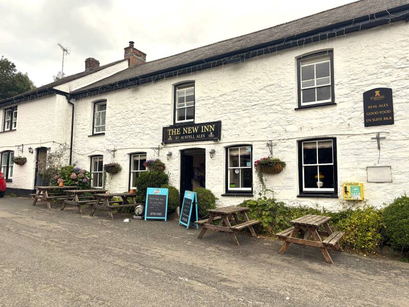
The New Inn, Veryan
Veryan & Portloe Pub Walk – Ancient Landscapes, Coastal Legends and Hidden Histories, 6.3 miles
Try this Pub & Walk
Veryan is one of Cornwall's most distinctive villages, but this walk reveals that there's far more to the parish than its famous round houses.
Within a few miles you'll discover Bronze Age burial mounds, the legendary resting place of a Cornish king, the earthworks of a Norman castle, dramatic cliffs overlooking Gull Rock and the picturesque fishing village of Portloe. Along the way you'll also uncover the remarkable legacy of the Trist family, three generations of Vicars who believed that a parish could always be improved, leaving an imprint on Veryan that is still visible today.
The New Inn is a fitting place to begin and end that journey.
Standing opposite the church at the heart of the village, it remains exactly what a village local should be: welcoming, unpretentious and firmly rooted in its community. After a day exploring one of Cornwall's most fascinating parishes, you'll find good honest food, friendly faces and, in cooler months, a warm fire waiting at the finish.
About The New Inn, Veryan

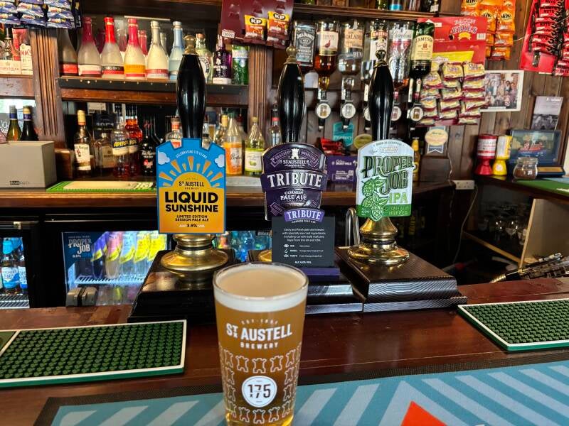

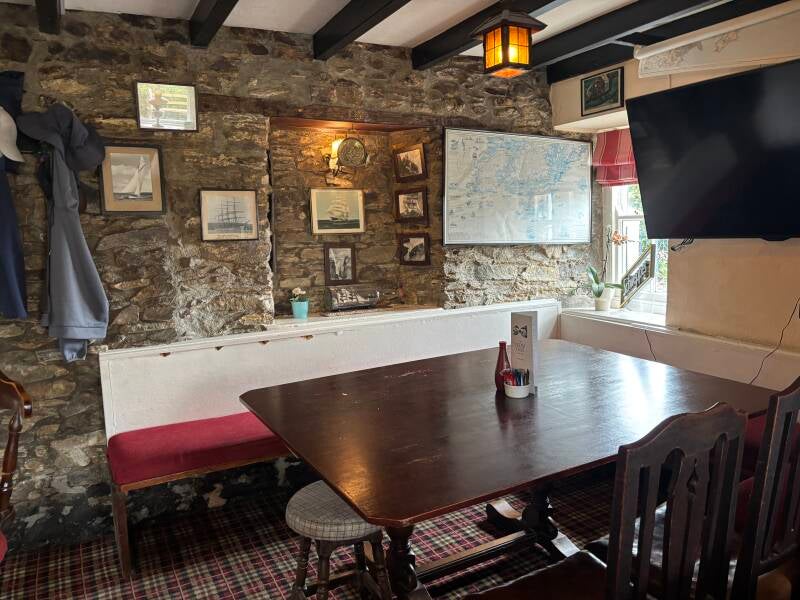
Last visit: July 2026
The New Inn is a village pub in the truest sense of the word.
Standing opposite St Symphorian's Church in the heart of Veryan, it occupies a central place in village life. Today, that role is in the hands of Bobby and Kara, who took on their first pub together in November 2024. They have embraced what The New Inn is rather than trying to turn it into something it isn't: a welcoming local serving both the community and visitors exploring the Roseland Peninsula.
Kara's warmth and hospitality immediately stand out. She has the natural ability to make visitors feel comfortable, while clearly understanding that a village pub survives through its regulars. During my visit, many tables were already reserved, always a reassuring sign that local people continue to support the pub.
The menu reflects a clear sense of purpose. While some pubs in Cornwall have developed into destination restaurants, The New Inn has chosen a different route, focusing on well-cooked pub classics at sensible prices. It is food designed to encourage people to return regularly, not simply for a special occasion.
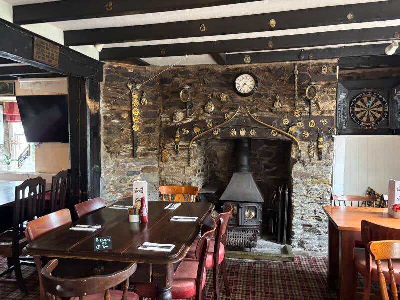
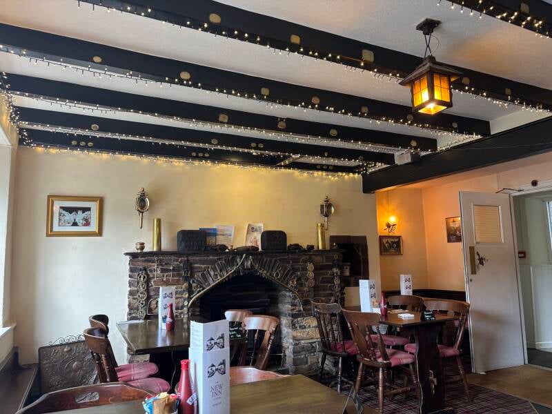
Inside, the long single-room bar has the feel of a traditional Cornish local. Nautical memorabilia and horse brasses reflect the parish's farming and fishing heritage, while two fireplaces, including an impressive log burner, create the sort of atmosphere that makes winter evenings in a village pub so important.
The New Inn may not be a destination dining venue, but that is not its role. Its value lies in being exactly what Veryan needs: a friendly, affordable village pub where locals and walkers can share good food, good conversation and a genuine welcome.
Pub Key Information
| WEBSITE | https://www.thenewinnveryan.co.uk/ |
| ADDRESS | The New Inn, Century Lane, Veryan, TR2 5QA |
| PHONE | 01872 501362 |
| WHAT3WORDS | ///owner.sidelined.recovery |
| PARKING | Limited on-street parking. There's a small parking area just below the war memorial. |
| LOCATION | Veryan lies in a part of Cornwall known as the Roseland peninsula. It's a strip of land lying to the south of Truro, and is bordered by the estuary of the River Fal to the west. St Mawes is the most significant village. |
| HANDY FOR | Truro; St Mawes; The King Harry Ferry; Mevagissey; Trelissick Garden |
Walk Overview
Beginning beside St Symphorian's Church, this route immediately reveals the character of Veryan. The village well and famous round houses reflect the influence of the Trist family, whose improvements shaped much of the settlement during the eighteenth and nineteenth centuries.
Leaving the village towards Pendower, the route crosses the ancient landscape of Carne, to Carne Beacon, the barrow traditionally associated with Gerennius, a legendary King of Cornwall, hinting at a much older past.
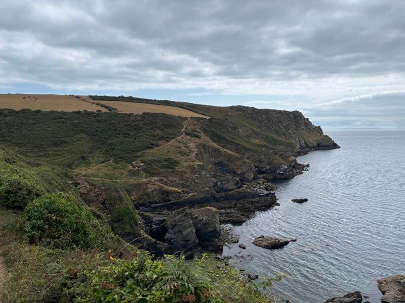
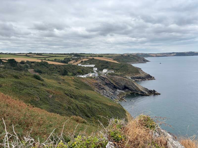
The route joins the South West Coast Path and the dramatic headland of Nare Head. Here, the views across Gerrans Bay are magnificent, with Gull Rock standing offshore—a beautiful landmark with a dangerous history.
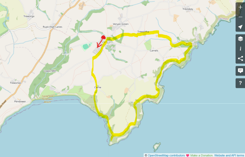
Following the coast to Portloe, the route reveals the maritime character of the Roseland Peninsula, before turning inland through peaceful farmland and returning to Veryan.




Walk Key Information
| START/FINISH | Veryan. Small wooded car park below Veryan Church & War Memorial. |
| PARKING | As above. Parking options are limited to street parking in the village, though not much of it. On street outside the New Inn is an alternative. |
| GRID REFERENCE | SW 916 396 for the parking area |
| WHAT3WORDS | ///dizziness.shortcuts.update for the parking area. |
| DISTANCE/TIME | 6.3 miles / 10 km; approx 3 hours |
| ASCENT | 1200 feet / 370 metres |
| PATHS/TERRAIN | Quiet country lanes, fields, and coast path. Gates and stiles. Might be livestock in some fields. Some steep sections. |
| DIFFICULTY | Moderate. |
| PUBLIC TRANSPORT | Buses every few hours to/from St Austell direction, except Sundays. |
| TOILETS | In The Square at Veryan, and at Portloe. |
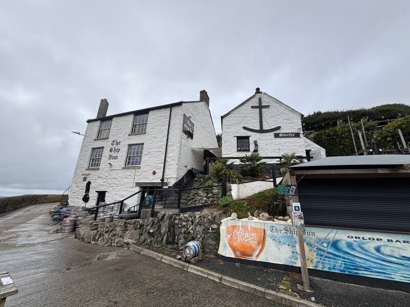
| OTHER PUBS TO VISIT | The route passes The Ship at Portloe, a community-owned pub. The Barley Sheaf at Gorran, near Mevagissey is excellent. |
Walk Instructions: Choose what works for you
There are multiple ways to consume the route described below.
- Either follow the online Walk Directions below, or download and print a copy of the route.
- If you have the OS Maps App, you can follow a saved route directly in the OS App.
- Or download the GPX file for use with your chosen GPS-based tracker App, like Strava. Upload the file when you Create a New Route in the App.

Walk Directions
- Start from the small wooded parking area just below the church. There are toilets across the road on ‘The Square’, opposite the Primary School. The well was installed by Rev Samuel Trist, the third generation of Trist’s to run Church matters in the village, in the days when houses didn’t have their own water, and in 1913 it was restored by his son – Pendarves Trist – to commemorate the coronation of their majesties George V and Queen Mary.
- There’s a red phone box to the side of the toilets in The Square, take the lane to the side of it, with the phone box on your left as you proceed gently uphill. Continue, following the sign for Pendower on Tollyfrank Hill. Pendower is the name of the beach about 1.5 miles down the lane. It joins with Carne beach to create a mile long south facing beach across Gerrans Bay. The Nare is a 5-star country house hotel at Carne Beach. We turn off before reaching it!
- There are five round houses in Veryan, you’ll pass between Roundhouse East (a holiday let called Chyrond) and West at the top of the hill, built by Jeremiah Trist in c.1816-1818.
- Continue ahead, on your way out of the village. Pass Leonards Boatbuilding at Churchtown Farm, then 25m further on look for a footpath sign to the left. Take the steps and stile into the field and follow the left-hand hedge on a well-marked path to a metal farm gate.
- Exit the field with a tarmac lane in front of you. Immediately see a footpath sign to the left before the lane, into another field via steps and a stile. This is the area of the Parish known as Carne. In a field to the right of you is the site of the old Veryan Castle, with some earthworks providing the evidence of its location overlooking Gerrans Bay.
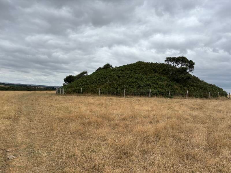
- In front of you in this field is a barrow - Carne Beacon - in which Gerennius (or Gerrans), a mythical king of Cornwall, was said to have been buried many centuries ago, with his crown on his head, lying in his golden boat with silver oars. It was opened in 1855 when nothing but a kistvaen (a rude stone chest) containing his ashes was found. More recently, the barrow was used as a beacon and as an observation post during World War II. The remains of the observation post remain as a concrete platform.
- The distinct path diagonally across the field to and past Carne Beacon lead to the exit from the field by steps. Continue straight ahead on a lane, and at the junction continue ahead where a sign says ’no access to Nare Head’, which isn’t true since this route takes you to Nare Head.
- Soon a footpath sign shows itself, guiding you on the lane past Beacon Cottage on the right. The lane approached a private garage with a wooden door, and then a house called ‘The Cottage’. Continue past it onto a grass path, and within c.10 metres, take the path to the left.
- Continue all the way down until you meet the South West Coast Path (SWCP) at a low earthen wall. Continue ahead over the wall.
- From here, there are SWCP signs and a clear route all the way to Portloe.
- Take the opportunity to explore the ‘side shoot’ paths to get a better view of Nare Head and Gull Rock, although the route offers plenty of vantage points for the latter. Gull Rock is located just under half a mile off Nare Head. It is a birdwatcher's paradise, and a nightmare to the odd mariner who has run aground on it. Perhaps the best-known shipwreck here is the German steel barque Hera, wrecked in 1914. Out of a crew of 24 only 5 survived long enough in the freezing conditions to be rescued by the Falmouth lifeboat. Those who didn't make it are buried in Veryan churchyard.
- Upon reaching Portloe, take time to explore – The Lugger on the slipway is a highly regarded small hotel that serves food. For the return route to Veryan, leave the SWCP at the slipway to head uphill on the lane, bear left to head in the direction of The Ship, which is well signposted throughout the village. It closed last year, but the local community intervened to buy it and got it back open in time for Christmas. Give it a go!
- Continue uphill, amongst houses in the upper part of Portloe, called Sunny Corner, until you see a footpath sign for Veryan to the right. This takes us in the direction of Trewartha Hall Farm.
- Turn off the road through the village, then turn immediately left to pass in front of a house. You’ll see an old metal gate ahead, which requires you to pass in front of the next house along too.
- Go through the gate into the field, then follow the hedge line on the left initially. The path in the field is clear, but the route soon cuts straight across the field to a small stone wall, which includes a stile, just below a telegraph pole.
- Climb over into the next field and follow it gently uphill with the hedge boundary on your left. Exit the field through a metal farm gate and proceed through the farmyard of Trewartha Hall Farm, then turn right to head up the drive.
- Ignore footpath signs off this lane at a little cluster of houses called Trewartha, and continue straight ahead, up to a junction where the drive meets a slightly bigger road with houses opposite.
- Cross over and head to the left. Take the lane to the side of Pencarrow Barn, passing the converted Trewartha Chapel (‘Eglos Coth 1826’). Continue straight ahead down a grass track through two metal farm gates into a livestock field, close now to Veryan.
- Exit the field through gate into a copse, then ahead into another livestock field towards the village. The path downhill is clear, heading diagonally to the corner. Exit the field, pass the play area, and enter the part of Veryan known as the water gardens, a gift to the Parish in 1931. The pond was described in old records as the old swan pond, a reference to the name of the local manor to which much of the parish once belonged – Elerky, which in Cornish means swannery, Take time to admire the bridges.
- Continue ahead past the pond, then turn left. You’ll recognise this as your starting point. The church is to your left, along with the War Memorial, and a little further ahead is the New Inn.
Additional Notes
The Trists of Veryan
Few families can have shaped a Cornish village quite as profoundly as the Trists shaped Veryan.
For around seventy years, three generations served as successive Vicars of the parish. John Trist arrived in 1772, his son Jeremiah succeeded him in 1782, and on Jeremiah's death in 1829 the role passed to his son Samuel. Their combined ministry spanned a remarkable period of continuity, during which each sought to improve the parish they had inherited.
John laid the foundations, planting many of the trees that still soften the village today and adding two bells to the church. Jeremiah possessed an extraordinary breadth of interests. As well as his pastoral duties, he established parish schools, improved the church, built his own residence at Parc Behan when the old vicarage proved inadequate, and between 1816 and 1818 commissioned the five iconic round houses that have become the symbol of Veryan.
Historic England records that they were built by the Lostwithiel builder Hugh Rowe, while the familiar stories that they were intended to keep the Devil from hiding in corners have become part of Cornish folklore.
Jeremiah's interests extended far beyond architecture.
He encouraged agricultural improvement through better drainage and the use of lime to enrich the soil, believing that practical innovation could improve both farming and the lives of his parishioners.
His enquiring mind is perhaps best illustrated by events in 1798. During the invasion scare prompted by the wars with Revolutionary France, the Government required vulnerable coastal parishes to prepare emergency plans. Jeremiah responded by compiling an astonishing inventory of the parish's people, livestock, boats, carts, horses, tools and weapons before producing a detailed evacuation strategy in the event of a French landing on the Roseland Peninsula.
It provides a remarkable snapshot of life in Veryan at the close of the eighteenth century.
Samuel Trist continued the family's work after succeeding his father in 1829, overseeing the restoration of St Symphorian's Church in 1847 and maintaining the tradition that the parish should continue to improve rather than simply preserve.
Although the line of Trist vicars ended with Samuel, the family's affection for Veryan did not. In 1913, Pendarves Trist restored the village well that Samuel had originally installed to provide fresh water for local people before homes had their own supplies. The restoration commemorated the coronation of King George V and Queen Mary, but it also served as a quiet tribute to the generations of his family whose vision had helped shape the village.
Visitors inevitably remember Veryan for its delightful round houses, yet they represent only one chapter in a much bigger story. The village's distinctive character is the legacy of three generations who believed that a parish could always be left a little better than they found it.
Nare Head – A Coastline Prepared for War
The dramatic views from Nare Head reveal little of the military history hidden beneath the grass and cliffs. Yet this exposed headland formed part of Britain's preparations for war during the twentieth century, protecting one of Cornwall's most strategically important ports.
Falmouth, only a few miles across the water, was a vital naval harbour and a key port for Atlantic convoys. During the Second World War, it became a potential target for enemy bombing raids. To help protect it, a network of decoy sites was established along the Cornish coast, designed to deceive enemy aircraft and draw attacks away from real military and industrial targets.
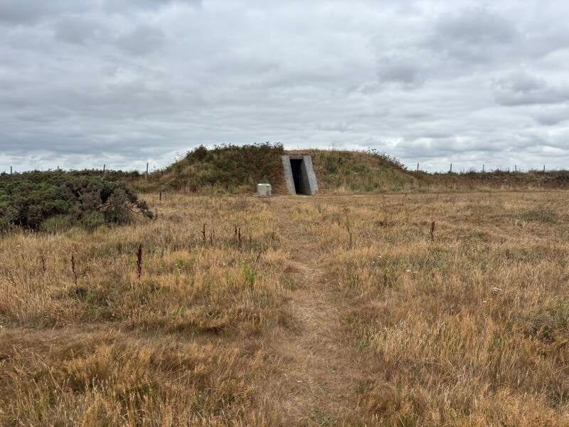
Nare Head was designated as a QF/QL/SF "Starfish" decoy site. These installations used lights and simulated activity to create the impression of a defended or strategically important location, encouraging enemy bombers to release their weapons away from their intended targets. The remains of the bunker and associated structures are a quiet reminder that this peaceful coastline once played a role in Britain's wartime defence.
It is not the first time this headland had been considered strategically important.
More than a century earlier, during the invasion fears of Revolutionary France, Veryan's remarkable Vicar Jeremiah Trist had prepared his own detailed parish defence plan, recording the people, animals, boats, carts and resources that would be needed should French forces land on the Roseland Peninsula.
Across two very different centuries, the same landscape inspired very different forms of preparation: first a parish readying itself for invasion, and later a nation using deception to defend itself from attack.
The Hera – A Tragedy Beneath Gull Rock
The beauty of the coastline around Nare Head hides the dangers that have always faced those who venture into these waters. Perhaps the most poignant reminder is the story of the German steel barque Hera, wrecked on Gull Rock in January 1914.
After months at sea, the vessel was approaching the Cornish coast when thick fog, fierce winds and dangerous waters caused her to strike the rocks beneath Nare Head. Of the 24 crew aboard, only five survived the disaster.
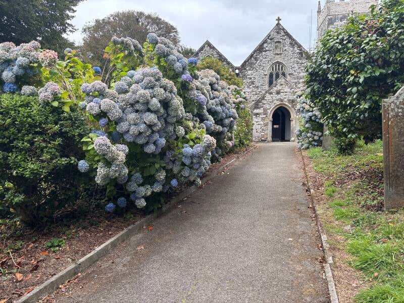
The people of Veryan recovered the bodies of fifteen sailors and gave them a dignified burial in St Symphorian's churchyard, directly opposite The New Inn. The sailors were laid to rest together, head to toe, creating a remarkable shared grave nearly 100 feet long—the longest marked grave in the United Kingdom.
The timing of the tragedy adds another layer of poignancy. The Hera disaster occurred only months before the outbreak of the First World War. These were not enemy soldiers, but working sailors from another nation who lost their lives to the sea, and the people of Veryan responded with compassion and respect.
Today, the grave stands as a powerful reminder that the waters around Cornwall have always connected communities as much as they have separated them. The same sea that brought danger also brought visitors, trade and shared humanity.
For walkers following the coast path above Gull Rock, the view may be breathtaking, but the Hera reminds us that this beautiful coastline has always demanded respect.
Other Pubs to try in Cornwall
Helford – From Shipwrights to Scientists: A River of Discovery
5.2 miles