

The Prince of Wales, Ham Hill, Stoke Sub Hamdon
The Walk: Ham Hill & Montacute – Hamstone, Hillfort & Norman Fortress, 4.5 miles
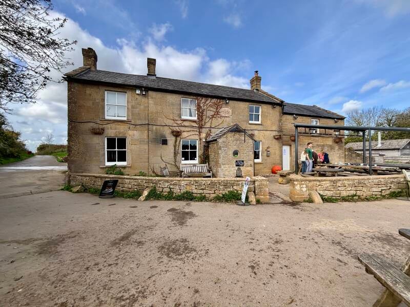
Try this Pub & Walk
Perched on the glowing golden ramparts of South Somerset, The Prince of Wales on Ham Hill offers one of the most atmospheric starting and finishing points for a walk in the West Country. This 7.3 km (4.5-mile) circular route seamlessly blends the sweeping 360-degree vistas of a massive Iron Age hillfort with a deep dive into centuries of English history.
You’ll trade wide-open plateau views across the Mendips, Quantocks, and Dorset Downs for deep woodland tracks, descending from the high ironwork ramparts to explore a dramatic Norman castle site, an ancient Saxon legend, and the picturesque, stone-built corners of Montacute village.
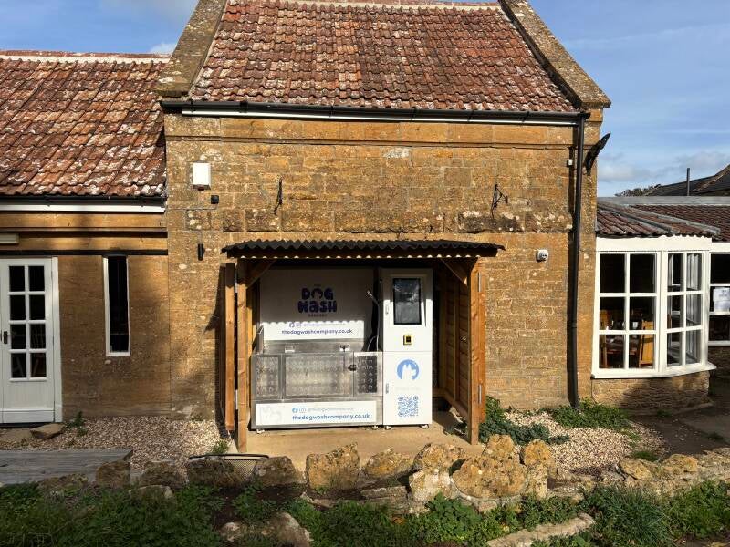
Whether you're drawn by the echoes of royal history, including a visit from the Prince of Wales himself, or simply looking forward to muddy boots, a traditional pint by the fire - and a self service dog-washing machine - this walk delivers a Somerset adventure that ends right where it should: at the heart of a proper country pub.
About The Prince of Wales, Ham Hill

Last visit: October 2026
An old black-and-white photograph of The Prince of Wales Hotel, as it was originally, caught my attention. Dating back to the 19th century, it provides a fascinating glimpse of Ham Hill in a very different era. The surrounding slopes were much more exposed then, with the honey-coloured stone and dust of an extensive quarrying industry defining the landscape. The hotel itself was one of the few buildings on this northern spur of the hill, providing refreshments for the quarrymen and accommodation for those a little further up the pecking order.
It's quite a contrast with today's setting.
The old quarry workings are now largely hidden beneath vegetation, and Ham Hill has become a much-loved Country Park. But quarrying hasn't disappeared altogether. Hamstone is still extracted for renovation and building maintenance, and The Prince of Wales remains here, continuing to provide refreshment several generations after those early quarrymen called in.
Today's customers seem a wonderfully varied bunch.
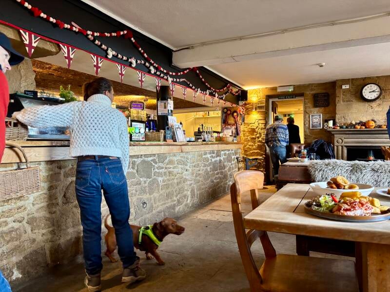
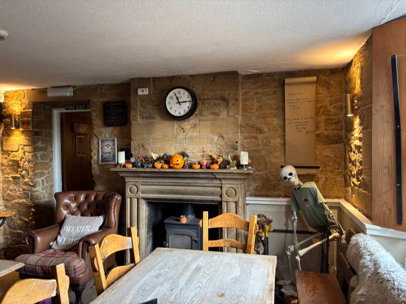
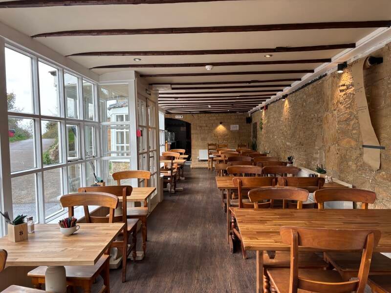
The main bar is full of muddy boots, muddy dogs and red-cheeked children and adults, all wrapped up in different layers for that awkward time of year when one person is enjoying T-shirt weather while another is feeling the cold. They're clearly all welcome. Alongside them, a separate dining room is equally busy, attracting a slightly more dressed-up country crowd who I suspect have driven to the door rather than yomping across the hill like the tribe in the bar, sweating in cagoules they could have left at home.
It was half term, and a very busy midweek lunchtime in late October, but the staff were superb. A small hiccup with my ham sandwich was quickly put right, accompanied by several entirely unnecessary apologies. It was a nice reminder that, however busy things get, this team genuinely cares about its customers. From what I've read, the pub is run by local families, and there was a real sense of a close-knit team working together, even with the inevitable distractions of school-holiday life for them.
There's plenty going on beyond the main building, too. Summer photographs show a sunny terrace with hanging baskets, an awning and those lovely views across the surrounding countryside. Food trucks, an outdoor bar and a performance space bring another dimension to the place, while the calendar includes Halloween celebrations and Christmas parties with carols. This is clearly a pub with an active following throughout the year.
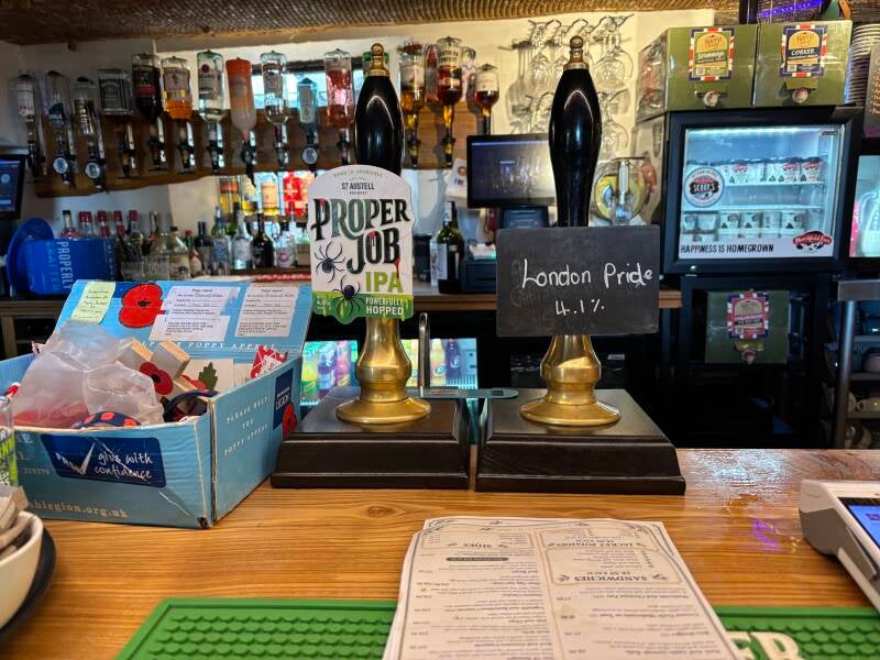
It's a country pub, a family pub, a locals' pub, a walkers' pub and, historically, a working pub. It's also a place where people have been coming for years, some having enjoyed their first pint here with their dads. And then there's the dog-washing machine! Quite brilliant, and a rather unexpected finishing touch to an already excellent visit. I don't even own a dog, but I was impressed.
There's a rather interesting royal connection here, too. The Prince of Wales is named in recognition of its position on land owned by the Duchy of Cornwall, an estate established by Edward III in 1337 to provide an income for the heir to the throne.
On 19 July 1923, Edward, Prince of Wales (later Edward VIII), visited Ham Hill as part of a tour of his Duchy estates in the West Country. He toured the quarries, visited archaeological excavations taking place on the hill and stopped for lunch at the Prince of Wales Inn. He also visited the War Memorial, where he ceremonially laid a bronze wreath in memory of the fallen of Stoke-sub-Hamdon. The inscription records him as Prince of Wales, Duke of Cornwall and Lord of the Manor of Stoke.
It's quite something to think that, over a century ago, the pub was welcoming its royal landlord for lunch.
I arrived knowing very little about this corner of Somerset, and left wondering why I'd taken so long to discover it. Ham Hill is clearly a special place, and The Prince of Wales is a pub that belongs here. I'm looking forward to spending much more time exploring this particular golden corner of Somerset.
Pub Key Information
| WEBSITE | https://www.princeofwaleshamhill.co.uk/ |
| ADDRESS | The Prince of Wales, Ham Hill, TA14 6RW |
| PHONE | 01935 713209 |
| WHAT3WORDS | ///done.outlawing.sailing |
| PARKING | Numerous car parks at or near the pub. |
| LOCATION | Ham Hill is in South Somerset, above the village of Stoke Sub Hamdon, just a few miles West of Yeovil. |
| HANDY FOR | Numerous honey-stoned villages which all seem to have a brilliant pub! Close to Montacute House. The Fleet Air Arm Museum at Yeovilton is excellent. |
Walk Overview
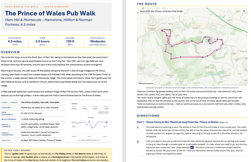
Starting from The Prince of Wales, the route first loops around the North Spur of Ham Hill, taking in the Hamstone War Memorial, the quarrymen’s Stone Circle, and the natural amphitheatre known as the Frying Pan.
Returning to the pub, the walk drops off the plateau along the Monarch’s Way through Hedgecock Hill Wood, crossing open fields to reach the wooded slopes of St Michael’s Hill.
After ascending to the 1760 Prospect Tower at the summit, a steep descent leads into Montacute village. The route passes the historic Abbey Farm gatehouse, the 1847 National School, and St Catherine’s Church, before following Middle Street and Townsend Lane out of the village.
A field-side path leads back uphill toward the southern fringe of Ham Hill Country Park, where a final short climb restores you to the high plateau. A level walk past the Visitor Centre finishes back at The Prince of Wales.


Walk Key Information
| START/FINISH | The Prince of Wales, Ham Hill, TA14 6RW |
| PARKING | Numerous car parks at or near the pub. |
| GRID REFERENCE | ST 479 171 for the pub. |
| WHAT3WORDS | ///done.outlawing.sailing |
| DISTANCE/TIME | 4.5 miles / 7.2 km; approx 2.5 hours |
| ASCENT | 720 feet / 220 metres |
| PATHS/TERRAIN | Country park paths, woodland tracks, field paths, village lanes. Some steep sections. |
| DIFFICULTY | Moderate |
| PUBLIC TRANSPORT | Stoke-Sub-Hamden is served by buses for Taunton, Yeovil, South Petherton. |
| TOILETS | At Ham Hill Visitor Centre; and The Prince of Wales. |
| OTHER PUBS TO VISIT | This is a ‘golden area’ for good pubs. At Montacute, try The Phelips Arms, or The Masons Arms at Odcombe. At Hinton St George, Lord Poullett Arms is superb; as is Dinnington Docks in the hamlet of Dinnington nearby. And closer to the Prince of Wales is the Fleur de Lis at the bottom of Ham Hill in Stoke Sub Hamdon and its neighbour The Lord Nelson at Norton Sub Hamdon. |
Walk Instructions: Choose what works for you
There are multiple ways to consume the route described below.
- Either follow the online Walk Directions below, or download and print a copy of the route.
- If you have the OS Maps App, you can follow a saved route directly in the OS App.
- Or download the GPX file for use with your chosen GPS-based tracker App, like Strava. Upload the file when you Create a New Route in the App.
Walk Directions
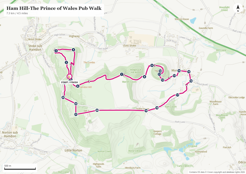
There are numerous signposted walking trails on Ham Hill across and around its flat top – the Monarch’s Way, River Parrett Trail, Leland Trail, and Liberty Trail all pass here. The Visitor Centre, Rangers Office and The Prince of Wales Pub are the principal buildings on the hill, and all are well signposted. They sit near the entrance to the Country Park at the top of Ham Hill Road, above Stoke-Sub-Hamden. There are numerous car parks at the top - most car parks were busy on a dry Autumn Half Term day when I visited, alive with families and dog walkers.
- This walk starts by admiring a view! The terrace in front of The Prince of Wales is truly a lovely spot. The route initially visits the North Spur of Ham Hill (to the left) to see the stone circle and War Memorial, and the location of what was the UK’s largest Iron Age Fort, before returning to the pub to set off in the other direction, for Montacute.
- With your back to the pub, go left and locate the War Memorial signpost, beyond the car parking area closest to the pub. Pass through a wooden gate on a well-made footpath. It’s clear where you need to go, and the War Memorial soon comes into view. (map waymark #2). The stone circle was a Millennium project addition, erected to honour the quarrymen of the hill. There are information boards dotted around the Spur, ideal for exploring children and inquisitive adults.
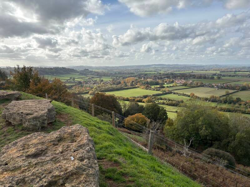
- Proceed to the Grade II Listed War Memorial – it’s made entirely from hamstone, quarried from and trimmed on this hill, and its position here on the North Spur provides one of the most commanding viewpoints on Ham Hill — the Mendips, Blackdown Hills, Quantocks and Dorset Downs are all visible. In 1923, Prince Edward (Prince of Wales, later King Edward VIII) was visiting the Duchy of Cornwall's Somerset estates, and his itinerary included the Ham Hill quarries. During the visit, he ceremonially laid a bronze wreath at the foot of the memorial. It was subsequently mounted on the north face of the obelisk, where it remains today (#3)
- The return to the Prince of Wales loops around the edge of what was the old hillfort – follow the narrow ridge that rises from the War Memorial, with the stone circle now off to your right. As you rise, ahead of you in the distance is the top of a tower mostly hidden in the trees – we’ll visit St Michael’s Tower on our way to Montacute later. Drop down to an information board in the park at an area called the Frying Pan, the site of an old livestock show ring, and meeting place - 20,000 people once came to hear a talk on fair wages for farm workers. (#4)
- Follow the distinct grass track as it curves around in front of the obvious grass bank of the Frying Pan. This track joins with another track as it proceeds gently uphill, now recognisably in the direction of The Prince of Wales.
- Back in front of the pub’s main entrance, look for a signpost for a path that drops down to “Wildwood Playzone”! After a few wooden steps, turn sharp left for more steps (stone now) to the bottom of the slope. (#5) Turn right at the bottom following the yellow Monarch’s Way markers.
- The route starts to curve gently left. Around the bend, ignore the footpath sign to East Stoke. Instead, a few yards further ahead look for the signpost into woodland for the Monarch’s Way. (#6) IMPORTANT NOTE: my visit followed some Autumn storms and the entrance here to the Monarch’s Way path was closed off. I was able to take another path to the left of it, signposted for “Montacute 1 mile”, and continued a short way along this. Pass a seat with a lovely view on your left overlooking the 12th Century Church of St Mary the Virgin, a Grade I Listed building in East Stoke. Soon a steep-ish scramble uphill to the right allowed me to rejoin the Monarch’s Way that runs slightly above this lower path – evidently the solution for numerous other walkers previously.
- The Monarch’s Way follows the tree line at the top of Hedgecock Hill Wood. Continue to wind your way through the woodland, ignoring wooden steps up to a field gate on your right. Our next destination is the tower at the site of an old motte & bailey fortress on St Michael’s Hill, but here we pass to the right-hand side of a limestone mound that perhaps suggests what St Michael’s Hill might have looked like without human activity. (#7)
- Continue on the Woodland trail downhill now along a fence, and as the path drops down into a gully, bear right in the direction of the fields. Cross a stile into the field, with the tree-covered St Michael’s Hill in front of you. (#8) Go diagonally left, following a clear grass path across the field towards the left-hand side of the hill.
- Spot a wooden footpath gate and information board at the entrance to the Hill’s footpath. (#9) Take a moment to read the board; there’s another further up the climb on the steep track up to the top of the mound. They provide some of the ‘aha’ insights that bring walks like this to life. Follow the spiral wooded path up to the tower, but be aware of the section through beech trees - notice a narrow track off to your left as you climb – it’ll be the route on our way back down.
- Don't let the 1760 Hamstone "Prospect Tower" fool you—you are walking up a place of ancient, high-stakes history. Before this tower was built, Robert of Mortain (William the Conqueror's half-brother) raised a Norman fortress here, dealing a devastating blow to a sacred Anglo-Saxon shrine. In 1068, local English insurgents made their desperate, final stand for freedom around the walls of this peaked hill before being crushed. When you reach the top, look closely at the base of the circular tower to spot the straight stonework foundations of the medieval chapel that followed. (#10)
- Continue back downhill, and then just as you reach the stand of beech trees, drop down the narrow right-hand path through undergrowth. (#11) This rough track then drops sharply left to continue downhill steeply through the trees, a more direct route to the bottom than the pleasant, winding path uphill earlier: it’s very steep initially – wish I had a walking pole!
- At the bottom, pass through a footpath gate into a field, and bear left in the direction of Montacute. (#12) Follow the fence line and head in the direction of the Church, whose tower is now visible. Pass through a wooden gate/stile in front of the incredible Abbey Farm. (#13) Montacute Priory here was dismantled following the Dissolution of the Monasteries in 1539, but this magnificent 16th-century farm building directly incorporates the surviving gateway to what was the medieval monastery. Much of the stone from the old hilltop castle and the priory on this site didn't go to waste —it was repurposed by the ambitious Phelips family to help build the dazzling Montacute House nearby.
- Follow Hollow Lane to the left towards Montacute Church, and the 1847-constructed Montacute National School opposite. (#14) The gothic-style plinth above the entrance delivers an important message: "Train up a child in the way he should go; and when he is old, he will not depart from it.” Around the corner, I visited the National Trust ticket office of Montacute House, reversing when I saw the £16.50 entrance fee. In contrast, the Church of St Catherine requests a voluntary donation. It’s an absolute architectural and historical gem that I highly recommend. The connection to the house is the Phelips family who are extensively commemorated, from 1484 and the 500 years that followed.
- Follow the road to the right through the village along Middle Street in the Yeovil direction, passing the entrance to Montague House (#15) , then the Phelips Arms, (a Pubs Worth The Walk feature for another day, when I will visit Montacute House!). Continue along South Street towards the Post Office and turn right onto ‘Townsend’. (#16) The lane winds through a residential area and starts gently uphill as it exits the village.
- Just beyond the speed limit signs, look for a ‘Townsend’ sign, and 20 metres ahead, a footpath finger marker guides you through a hedge into the field on the right. (#17) This path allows walkers to follow the route of the lane from the safety of the field, although note that there may be cattle present. This path provides some lovely views of St Michael’s Hill and Montacute. Continue uphill along the hedge line to the side of the lane, all the way to the point where the path rejoins the lane at the top of the hill.
- We’re close to the southern fringe of Ham Hill Country Park here. Bear slightly right and carefully cross the road into the (sheep) field. (#19) Turn right to follow the fence to the side of the lane. It’s a gentle slope initially, although you’ll see a steep ridge ahead. Here, take the path up its short but steep face, guided by a wooden marker post on the brow – it elevates you back onto the plateau of Ham Hill.
- Pass through a gate behind the marker post into the adjoining field. The route is level from here. Continue in this next field on a grass track along the line of its right-hand boundary. At the far end of the field pass through a wooden footpath gate. (#20)
- Follow the signposts to the Visitor Centre (toilets there #21) on a woodland track. Stay straight ahead to pass a house called Hill Top on your right, and a stone merchant opposite.
- Pass in front of the visitor centre into its car park and exit towards Ham Hill Road. (#22) Turn left to follow the footpath, continuing past other car parks, until you reach a signpost that points across the road towards The Prince of Wales Pub. (#23)
- Reach the car parking area near the Rangers Office. (#24) Turn right here and follow the lane directly to the pub.
Other Pubs to try in Somerset


Forest & farmland tracks near Taunton and an award-winning country pub.
5.5 miles
