

The Blue Ball Inn, Countisbury
Above the Bristol Channel – Countisbury Moor to the Foreland Circular from the Blue Ball Inn, 4.7 miles
Try this Pub & Walk
Driving west on the A39 from Porlock, you cross some of the wildest high ground in Exmoor.
The road threads between cattle grids onto open moorland, with sheep grazing the slopes, Exmoor ponies sometimes appearing against the skyline, and the Bristol Channel opening out to show off the coast of South Wales. Old tracks and scattered farms remind you that this landscape was travelled long before the road arrived. It is a place to keep your eyes moving between the road, the raw moor and the sea far below you.
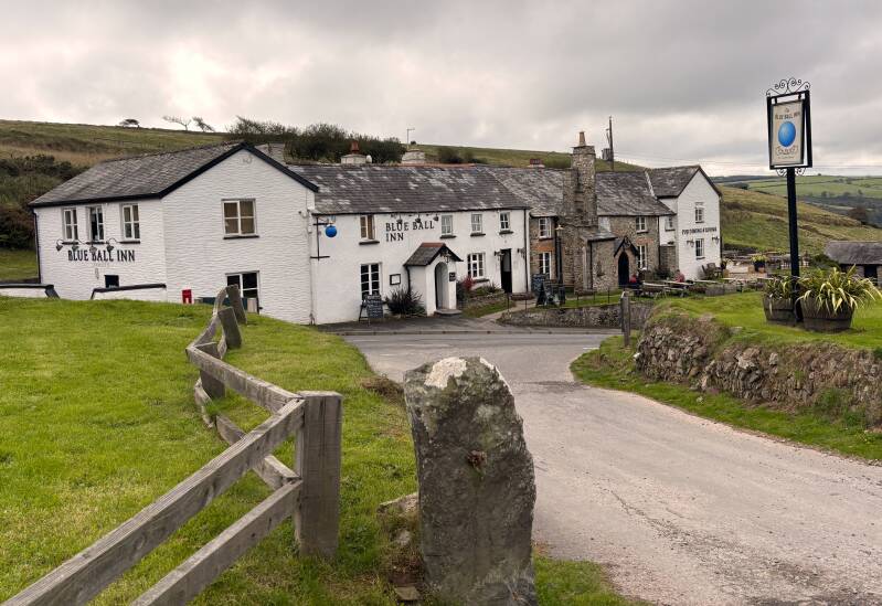
Ten miles on, just as the road rounds a bend, Countisbury appears: a handful of stone cottages, a church set back from the road, and the Blue Ball Inn right on it. Almost before you have registered the place, the A39 tips into the descent towards Lynmouth.
This is no ordinary coastal road. Countisbury stands at around 1,000 feet above sea level, and the road drops towards the sea over a descent of nearly two miles, with gradients reaching one in four in places. There are no dramatic hairpins to soften the experience: the land simply falls away towards the coast beside you.
For fearless drivers, Countisbury Hill is one of Britain’s great coastal drives, almost a rite of passage. For the more squeamish — myself included — it can be a road to avoid, sending you searching instead for the narrow lanes that wind their way down through the hills. Either way, the descent makes an impression. Countisbury is easy to drive past, but it is worth stopping for sure.
The hill is only part of the story. The views are perhaps the finest in all of North Devon.
From Countisbury, the high ground presents some remarkable walking options, where old tracks cross the moor before the South West Coast Path winds through woodland and along steep coastal slopes towards Foreland Point. Here, the land thrusts into the Bristol Channel, with the lighthouse marking its exposed tip, and views stretching across the water. The return brings you back onto the heights above Lynmouth Bay, where the twin villages of Lynmouth and Lynton sit across the water, linked by their extraordinary cliff railway. It is a walk of contrasts: open moorland, hidden farms, wooded cliffs and big coastal views — with plenty to discover beyond the road.
The Blue Ball stands at a natural meeting point between the high moorland and the coast, on the old route between Porlock and Lynmouth. Its position makes immediate sense when you appreciate what travellers faced on the road below. For centuries, this was a place to pause before or after the formidable climb between the coast and the high ground. Today, it offers a welcome stopping point for walkers exploring this dramatic meeting of moor and sea.
About The Blue Ball Inn, Countisbury


Last visit: October 2026
The Blue Ball’s position is no accident. The old route between Porlock and Lynmouth had to negotiate the steep descent and ascent of Countisbury Hill, and an inn near the top offered a natural stopping point for travellers and their horses. What is now a spectacular drive was once a serious obstacle in the journey: a place to rest, take refreshment, change the horses, and prepare for the next stage. The inn’s location tells us something about the practical geography of travel long before the road became a destination in its own right.
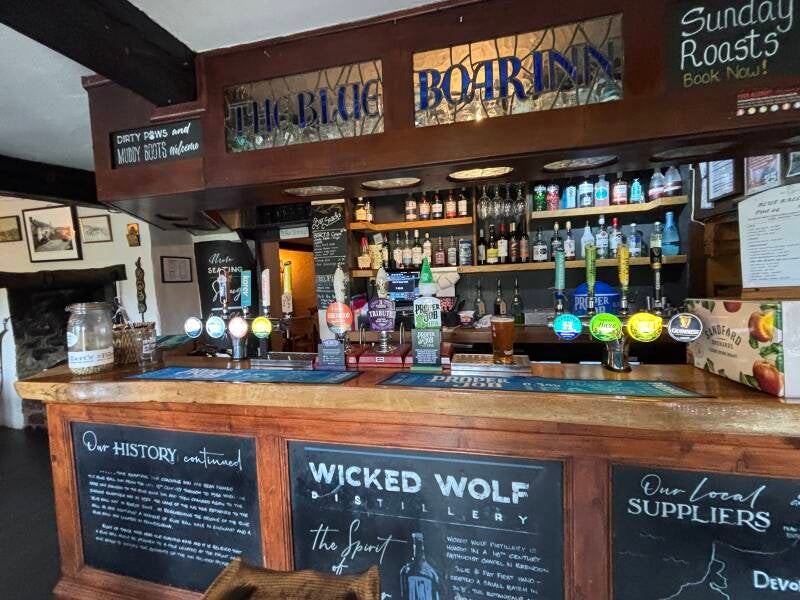
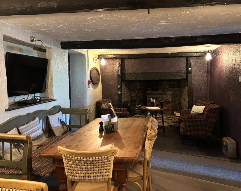
The Blue Ball has the character you might hope to find in an old coaching inn: slate floors, low ceilings, several levels and a succession of cosy spaces. It feels as though the building has grown around its original purpose rather than been stripped back to create a uniform pub interior. The history board inside traces its name through several changes, but the sense of an old inn remains. This grade II listed old inn has evolved over centuries (some say it dates back to the 13th Century) with a giant fireplace and chimney at its core.
Today, this is a business serving walkers, diners and people staying in the area. There is a dedicated check-in area, a pool room, a TV lounge and a snug, with various seating areas for dining. The spaces feel homely and well considered, and the wider offer makes sense in a place where accommodation and food are important parts of the business.
The setting does much of the work. Exmoor is on the doorstep, the coast path in easy reach, and the inn is well placed for exploring Lynmouth, Lynton, the East Lyn valley and the high moors. With fires in winter, outdoor seating for warmer days and sunsets over the coast, it is easy to understand the appeal as a place to stay.
The Blue Ball is a St Austell Brewery house. I was disappointed to find that taken literally with only Tribute and Proper Job ales available. I can get them at Sainsbury's at home. Conversely, the range of boxed local ciders was really impressive. I would love to see the same enthusiasm for showcasing local beers.
But that's a personal preference rather than a criticism of the wider offer - the Blue Ball is not a small, independent drinking pub with a strong personality built around its bar. It is a historic inn that has adapted to a modern mix of visitors, diners and guests. If you want a comfortable base for walking, good food and a pub with genuine history, it makes a persuasive case for itself.
There is more to its story than the present-day name suggests. According to the inn’s own history board, it was known as the Blue Ball until 1986, became the Blue Boar and then the Exmoor Sandpiper, before returning to the Blue Ball in 2007.
They say the inn took its name from a blue ball hoisted on a pole to summon passing coaches. But I wonder. Other Blue Ball Inns tend to trace their names not to signalling systems but to something simpler: a big, bright, blue-painted sphere hung outside so travellers who couldn’t read could spot the inn from the road. A wooden ball daubed in Prussian blue would have stood out against the Countisbury weather far more reliably than any coded message.
In January 1899 the road outside this door carried one of the great feats of the lifeboat service. The Forrest Hall, a 1,900-ton ship, was drifting ashore at Porlock Weir in a gale, and the sea was too rough to launch from Lynmouth. So the lifeboat Louisa was taken overland instead. About a hundred people and eighteen horses hauled her ten tons up Countisbury Hill, stopping at the Blue Ball for refreshments and a wheel repair. Twenty men took her on across the moor and down Porlock Hill, and she was launched at 6.30am, nearly eleven hours after setting out. All eighteen men aboard the Forrest Hall survived. The haul was re-enacted in 1999, for the centenary, in weather almost as poor.
Pub Key Information
| WEBSITE | https://www.blueballinn.com/ |
| ADDRESS | The Blue Ball Inn, Countisbury, Lynmouth, Devon, EX35 6NE |
| PHONE | 01598 741263 |
| WHAT3WORDS | ///bootleg.weedy.guideline |
| PARKING | Pub car park; options on A39 to Porlock. |
| LOCATION | Countisbury sits high on the North Devon coast, close to the border with Somerset, on the A39 in between Porlock and Lynmouth. It's roughly 40 miles from Taunton. |
| HANDY FOR | Lynmouth & Lynton; South West Coast Path; Valley of the Rocks; Doone Valley; Exmoor. |
Walk Overview
This is a walk through some of Exmoor’s most dramatic coastal country, where open upland gives way to isolated farmland, wooded cliffs and the wide sweep of the Bristol Channel, with amazing views across Lynmouth Bay to finish. Go on a clear day!
The early stages offer a sense of the high, exposed landscape that makes Countisbury so distinctive. Farms sit in folds of the land, partly sheltered from the weather, while the sea and the distant Welsh coast provide an ever-changing horizon.
The character of the walk changes as you reach the South West Coast Path. Here, the route winds through woodland and along steep coastal slopes as you head towards Foreland Point. The woods around Glenthorne Cliffs reflect the influence of the historic Glenthorne estate, while the shape of the headland hints at the more demanding terrain beyond.
There is an optional, tougher detour around Foreland Point itself to see the lighthouse (adds 500 feet climb) for confident coastal walkers; the main Coast Path route described takes the ‘pass’ before turning back towards Countisbury.
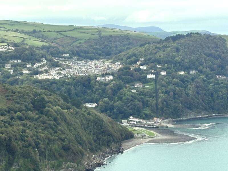
The return brings another change of mood, as the path climbs back towards the high ground beneath Butter Hill. Across Lynmouth Bay, roughly two miles away, sit Lynmouth and Lynton, their connection made visible by the remarkable cliff railway climbing the hillside between them, clearly visible in the right weather. Keep going towards Countisbury, where the Blue Ball awaits at the top of the hill.



Walk Key Information
| START/FINISH | Blue Ball Inn, Countisbury, EX35 6NE |
| PARKING | Pub car park; options on A39 to Porlock. |
| GRID REFERENCE | SS 747 497 |
| WHAT3WORDS | ///bootleg.weedy.guideline |
| DISTANCE/TIME | 4.7 miles / 7.5 km; approx 2 hours |
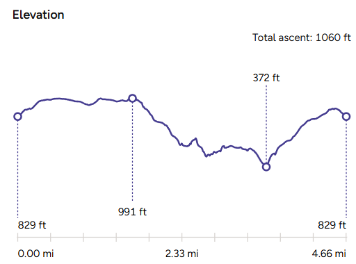
| ASCENT | 1060 feet / 330 metres |
| PATHS/TERRAIN | Field tracks; stony footpaths; some steep |
| DIFFICULTY | Moderate |
| PUBLIC TRANSPORT | Daily bus between Porlock & Lynmouth. |
| TOILETS | Only at The Blue Ball Inn. |
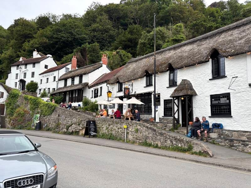
| OTHER PUBS TO VISIT | The Rockford Inn, Rockford (EX35 6PT) is one of my favourite pubs! Try also The Staghunters Inn (EX35 6PS) at Brendon. The Rising Sun at Lynmouth is on most lists! |
Walk Instructions: Choose what works for you
There are multiple ways to consume the route described below.
- Either follow the online Walk Directions below, or download and print a copy of the route.
- If you have the OS Maps App, you can follow a saved route directly in the OS App.
- Or download the GPX file for use with your chosen GPS-based tracker App, like Strava. Upload the file when you Create a New Route in the App.

Walk Directions
-
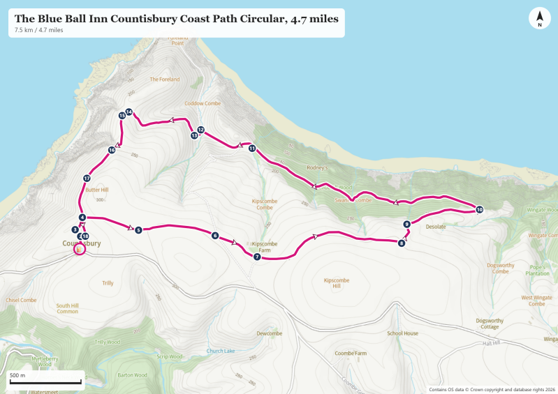
Countisbury is a cluster of cottages, a church and the Blue Ball Inn. It’s easy to drive past it as you round a bend on the A39 from Porlock. Park in the large car park across the road from the pub. Should you drive past, note that the A39 drops steeply down to Lynmouth from the here on one of the UK’s most dramatic coastal roads – a bucket list 2 miles in its own right for some - with limited opportunity to turn around until you reach the bottom. If the pub car park is full, there are a couple of car parking options within a mile of the pub back in the Porlock direction, at Barna Barrow (Postcode: EX35 6NE Grid Reference: SS 752 495 What3Words: buzzing.strikers.dusty) and Countisbury Common (Postcode: EX35 6NE Grid Reference: SS 758 494 What3Words: clearcut.running.harmlessly).
-
From the pub car park, take the cut through to the side onto the lane up to the church of St John the Evangelist. There’s a footpath marker in front of the church gate offering a choice – head into the church yard straight ahead, or bear right past the front door of a cottage. I preferred the church yard option and a quick visit to the church, imagining how isolated a community it would have served before the A39 was conceived.
-
The footpath route leads to the left of the church door. Turn the corner and continue straight ahead on a path up to a wooden footpath gate to exit the church yard. You emerge onto an area of open grass land, with a ‘mast’ visible on the hill in front of you. (We’ll be passing this way on the return journey, to the left side of that mast). Drift right to the wall and bear right on a path that follows the wall around the corner in the direction of Barna Barrow. (Waymark #4)
-
Continue on this route, with the wall on your right, as it continues gently uphill on a grassy track between the gorse. At a fork in the grass track, bear slightly left rather than maintaining the direction of the high point of Barna Barrow (Waymark #5. Note that there’s a slither of the A39 main road visible to the right, and access to car parking below Barna Barrow from there).
-
Continue straight ahead between the gorse and heather on a wide grassy track, now heading in the direction of Kipscombe Farm. The track starts to arc to the right, where you’ll then see a footpath marker guiding you across a driveway (that leads down to Foreland Point Lighthouse) showing ‘County Gate 2 ¾ miles’. Continue ahead across the field track, aiming for a small stand of beech trees in the distance near the farm. There’s a clear view of Kipscombe Hill to the right of the trees – you might see a herd of Exmoor ponies grazing here.
-
Cross the driveway to the farm and surrounding cottages, and continue straight ahead to pass the beech trees on your left (waymark #7). Continue straight ahead and notice some good views now of Foreland Point to your left. Follow the field track to a wooden farm gate and pass into the field which you’ll likely share with sheep.
-
Continue straight ahead on the distinct grass track, which leads towards an old hay feeder in the field, then the path heads off at an arc slightly to the right, towards an obvious gateway in (what was once) the fence. From this gate, walk in parallel to the boundary wall at the bottom of the field, roughly 30m below you. Aim for the metal farm gate – one of the gate posts has a fading splash of yellow paint, the clue that you’re on the footpath.
-
Cross the next field diagonally to the left, to the corner. You’ll see a metal farm gate, and some more obvious footpath signs, including a finger marker pointing towards the Coast Path. This is an elaborate electric gate, but fear not, there’s a footpath gate to the right. Pass through and join the farm track on the other side of the gate. (Waymark #8)
-
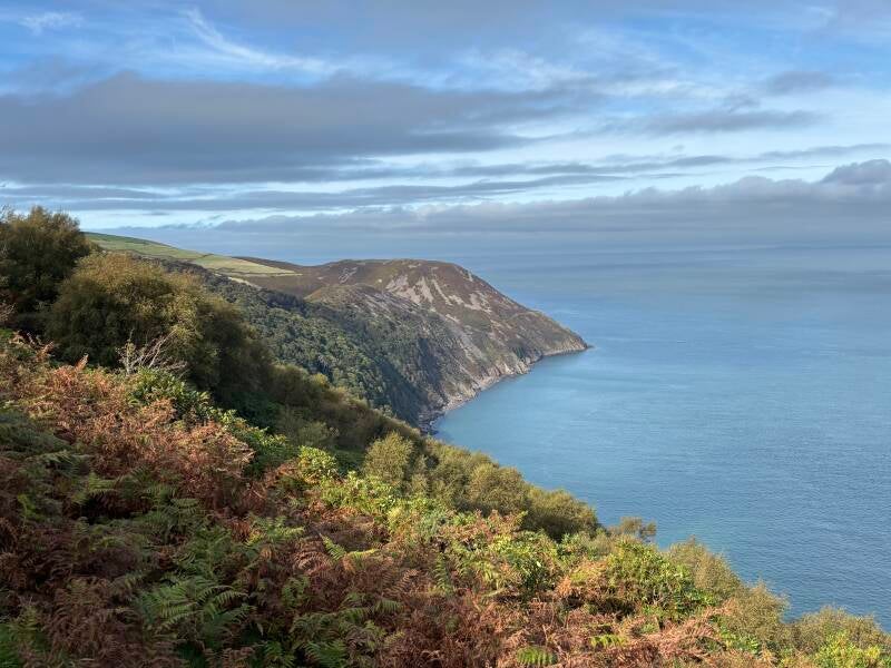
Now follow the stoney farm track downhill in the direction of the coast. Within 100m of the gate, a footpath marker shows the way, off to the left - over a hump, and then steeply downhill on a grass track between the ferns with wonderful sea views.
-
At the next footpath marker turn right, not left (look closely at the marker for the yellow arrow clue). Turning right feels counter intuitive since our destination is to the left. But we’re not yet at the coast path, which is somewhere below us - we need to zig zag a little more to drop further down the slope.
-
Continue downhill on an easy path which eventually levels out, again offering superb views, now in both directions – Bossington to the East and Foreland Point to the West. Unseen, we’re passing below an old farm here called Desolate, hidden above us. I can imagine how they feel in Winter! And here’s the footpath marker announcing the South West Coast Path. (Waymark #10)
-
Take the path to the left, signposted for Lynmouth. This initial section along the coast path enters Chubhill Wood, dropping downhill before levelling out on a good path between rhododendrons on the slopes above and below the path, and native trees, reminiscent of the Exmoor combes further inland. Pass a sign for the National Trust’s Glenthorne Cliffs — named for Glenthorne House to the east of us, the dramatic neo‑Tudor seat of Rev. Walter Stevenson Halliday, who owned the entire parish of Countisbury in the 19th century and shaped much of the wooded coastline along this walk.
-
Eventually, this section of the walk breaks out of the trees to provide a clear view of the sky, and then rounds a corner to pass another National Trust sign, for Gurney Woods. The path drops onto the private driveway here of Rodney’s Cottage, hidden lower down the cliff below us. But a wonderful sight – the owners have set up a simple ‘honesty café’ at this spot – some coolboxes offering refreshments, some seats and a table – and a link to a PayPal account should you wish to contribute, with money promised to be put towards buying seed to encourage birdlife to this part of the woodland. (Waymark #11)
-
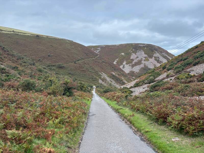
Continue up the drive beyond the wooden gate. Just over the crest ahead of you, join a tarmac road. It’s the access road for Rodney’s Cottage, and for the Foreland Point Lighthouse and the Lighthouse Keepers’ Cottage (available as National Trust holiday accommodation).
-
Follow this road downhill towards a small bridge over the road, just visible below you. As you proceed, notice that the Foreland isn’t a straightforward protrusion of land into the sea, but has its own conical shape, with a ‘pass’ separating it from the hillside inland. The South West Coast path follows this pass, which is signposted to the left just beyond the bridge (Waymark #12). If you wish to continue to the lighthouse, and follow an alternative path around the headland, continue on the driveway. The route adds an extra mile and another 500 feet of elevation to your route. It’s quite a narrow path in sections above high sea cliffs, with walking on some scree – it’s a route more suited to experienced and confident coast path walkers, and why the South West Coast Path uses the pass described.
-
Having turned left to continue on the South West Coast Path, a flight of steps allows you to gain height quickly along this, the steepest section of the climb back up to Countisbury. After the steps, the rest of the climb is quite reasonable, and there are some conveniently positioned wooden benches for a rest (or to enjoy the view) as you ascend.
-
Just beyond the second bench, you complete the ‘pass’ section and wonderful sea views open up again to the West, where Lynmouth, Lynton and the cliff railway connecting them is easily seen across Lynmouth Bay. You can also make out the famous coast road of Countisbury Hill, with its one in four gradient (25%). If you wish, from here you can drop down a little to your right to pick out a path to the high point of the Foreland (c.700 feet), and you get a sense of the scree along the alternative path around the headland. (Waymark 14)
-
Our route is to the left, up a steep-ish slope on a wide grass track. Take care as you ascend here as you can walk close to the cliff edge in parts, especially near an area marked Great Red on OS Maps (Waymark #15). The Coast Path then curves to the right, beneath Butter Hill with its communication mast, and continues to rise but more gently now. Progress is easier, so plenty of opportunities to stop for photos. (Waymark #16).
-
As you reach the top you spot the tower of the Countisbury Church over the brow, and the familiar open grassed area where you turned towards Barna Barrow at the start of the walk. Retrace your steps to the Blue Ball Inn from here.
Additional Notes
Imagine Countisbury before the A39
It is easy to see Countisbury as a handful of cottages, a church and a pub beside a spectacular road. But that is the view of a visitor passing through. For most of its history, Countisbury was a community living on the high ground above the sea, connected to its neighbours by tracks, paths and difficult routes through the hills. The road has made the place easier to reach, but it has also changed the way we see it.
The writer John Presland, in Lynton and Lynmouth: A Pageant of Cliff & Moorland (1917), gives a vivid sense of what the old route could be like. He describes the steep climb from Lynmouth, where strong winds could whip the red road dust into swirling clouds. It is a reminder that the hill we now negotiate in a car was once a formidable obstacle for people, animals, carts and coaches. From Porlock, the modern visitor crosses the high ground before Countisbury flashes into view; from Lynmouth, the road rises steeply towards the inn and the moor beyond.
The Blue Ball’s position makes sense when you imagine that older journey. The inn stood on the route between Porlock and Lynmouth, near the top of the climb out of the latter. It was a place to pause, take refreshment and prepare for the next stage. A photograph of a coach and horses stopping outside in 1907 provides a glimpse of that world just as motor transport was beginning to change it. The inn’s history is not simply an attractive backstory: its location was once a practical part of travelling through Exmoor.
A settlement hidden in the landscape
Look beyond the cottages and you begin to understand why the settlement is so scattered. Farms occupy hollows and folds in the land, seeking some shelter from the weather on this exposed coast. The farm called Desolate, which you pass above on the descent towards the coast path, seems almost to announce its own situation. It is a name that invites you to imagine a winter day when the wind and rain have settled over the hills.
Countisbury was never a large village in the conventional sense. The Domesday survey of 1086 recorded a settlement with woodland and pasture as well as cultivated land; Presland’s account gives a glimpse of a working community with livestock and resources adapted to the local landscape. By the nineteenth century, the parish covered around 3,512 acres. The Imperial Gazetteer of England and Wales, published in the 1870s, recorded 176 people and 38 houses.
The population later declined, and the settlement remains dispersed. In the modern landscape, the A39 divides the cluster of cottages and the church from the wider parish of farms and open ground. The road brings many people through, but it can obscure the older geography: a community spread across the land rather than concentrated around a village street.
A hilltop with a longer history
The high ground above Countisbury has long offered both a place of refuge and a vantage point. The Iron Age promontory fort at Wind Hill, often called Countisbury Castle, lies nearby. Local tradition associates the area with the Battle of Cynwit in 878, when a Saxon force led by Odda defeated Viking forces associated with Ubba. The precise location and details of the battle remain matters of historical interpretation, but the setting makes clear why this headland would have been strategically important.
The name Countisbury is often interpreted as meaning something like “camp on the headland”, although place-name explanations should be treated with care. What is clear is that this is high ground with commanding views over the coast and the routes inland. The remains of the fort, the old tracks and the later road all speak to the importance of movement and visibility in this landscape.
The medieval history is another reminder that Countisbury was not an isolated backwater. The manor belonged to Ailmar in the time of Edward the Confessor, before passing into Norman hands after the Conquest. Around 1200, Henry III granted the manor, along with Lynton, to Ford Abbey. Presland also records the abbey’s historic fishing rights along this stretch of coast. The land supported livelihoods, provided resources and connected communities, even where travel was difficult.
Countisbury’s height matters for more than the road. From the high ground, the coastline and the approaches inland are laid out before you. The nearby Iron Age promontory fort at Wind Hill, often called Countisbury Castle, is a reminder that this commanding position had significance long before the coaching road. The traditional association with the Battle of Cynwit in 878 may be uncertain in its precise details, but the landscape makes the strategic logic easy to understand: from here, you can see who is approaching, and the steep slopes and exposed headland offer natural advantages to those holding the high ground.
It is worth imagining the height in human terms. Lynmouth lies at sea level; Countisbury stands around a thousand feet above it. The road connecting them gains or loses that height in less than two miles, with stretches as steep as one in four. In Snowdonia, a climb of a thousand feet would be a meaningful part of a mountain day. Here, it is concentrated into a short, uncompromising stretch of road, with the sea and the steep coastal slopes alongside. The modern driver experiences it as a test of nerve; earlier travellers had to contend with the gradient, the weather, the animals pulling their loads and the condition of the road itself.
Watching the sea
The high ground also gives a clear view over the Bristol Channel, one of the reasons the coast has long demanded attention. From Butter Hill, a former maritime lookout could be used to observe shipping. Today, the communications mast is a more obvious modern landmark, but the principle is much the same: from here, you can see a long way.
Foreland Point Lighthouse, first lit in 1900, was built to help vessels navigate this exposed stretch of the Channel. The headland, offshore hazards and powerful waters made the coast a place of risk as well as beauty. The lighthouse is not on the main route of this walk, but its presence is part of the wider story of the landscape you are crossing.
And then there is the lifeboat journey of 1899. The Louisa was hauled overland from Lynmouth towards Porlock Weir during the storm, a remarkable feat involving a large number of people and horses. The story gives the steepness of Countisbury Hill a different significance. It is one thing to descend it by car; quite another to imagine hauling a heavy lifeboat up from Lynmouth and onward across the moor in darkness and bad weather.
The estate beyond the woods
The wooded slopes along the coast are not simply a natural continuation of the moor. Much of the landscape around Glenthorne was shaped by the historic estate associated with Rev Walter Stevenson Halliday, who acquired land in Countisbury from 1829 onwards. Glenthorne House was built in 1829–30, and Halliday’s influence extended across the woods and cliffs along this part of the coast. The Blue Ball itself appears on the 1841 tithe map as a property owned by Halliday.
The estate’s legacy is visible in the managed woodland and the paths that now allow walkers to pass through it. Glenthorne House is some distance to the east, beyond the route of this circular walk, but it belongs to the same landscape. It is a striking reminder that this apparently remote coast has also been shaped by wealth, landownership and the deliberate creation of a designed landscape.
There is a poignant contrast here with St John the Evangelist Church at Countisbury. The church has a history of support and investment, including work in the nineteenth century associated with the local estate. When I visited, though, I left feeling rather sad. Many of the churches I have visited this year have felt uplifting because of the evidence of people still caring for them, maintaining them and organising their lives around them. Countisbury’s church felt as though it needed a congregation, and investment simply to prevent further decay.
Perhaps that is part of the story of the place. A church that once served a more substantial rural community now sits beside a road carrying visitors to the coast, while the farms and cottages are scattered across the parish. The building remains, but the life that once gathered around it is less visible.
The landscape we came to see
Countisbury has been many things: a working rural parish, a route across difficult country, a coaching stop, a lookout over the sea and now a place to pause on the way to Exmoor’s coast. Its farms, church, fort, inn, lighthouse and old tracks each tell a different part of that story.
John Presland’s writing is valuable because he looked closely at the details: the weather on the hill, the dust on the road, the farms tucked into hollows, the way the landscape could change character in a few steps. His book was published in 1917, but it encourages us to look beyond the obvious view and imagine how people once experienced this place.
Today, we arrive for a walk, a meal, a pint, or a view across Lynmouth Bay. The road makes that visit possible, but it can also tempt us to treat Countisbury as a passing moment between Porlock and Lynmouth. Stop here, and the place opens up. Stay at the Blue Ball Inn, or one of the National Trust-owned cottage, or the old Lighthouse Keepers’ Cottage.
For centuries, people came through Countisbury because they had to. Today, we come because we can.
Other Pubs to try in Devon
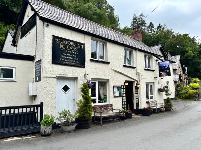
Exmoor Circular Walk to Watersmeet along the East Lyn River from Rockford.
3.2 miles
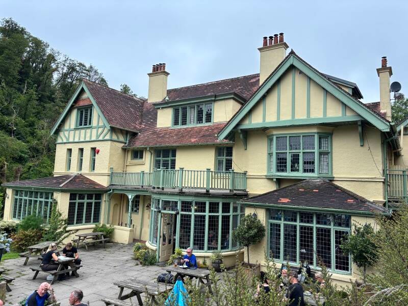
Challenging Woody Bay & Heddon's Mouth Cleave walk via The Hunter's Inn.
8.4 miles