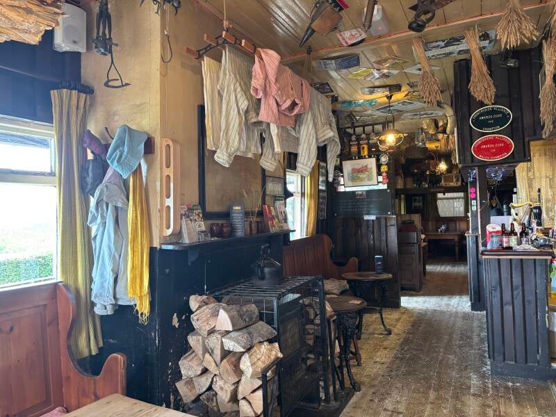
White Hart Community Inn, St Dogmaels / Llandudoch
Tour of St Dogmaels Abbey, village & Poppit Sands in the Pembrokeshire National Park, 6.2 miles

Try this Pub & Walk
Most people passing through St Dogmaels are heading somewhere else. The road narrows, the speed limit drops to 20mph, and within a minute or two the village has been left behind as the road winds towards Poppit Sands. But this is not simply the route to the beach. St Dogmaels is a village that deserves a pause.
Set on the banks of the River Teifi, where the river meets the sea, this is a place shaped by centuries of people, industry and faith. The Abbey stands as a reminder of the medieval community that once dominated the valley, while the river below tells a more practical story of boatbuilding, fishing and the working lives of generations who depended on these waters.
At the heart of it, as you arrive in the heart of the village, sits the White Hart. It's been trading since 1769, and it very nearly didn't make it to see its 250th birthday — it closed in 2019, the last 'traditional' pub left in the village. St Dogmaels wasn't having that. Two years of fundraising later, the pub now belongs to its own community, backed by well over 500 shareholders as far afield as Australia and Canada.
This circular walk is a journey through the layers of the village. It begins by the river, passes the remains of St Dogmaels Abbey and the working watermill, climbs above the village for wonderful views across the Teifi and its estuary, then heads towards Poppit Sands before returning along the coast path.
By the time you return to the White Hart, you have not simply completed a circular walk; you have travelled through the story of St Dogmaels itself.
And that is why the White Hart is the right place to finish. It is not the pub with the biggest view, the most dramatic setting or the loudest reputation. It is something perhaps more valuable: a place that truly belongs to this village.
About The White Hart, St Dogmaels


Last visit: July 2026
The White Hart is the sort of pub that could easily be missed.
Unlike some of the better-known waterside destinations nearby, it does not sit overlooking the Teifi estuary, tempting visitors with a sweeping view. It does not announce itself as a destination. It simply sits in the heart of St Dogmaels, quietly doing what pubs have always done: providing a place for people to meet.
And that is precisely why it matters.
The White Hart has been part of village life for generations. When my family moved from England to Wales in 1975, arriving in St Dogmaels on a wet January night, it was one of our first connections with the community we were joining. The owner of the house we rented invited my father to the pub, and the nearest was the White Hart. It was a place of simple pleasures: a welcoming doorway, a child’s coke and chips, and a reminder that we were becoming part of a Welsh-speaking village. Mr Chandler was the landlord in those days.
Nearly fifty years later, the White Hart still represents that same sense of welcome.
Its survival is a story in itself. Like many rural pubs, it faced the pressures that have closed so many others. But unlike many, it remained at the heart of a village that recognised what it would lose. The community came together to secure its future, but the important thing is not the share certificates or the fundraising. The important thing is what they were protecting: a place where St Dogmaels people could continue to gather.
The pub is now sometimes formally known as the White Hart Community Inn, but locals will always simply say the White Hart. That is how places like this work. A legal name may change; a sense of belonging does not.
Today, the White Hart brings together the many strands of modern St Dogmaels. There are families whose roots run deep in the village, people who left to build careers elsewhere before the pull of hiraeth brought them home again, and a new generation of artists, makers and entrepreneurs proving that a fulfilling life does not always require leaving this beautiful corner of West Wales.
The White Hart welcomes them all.
Pub Key Information
| WEBSITE | https://whitehartinn.cymru/ |
| ADDRESS | Finch Street, St Dogmaels, SA43 3EA |
| PHONE | 01239 615955 |
| WHAT3WORDS | ///skidding.ever.outlined |
| PARKING | Limited car parking. Use the St Dogmael's High Street car park, 50 metres uphill from the White Hart. |
| LOCATION | St Dogmael's is close to the town of Cardigan, which sits on the A487 coast road between Aberystwyth and Fishguard. It's c.30 miles north east of Carmarthen. |
| HANDY FOR | Poppit Sands; start of the Pembrokeshire Coast Path; Cardigan Castle; Cilgerran Castle; Welsh Wildlife Centre near Cilgerran; Dolphin spotting in Cardigan Bay. |
Walk Overview
Begin by visiting the banks of the River Teifi below the White Hart, where the landscape today gives little indication of the activity that once took place here. This was a working river, with shipbuilding and fishing at the centre of village life. The return of the herring fleet would once have been a significant event, bringing boats, trade and people back to the waterfront.
From here, head towards St Dogmaels Abbey and the Church of St Thomas. The Abbey ruins are the obvious attraction, but do not miss Y Felin, the traditional working watermill nearby, still producing stoneground flour. If you can time your visit when it is open, it is well worth exploring.
The route then climbs above the village through Cwm Degwel, giving wonderful views back towards the Abbey, the Teifi and the settlement below. The excellent condition of these paths is testament to the local volunteers who maintain them — another example of the care people in St Dogmaels have for their surroundings.
Beyond the village, the walk passes farmland and open countryside, eventually opening out towards views of Gwbert and Cardigan Island before descending towards Poppit Sands.
The route brings you past the Teifi Waterside Hotel, the Ferry Inn and back through the village, where the river, the old streets and the Abbey come together once more.
Look out for the blessing stone near Alexander Gardens and consider its origins. Like so much around St Dogmaels, it carries echoes of a past that is not always fully explained.


Walk Key Information
| START/FINISH | At St Dogmaels' High Street Car Park |
| PARKING | Public car park, Pay by Phone: High Street, St Dogmaels, SA43 3EA |
| GRID REFERENCE | SN 166 460 |
| WHAT3WORDS | ///snack.subtitle.rectangular |
| DISTANCE/TIME | 6.2 miles / 10 km; approx 3 hours |
| ASCENT | 785 feet / 240 metres |
| PATHS/TERRAIN | Quiet village roads initially. Clearly marked footpaths, wooded tracks and fields. Some grassy tracks becoming overgrown. Numerous gates. Walk from above Poppit to outskirts of St Dogmaels is along narrow, sometimes busy road. |
| DIFFICULTY | Moderate |
| PUBLIC TRANSPORT | Cardigan is a good bus hub. Bus services run from Cardigan to St Dogmaels every two hours or so. |
| TOILETS | At the car park; at Poppit Sands; both the Ferry Inn and the Teifi Waterside Hotel are passed on this walk, and have toilets. |
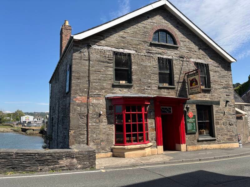
| OTHER PUBS TO VISIT | The Ferry Inn, St Dogmaels; Teifi Waterside Hotel, Poppit; The Castle Inn just before going over Cardigan Bridge is terrific. |
Walk Instructions: Choose what works for you
There are multiple ways to consume the route described below.
- Either follow the online Walk Directions below, or download and print a copy of the route.
- If you have the OS Maps App, you can follow a saved route directly in the OS App.
- Or download the GPX file for use with your chosen GPS-based tracker App, like Strava. Upload the file when you Create a New Route in the App.

Walk Directions
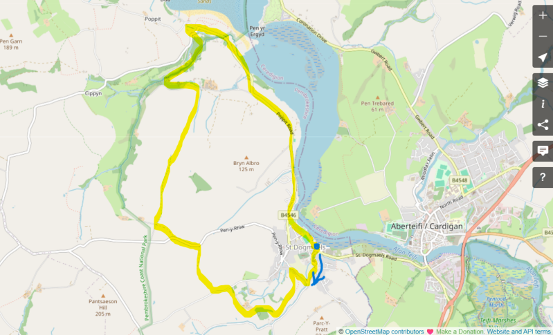
- From the car park, return to the road and turn left. You’ll soon pass The White Hart on your left-hand side. Take a moment to visit the banks of the River Teifi, , where shipbuilding and the return of the Herring fishing ‘fleet’ would have featured centuries ago. Go past the pub, head left just before the garage on the public footpath to the river frontage – no evidence today, only some old stone warehouses used by the garage.
- Back to the road, cross over and make your way along Mill Street towards the remains of St Dogmaels Abbey and its visitor centre, and the Church of St Thomas. The mill - Y Felin - is a traditional working water mill producing stoneground flour. Try to coordinate your visit while its open. Check ahead with Miller Emma who might be able to arrange a tour.
- With the Abbey on your right, continue on the road past the pond, round the corner to the junction beyond B V Rees garage. Turn right onto Cwm Degwel.
- Follow the road uphill, and as it starts to curve, alongside a house drop down to a narrow lane to your right that has a ‘No Through Road’ sign on it. Quickly, there’s a very sharp bend on this residential lane, which then climbs steeply above with village, offering views of the River Teifi, and the abbey, as you climb out of the village.
- As the path reaches the top, turn sharp left, almost back on yourself, in front of a house called Prysgol, then a few other properties. Continue, and you’ll soon see a footpath to follow up ahead, above the cwm.
- This stretch of the walk carries you up through the woods high above the ravine of Cwm Degwel on a well-maintained path. There’s a highly active team of volunteers in St Dogmaels doing a fine job of footpath maintenance, which is evident here.
- Eventually the path levels out. Follow until an old metal kiss gate to your right offers a route through a field which you cross into a wooded path straight ahead. You’ll likely share the fields around Pencnwc Farm with horses: these are horses of the Pembroke Stud, a specialist breeder of Irish Draught and Irish Sports horses.
- As you exit the wood into another horse field, turn right towards the farm house, following a hedge initially, and then line of the fence around the farm’s garden to a gate. Exit onto the farm track.
- Follow the track to the road, then turn left along the road as we start something of a zig zag route towards Poppit. Look for a small cluster of trees as the road curves a little to the right, and just beyond, an unmarked path through the hedge row. Continue ahead in this shady area of copse on a grass path.
- Go through a gate into a field, then turn immediately left to follow the field boundary to the corner, then right, down the field to the exit onto a wide grass track between fields.
- Go through a farm gate in front of a small pond near to Bryncws Farm and join the lane. Go right here to join a road. Turn left.
- Follow the road to the bend, where a bridleway is signposted to the right. Follow that route, then at the first opportunity, follow the next bridleway signposted to the right. You’ll by now start to see waymarkers for the new Teifi Valley Trail, an 83 mile route running between the Cambrian Mountains and Poppit Sands, some of the best walking in West Wales. (There’s a plan to leverage it to create a ‘Celtic Circle’, a 170 mile circular route. This will combine the Teifi Valley Trail with the Wales Coast Path to Borth, then adding a marked trail up to Strata Florida touching also on the Cambrian Way en route).
- Ironically, this next bridleway section was the hardest to traverse: it’s clearly a well-used track in wetter months as the footing is baked-in horse hoof prints, with then overgrown grass hiding them, making each footstep one requiring gingerly caution. Perhaps this area is out of jurisdiction of the St Dogmaels footpath team – I’ve seen requests for volunteers to help maintain the Teifi Valley Trail.
- Eventually reach a metal gate into open fields with fine views across to Gwbert and Cardigan Island. There’s a rough track running down the middle of the field in front of you – follow it all the way down to the farm, Manian-Fawr. The name is thought to relate to an old castle or fortified landmark once present in this area.
- Once in the farmyard you have a choice: turn left and continue to follow the entire walk route; or turn right and chop off the Poppit section to arrive on the road back to St Dogmaels at the top of the road above The Teifi Waterside Hotel.
- Turn left down the lane in the direction of Cwmdeifio Uchaf. Look for a clearly marked footpath route to the right off this private lane. It runs through a shady wooded area (above which the old ‘manian fawr’ settlement is thought to have been located). Proceed through a red-coloured gate and follow the route all the way into the holiday park.
- Once inside the park, turn immediately right to pass to the side of the swimming pool on a footpath from the park to Poppit. When you reach the road, cross carefully and proceed directly to the Poppit Sands car park. Café and toilets ahead of you, and a RNLI shop.
- To start the return to St Dogmaels, follow the coast path markers heading right on a sandy track near to the main road. It eventually joins a pavement and leads to The Teifi Waterside Hotel. Cross to the hotel entrance to use the hotel’s footpath up the hill along the left-hand hedge.
- At the top of the hill there’s an unavoidable section along the main road. It can be narrow in places, and busy with beach traffic at weekends or school holidays, so please take care.
- Continue past the moorings in St Dogmaels, and onward past The Ferry Inn (excellent waterside pub with super river views), and once past the Pottery on your left look for a footpath sign between houses on a narrow path in the direction of the River Teifi.
- This narrow path runs above the river to a public space called Alexander Garden, in front of the village school. Try to find the ‘blessing stone’ and decide on its origin and purpose! Continue past Teifi Villa (formerly the Teifi Netpool Inn) and follow a lane around the school to arrive back at the car park. Follow the road down to The White Hart.
Additional Notes
An Abbey, the River Teifi and the village it built
St Dogmaels' whole reason for existing traces back to one genuinely unusual foundation.
The Abbey here was established in 1113 for thirteen monks brought over from the French monastery of Tiron, raised to full abbey status in 1120 — the only Tironian house ever founded in England or Wales.
Tironensian practice required the monks themselves to master real trades — joinery, masonry, blacksmithing, painting — so from the very start they had a direct hand in building the place with their own labour, rather than simply commissioning it. It thrived for centuries, and developed a genuine reputation for scholarship, and even held the Isle of Caldey as a daughter house and pilgrimage site.
The Abbey may suggest a world of quiet contemplation, but the monks were not immune from the temptations of ordinary life. In 1402, a visitation by the Bishop of St David’s found the monastery in some difficulty. Among the concerns raised were that monks had been visiting taverns in St Dogmaels, drinking together, gossiping excessively and were suspected of socialising rather too freely with women lodging in the town.
The Bishop responded firmly. Monks were reminded that their calling was prayer, not tavern visits and drinking bouts. One unfortunate brother, Hywel Lange, was even instructed to give up wine and mead for a year and give his allowance to the poor.
History has a habit of reminding us that people have always been people.
The village that grew up in the Abbey's shadow had its own, much more recent boom. St Dogmaels became a significant herring fishery through the 18th century, and the 19th brought a genuine shipbuilding trade on the Teifi — the warehouses and lime kilns still visible along the riverbank are the physical leftovers of that wealth.
Pinog, on the walk's opening stretch, was the working heart of it: boats were built directly on this bank of the river through the 1800s. Nearby, a Blessing Stone, thought to have originally been part of a prehistoric burial mound, played its part in the industry too.
The pub landscape around St Dogmaels has shifted a good deal over the last twenty-odd years, and it's worth knowing the wider picture rather than treating the White Hart's survival in isolation. The Teifi Netpool Inn — its name itself a nod to the estuary's net-fishing tradition — has largely given up being a pub at all, trading now mainly as holiday accommodation under the name Teifi Villa.
The Ferry Inn, by contrast, has thrived, and has become a genuine destination in its own right, with excellent food and a river frontage most pubs would kill for.
At Poppit itself, the old Webley Hotel has been transformed into the Teifi Waterside Hotel, a serious piece of investment capitalising on one of the best views on this stretch of coast.
And Crwst — the Cardigan bakery and café that opened its first site in 2018 and has since gone on to supply Selfridges — added a second café right on Poppit beach a few years later, now widely considered the best of its kind on this part of the coast.
All of it points the same way: this whole stretch of the Teifi is quietly attracting the kind of investment and attention that used to bypass it entirely. Perhaps a post-Covid wave of staycation visitors is discovering West Wales for the first time.
The White Hart's survival isn't a story that stands apart from that wider pattern — it's simply the village's own way of making sure that whatever else changes along this gorgeous river, there's still one pub at its centre that's always, unmistakably, been theirs.
Other Pubs to try in Pembrokeshire
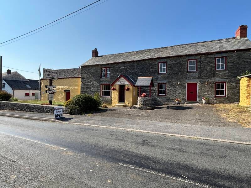
Ffynone Falls, Celtic mythology and a link to Buckingham Palace in Newchapel
5 miles