

The Plume of Feathers, Rickford
Beacon Batch, Burrington Combe & Rickford – this pub walk reveals layers of Mendip history, 6.5 miles
Try this Pub & Walk
You might have driven through Rickford many times without ever quite knowing what lies beyond the road.
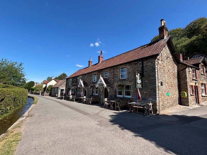
It's a tiny village tucked into one of the prettiest Mendip combes, and from the A368 the first thing that catches your eye is the Mill Pond, its water flowing steadily beneath the road and past the little Swiss-style chapel reflected in the water. Then you see the cottages nestled along the lane, and The Plume of Feathers — an old village pub sitting prominently at the heart of it all.
Rickford has the feel of somewhere unexpectedly discovered. One local I met described it as the “quintessential definition of England”. I can understand why. There are very few houses, very few people, a stream and ford running through the middle of the village and a pub that has been part of its story for generations.
So now's the time to stop.
The walk starts from nearby Blagdon and climbs onto Black Down to reach the trig point at Beacon Batch, the highest point on the Mendips. From there it descends through Burrington Combe before eventually arriving at Rickford, where the character of the walk changes again.
You'll encounter some remarkable traces of the past along the way, and Rickford itself has far more stories than its size suggests. Water, religion, war, industry and one of Bristol's great families have all left their mark here. Some are obvious; others need a little looking for.
But don't rush through the village trying to find them all.
Take some time to explore Rickford, then settle down at The Plume of Feathers. The pub is the beating heart of this extraordinary little cluster of houses, and after you've seen the village on foot, you'll understand why it is such a good place to stop.
There are plenty of stories here. I'll leave some of them for the Notes below.
About The Plume of Feathers, Rickford

Last visit: August 2026
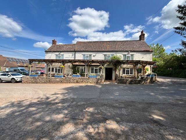
You can't really miss The Plume of Feathers.
Driving above Rickford on the A368, it appears to be the obvious heart of this tiny cluster of houses below you, and there always seem to be people sitting outside enjoying a pint. After years of passing through and wishing I could join them and discover what this intriguing little village was like, I finally stopped.
It was worth it.
The Plume has been part of Rickford for generations. The earliest surviving document relating to the property dates from 1801. It was once a working rural pub in every sense: farming and beer retailing took place here, cider was made from the surrounding orchards, and in the early twentieth century the pub could be open from six in the morning for men wanting a pint before work.
You can still feel something of that history inside.
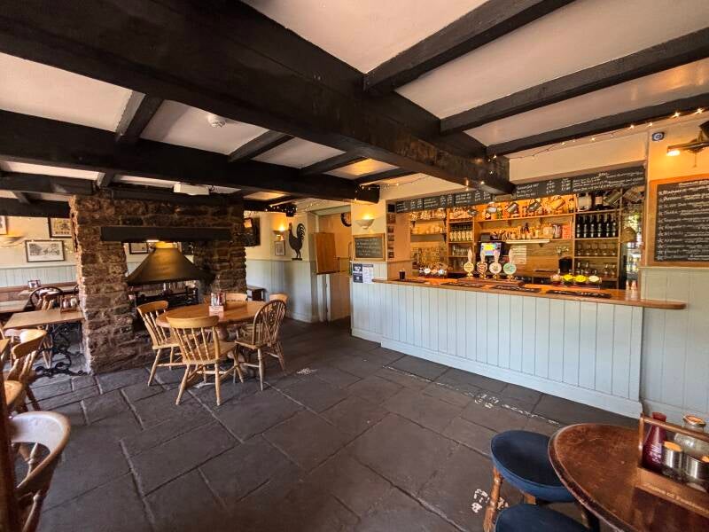
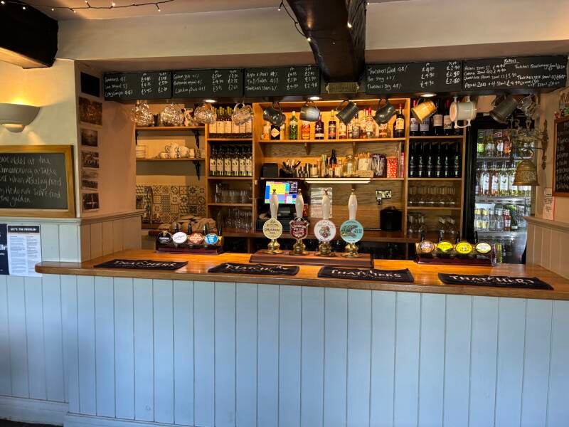
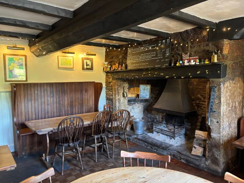
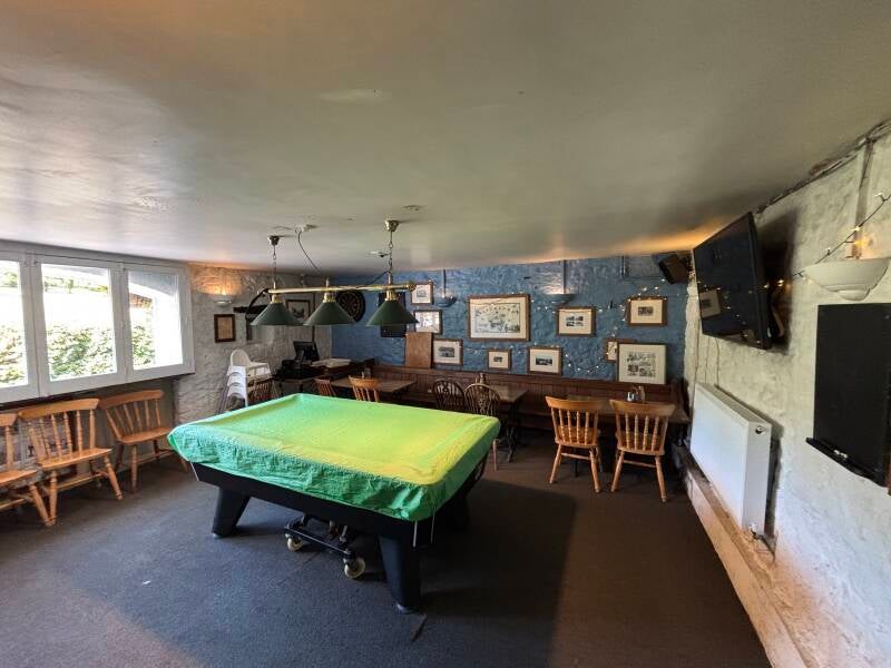
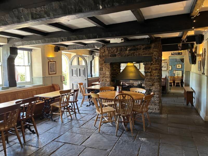
The pub is arranged around three rooms, with the main bar occupying a large space around a huge log burner on a slate floor. A second, cosier room opens off the bar, while a lower room provides additional seating and a pool table.
Historical photographs of the village, its people and the pub are displayed throughout, making it easy to start imagining the Rickford of earlier generations. A pub copy of Mary Coward's book, “Rickford-A history of a North Somerset Village” is available behind the bar if you'd like to read the history of the village.
But this isn't a museum.
It's a living village pub.
Kate and Dan have been at the Plume for 20 years this year, and during my visit I met Amberley, who was working front of house. She had one of those natural abilities to make people feel welcome that can't really be taught, a real gem. Meanwhile, the people I met during the walk were already talking about the pub as somewhere they regularly visit.
At Yeo Valley I was told about the Friday “gin trail” from Blagdon, with the Plume as its destination on the way home. Later, a mountain biker I met on Black Down told me the Plume was his local and was looking forward to returning for the food. I tried the Ploughman's myself — enough to move the Plume into second place in my highly unofficial search for the best pub lunch — but the pizza menu has already given me a reason to return. Roquefort pizza? Absolutely.
And then there are the ducks.
The annual duck race takes advantage of the ford running through Rickford, with the Plume acting as its headquarters for a wonderfully eccentric Mendip summer event that raises money for local charities. I missed this year's race by only a few weeks, but the painted rubber ducks around the pub made sure I knew I'd missed something significant.
This is what makes The Plume special.
Its setting is extraordinary, its history is fascinating and its food is worth stopping for. But underneath all of that, it is still what you hope to find when you turn off a main road into a tiny village: a pub where local people come, where visitors are welcomed, where things happen, and where the community has a place of its own.
Rickford may wear many historical layers.
The Plume of Feathers is the beating heart beneath them all.
Pub Key Information
| WEBSITE | https://theplumeoffeathers.com/ |
| ADDRESS | The Plume of Feathers, Leg Lane, Rickford, near Burrington, BS40 7AH |
| PHONE | 01761 462682 |
| WHAT3WORDS | ///holds.scary.purse |
| PARKING | Limited. Some on-street parking in front of the pub. And some in a field up the lane. |
| LOCATION | Off the A368 Bath to Weston-super-Mare road, in between Blagdon and Burrington. Entering the village from The Batch requires a 4x4 to drive through the ford. Best approach is from the Blagdon direction to turn off easily into the upper part of the village near the pond. |
| HANDY FOR | The Mendips. |
Walk Overview
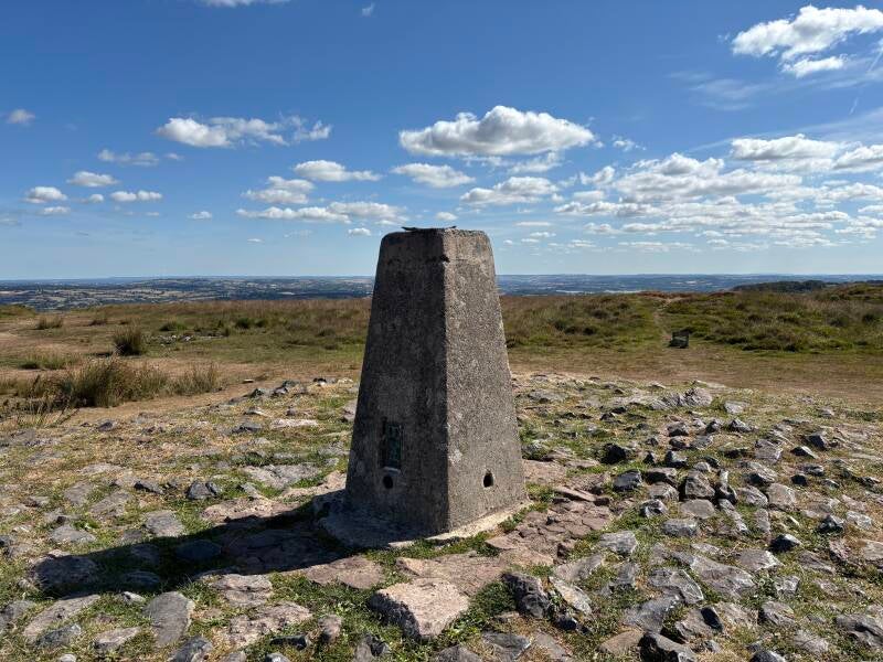
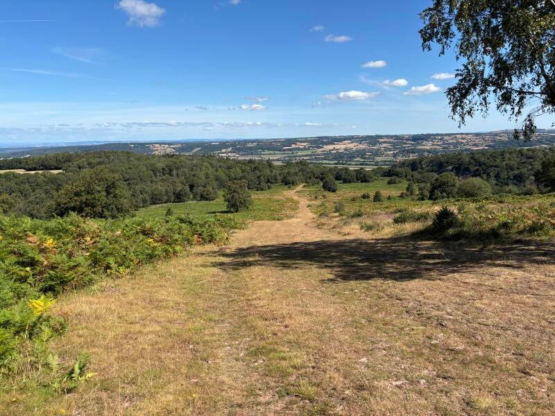
This is a classic Mendip walk, with Beacon Batch — at 325 metres, the highest point on the Mendips — providing the headline achievement.
Starting near Blagdon, the route climbs through quiet lanes and open countryside before reaching the high ground of Burrington Ham and then Black Down. The final climb to Beacon Batch opens out into the broad Mendip landscape, with the trig point marking the summit.
There is more to discover up here than the views. A short diversion reveals the remains of a Second World War Starfish bombing decoy, one of a network of sites designed to deceive German bombers into attacking a false version of Bristol rather than the real thing.
The route then descends towards Burrington Combe, where another very different piece of history awaits. The Rock of Ages cleft is associated with Augustus Toplady, once curate of nearby Blagdon and traditionally said to have been inspired here to write the famous hymn. Whether the story is fact or legend is itself part of the fascination.
From the Combe, the route climbs again before descending into Rickford. After the open expanses of Black Down and the drama of Burrington Combe, this tiny village feels like another world. Its spring-fed stream, Mill Pond, unusual chapel and collection of old buildings make it well worth slowing down and exploring.
And then there's The Plume of Feathers.
The pub has been at the heart of Rickford for generations, and arriving here on foot gives you a very different appreciation of its setting. Take some time to wander through the village, then settle in at the Plume for food, a drink and the warmth of a proper village pub.
The walk continues past the Wills family's Coombe Lodge Estate before returning to Blagdon, completing a route that manages to combine the highest point of the Mendips with wartime history, local legend, an extraordinary little village and a pub that is very much still part of its community.
It's a lot of Mendip walking in one outing — but the layers reveal themselves as you go.



Walk Key Information
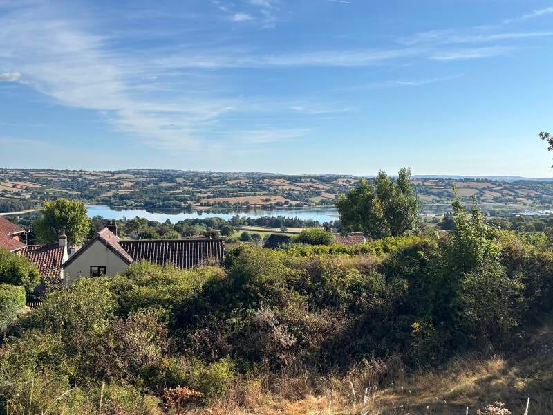
| START/FINISH | There's a small picnic area and viewpoint (called The Rocks) up a lane above Blagdon called Street End, close to the entrance to Yeo Valley's Headquarters. Go straight uphill to the side of the Seymour Arms. |
| PARKING | The parking area is quite limited. It might be possible to utilise visitor parking at Yeo Valley if you ask at reception. |
| GRID REFERENCE | ST 498 586 for the viewpoint |
| WHAT3WORDS | ///drooling.axed.downs for the viewpoint |
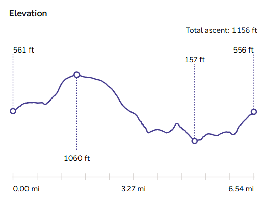
| DISTANCE/TIME | 6.5 miles / 10.4 km; approx 3 hours |
| ASCENT | 1150 feet / 355 metres |
| PATHS/TERRAIN | Lanes, grass and gravel tracks, fields, moorland. Some field gates. |
| DIFFICULTY | Moderate. |
| PUBLIC TRANSPORT | Unclear. |
| TOILETS | Yeo Valley HQ Canteen has a cafe (and loos) available to the public; public toilets at the bottom of Burrington Combe, near the Rock of Ages; The Plume of Feathers. |
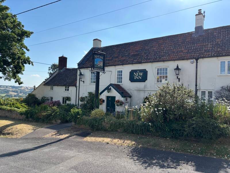
| OTHER PUBS TO VISIT | The New Inn at Blagdon; The Crown at Churchill; The Swan at Rowberrow. All are featured on this website. Also try The Langford Inn, Lower Langford. |
Walk Instructions: Choose what works for you
There are multiple ways to consume the route described below.
- Either follow the online Walk Directions below, or download and print a copy of the route.
- If you have the OS Maps App, you can follow a saved route directly in the OS App.
- Or download the GPX file for use with your chosen GPS-based tracker App, like Strava. Upload the file when you Create a New Route in the App.
Walk Directions
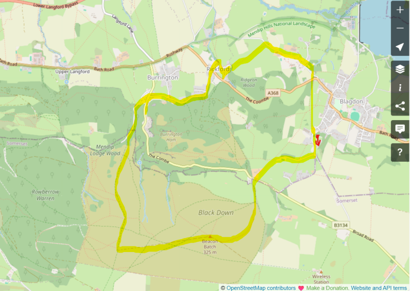
- Turn left out of the parking area to start making your way gently uphill. This is a quiet lane, but there’s a grass verge to follow for the first section at least. I popped in to the Canteen at Yeo Valley’s HQ, a short distance from the car parking area. As well as being their in-house canteen, it’s open to the public too, so give it a try if walking here on workdays – it’s a fabulous café, with great views. Coffee and the loo set me up for this walk.
- Continue on the road uphill, all the way out of Blagdon, until you reach a junction. The road to the right heads upward towards Burrington Combe, but there’s another lane leading off here – Luvers Lane – which is sharp right. Follow that. This part of the route is called the Limestone Link, a 36 mile route joining the limestone of the Cotswolds to that of the Mendip Hills.
- Continue on this tarmac drive straight ahead until you come to a metal footpath gate immediately ahead of you. This part of the Mendips crosses land that has been dedicated to the public by the landowner Sir David Wills and is part of the Coombe Lodge and Langford Court Estate.
- The route is straight ahead through the gate following clear paths, initially on a gravel & grass track to the side of this first field, and then across subsequent fields you reach a met walkers gate into the moorland of Burrington Ham (or common).
- As soon as you pass through the metal gate, bear left immediately to go through another metal gate, as we progress towards the slopes of Beacon Batch.
- Emerge after a short distance of shady woodland to a parking area, one of the main car parks for exploring Burrington Ham, and Black Down on the other side of the B3134, which is where we’re heading. Turn left to follow the B3134 uphill - there’s safe walking along the other side of the road, so cross this busy road carefully. After 100 metres, and just as the bend ends, there’s a right-hand turn, a driveway that runs past Ellick House and Ellick Lodge to become a footpath through the copse ahead.
- Pass through the metal footpath gate onto Black Down. You’re immediately presented with a multitude of footpath options to choose from. The one we want is literally straight on from the gate - straight up the slope ahead - which leads to the summit of Beacon Batch. The grassy path at the start becomes steeper and stonier as you climb, and then narrows into a channel cut by water, but a new footpath has been forged above this channel making walking a lot easier.
- It reverts to a grass track as it levels off, and the trig point comes into view to the right. This track meets a gravelled footpath which runs right up to the trig point. This summit area of Black Down is known as Beacon Batch, and is the highest point on the Mendips at 325 metres (1066 feet).
- Pass over the trig point to continue on the gravel path slightly left ahead, roughly maintaining the same direction as the route you arrived on. Stay on this path until it’s no longer gravel. We’ll turn right now on a broad grass track downhill in the direction of Burrington Coombe. However, there’s something of interest a few hundred metres to the left, just before the path starts to drop down steeply towards Tyning’s Farm. During World War II a bombing decoy town was constructed on Black Down, which was intended to represent the blazing lights of a town. There’s a military bunker still, but little other evidence.
- The grassy track narrows at the bottom of the hill as it enters a woodland ahead, and eventually drops to a gravel track beyond a metal barrier. Turn right down the lane.
- The gravel gives way to tarmac and then you’ll soon see a footpath sign heading off to your left, but carry on down the lane until you see a ‘Restricted Byway’ sign to your right. It rises over a hump then drops downhill sharply through some trees, and emerges next to a cottage. Turn right to reach the road, the B3134 again.
- Cross over. From here, the route heads up Burrington Combe where we will visit the Rock of Ages, but returns this way. As you start off to the right, make use of the forecourt of the old pub rather than staying close to the road. Just on the other side of the pub, you can head across the grass to a wooden footpath gate in its left corner, which emerges next to public toilets.
- Continue across the parking area and you’ll see some information boards regarding the Rock of Ages, which you can see soon after entering the gorge of Burrington Combe. Across the road, on the rockface with the cleft, you’ll see a commemoration of the Rock of Ages.
- Retrace your steps back through the old pub car park, and continue until Ham Link on your right. Follow this quiet residential lane gently uphill, until you reach a junction, and bear right where a sign warns ‘Unsuitable for Motors’. This lane rises quite steeply past cottages, and then eventually levels out to become a gravel track and driveway. Continue straight ahead. #
- At another junction, bear left downhill on a Bridleway called Rickford Rise. Continue down to the bottom of this lane until it meets the A368. Cross carefully into Rickford, join a lane called The Batch, and as you navigate past the ford, admire this curious village all the way to The Plume of Feathers. There are so many interesting buildings and fact about the village – take a moment to explore.
- To the side of the pub is Leg Lane. Follow it, heading gently uphill past Rickford Mill, continuing all the way to a metal gate into a field. There’s a distinct path through the field to the metal gate into the next field. There’s likely livestock in these fields. Across the next field aim for the metal farm gate in the fence ahead. Then you’ll see the next destination - another metal farm gate.
- Turn right on Bourne Lane. Pass Ridge Farm. Then walk past the high, old stone walls of privacy at Coombe Lodge. (I’ve shared a photo of the house that you can just about catch a glimpse of over the wall!)
- Continue along Bourne Lane to the handful of cottages known as Menlea. Start gently uphill. Look for a gas installation building on your right. Take the path in front of it heading uphill between hedges. The route back to the car from here is almost straight uphill, through fields, but first we have to negotiate the main A368 road into Blagdon.
- Listen for cars before emerging very carefully onto the main road, and crossing briskly to the path opposite. After a few yards on this woodland track, you’ll see a footpath marker to the left. Go through a metal kissing gate into a field and then follow the right-hand boundary uphill to the gate.
- In the next field head towards the right top corner, where there’s a metal footpath kiss gate into the next field. Straight over the next field, and then straight across the final field in the direction of the large L shaped house in front of you. You’re aiming for a stone-slab stile, just to the right of the house.
- Emerge onto the main road above Blagdon, and turn right to make your way back to the little car park a short distance up ahead.
Additional Notes
Rickford Rising, the Ford & the Water That Shaped a Village
It is difficult to understand Rickford without first understanding its water.
At the foot of Blagdon Combe, the Mendip limestone has a remarkable way of hiding water underground before releasing it again as springs. At Rickford, the result is the Rising: a clear, constant spring emerging from the hillside before flowing beneath the road and into the Mill Pond.
The flow is extraordinary. Rickford's history records an average of around 13.7 million litres of water a day, fed by the underground drainage of the Mendips. The Rising has reportedly never been known to run dry.
It is easy to imagine the significance that must have had for a small settlement.
The water provided power for mills, shaped the village's boundaries and created the ford that may lie behind Rickford's name. An early Anglo-Saxon reference to the area describes a large spring as Schirebourne, or “clear stream”, while two mills on the stream were recorded in the Domesday Book.
The relationship between village and water remains remarkably visible today.
The brook runs through Rickford and, historically, formed the boundary between the parishes of Burrington and Blagdon. That created some curious consequences: people living on opposite sides of the stream could belong to different parishes, even though they were neighbours.
Further down the village, the water becomes even more difficult to ignore.
The road itself enters a substantial ford. There is no conventional two-lane carriageway here; instead, the route narrows to a single lane alongside a footpath before part of it disappears into the stream bed. The ford is deep and uneven enough that it is effectively a four-wheel-drive crossing rather than a normal road for ordinary cars.
It is an extraordinary sight in a modern English village.
But perhaps it shouldn't be surprising. The name Rickford is thought to incorporate the idea of a ford, and the stream has been part of the settlement's physical geography for centuries. Here, the water hasn't simply been accommodated by the village. The village has been built around it.
That becomes even clearer at the Mill Pond.
The pond has existed for centuries, with a leat carrying water towards the mill. The readily available supply supported a variety of local industries, most notably flour milling and later paper making. The paper mill continued to produce paper by hand into the nineteenth century, making use of the same resource that had first helped establish milling here.
In the late nineteenth century the landscape around the pond was transformed again, with W. H. Wills landscaping the area and enlarging the pond.
Today it is one of Rickford's prettiest features: water lilies, the little chapel reflected on the surface, the cascade below and the Rising continually replenishing it.
It is easy to see only the beauty.
But look at the water closely and you are looking at the reason Rickford is here at all.
Source: Mary Coward, Rickford – A History of a North Somerset Village, Rickford History Group.
Bristol Water – From Mendip Spring to City Supply
By the late nineteenth century, Rickford's water was no longer simply a local resource.
Bristol was expanding and its demand for water was growing. The reliable supply emerging from the Mendips attracted the attention of the Bristol Waterworks Company, which obtained powers in 1888 to take water from Rickford.
The Gauge House, built in 1895, is the most visible reminder of what happened next.
But it is easy to miss what makes this particular corner of Rickford so captivating. The Gauge House is not an isolated piece of water infrastructure: it is part of a remarkable sequence of water and buildings that unfolds as you move through the village. The Mill Pond, its small waterfall, the elegant Mill House and the chapel lead the eye onwards towards the Gauge House, and then further along the road towards The Plume of Feathers. Water, stone and buildings combine to produce an almost Swiss-like quality in this tiny Mendip settlement.
Only then does the practical purpose of the Gauge House become apparent.
Beneath it are the regulating arrangements that controlled the flow of water through Rickford. Water needed to remain in the brook, while surplus could be diverted into a pipe carrying it towards Blagdon Lake.
So the water that had once turned Rickford's mill machinery was being incorporated into a much larger infrastructure — helping supply Bristol.
The Gauge House also provides another glimpse of the influence of the Wills family. The land on which it was built was acquired from the estate, and the Wills family retained rights relating to the supply of water to parts of their Rickford property.
There is something rather satisfying about following the water's journey.
It begins as rain falling on the Mendip Hills, disappears underground, emerges at Rickford Rising, fills the Mill Pond, passes through the village and eventually becomes part of the infrastructure serving a growing city.
For centuries, Rickford lived from its water.
By the end of the nineteenth century, Bristol was living from it too.
Source: Mary Coward, Rickford – A History of a North Somerset Village, Rickford History Group.
Rickford Chapel – Methodists, Baptists & Dissenters
The little chapel beside the Mill Pond looks almost as though it has arrived from somewhere else.
The building was commissioned by W. H. Wills as a Baptist Chapel and hall and completed in 1888. An earlier Baptist chapel, together with a barn, yard and cottage, had stood nearby before being acquired and demolished to make way for the new building.
But the religious story in Rickford goes back further.
Dissenters were living in the village in the early nineteenth century, and “Deeds of Dissent” were registered in 1828 and 1843, allowing dwellings in Rickford to be used as places of Protestant worship.
A chapel was operated by Methodists until 1854, when the Baptists took over. An “open church” was subsequently formed in 1859, allowing former Methodist attendants to join. But disagreement arose because the Methodists had not been baptised, and they eventually resigned.
The present chapel therefore represents much more than a pretty building beside the pond. It is part of the story of the religious divisions and adaptations that shaped communities across England during the nineteenth century.
There is an especially nice connection here with the wider story of England's religious strands explored elsewhere on Pubs Worth the Walk.
The Wills Family & the Western Mendips
The Wills family left a remarkable mark on this part of the Mendips.
Sir W. H. Wills acquired Coombe Lodge, Blagdon and around 400 acres in 1879. Over the following years he bought additional land and property around Blagdon and Rickford, built farmhouses and cottages, and became an important local landowner.
His influence can still be seen in Rickford.
The family acquired buildings and land as they became available, including Rickford Mill House, and built cottages for estate workers. They also commissioned the present chapel. Their wider estate encompassed land around Rickford, Burrington, Blagdon and Langford.
The family wealth came from Bristol's great W. D. & H. O. Wills tobacco business, which grew into one of Britain's major tobacco companies and later formed part of Imperial Tobacco.
The story therefore isn't simply one of a wealthy family buying a country estate.
It is a story of Bristol industrial wealth reaching out into the Mendips and becoming physically embedded in the landscape: houses, cottages, farms, chapels, roads, water infrastructure and eventually the great country estate at Coombe Lodge.
The walk provides glimpses of that influence rather than a grand tour. The land through which the route first climbs towards Burrington Ham forms part of the estate land made available to the public, while later, leaving Rickford, the route passes the high stone walls of Coombe Lodge.
The Wills family effectively wrote themselves into the landscape.
Rock of Ages – the Cleft, the Hymn & the Legend
The final layer belongs not to Rickford itself, but to the Burrington Combe section of the walk.
The cleft in the rock face is traditionally associated with Augustus Toplady, who was curate of Blagdon in the eighteenth century. According to local tradition, he sheltered here from a violent storm and the experience inspired him to write Rock of Ages, Cleft for Me.
It is a wonderful story.
Whether it is literally true is less certain.
The tradition has become inseparable from the place, and the cleft is now marked with a commemoration of the hymn. Local churches continue to gather here for an annual Rock of Ages service, maintaining a connection between the landscape, the hymn and the communities around it.
Toplady himself provides another link with the walk's starting point. He served at Blagdon, and the church there features in our New Inn, Blagdon walk and pub entry.
And if Rock of Ages sounds like an unlikely cultural reference point for a modern walker, there is another route into it.
You may know the phrase from Queen.
The words appear in Brighton Rock, providing a rather different musical echo of a hymn written more than two centuries earlier.
From Mendip geology to eighteenth-century Anglicanism and twentieth-century rock music, it is another example of how much cultural history can hide behind a name on a rock face.
Other Pubs to try in Somerset

West Mendips Circular Walk to Dolebury Warren and my favourite Churchill pub
5 miles
An easy woodland walk through the 'calamine capital' of the South West!
2 miles