

Holford, The Plough Inn
The Walk: Red Deer (maybe), Wooded Combes & Wordsworth - A Quantocks Shortcut, 4.5 miles

Try this Pub & Walk
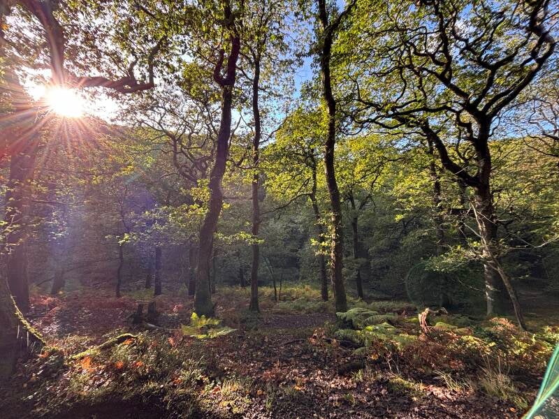
The Quantocks have a way of making you feel a long way from the everyday, with their ancient oakwoods, deep wooded combes and open hilltops looking out across Somerset towards the sea. In autumn, the landscape takes on another character altogether, as the woods turn russet and gold and the annual red deer rut brings the possibility of hearing a stag's roar echoing through the valleys.
This 4.5-mile circuit from Holford is a fine introduction to that landscape. You'll climb through Alfoxton Woods to the higher ground around Longstone Hill, descend into secluded combes and follow streams through the folds of the hills. There's enough ascent to make it a proper walk, but no need to commit to a full day's expedition to experience the Quantocks at their best. Along the way, you'll pass Alfoxton House, where William and Dorothy Wordsworth lived during their remarkable time in the company of Samuel Taylor Coleridge.
And then there's The Plough. From the road it might look like a pub to pass on the way somewhere else, but step inside and you'll find an old country inn with its own literary connections, a ghost story and the potential to round off a day on the hills in just the right way. They should offer 'FREE QUANTOCKS WALK WITH EVERY PINT'. Come for the landscape, take time to discover the history, and give this characterful village pub the support that helps keep places like it alive.
About The Pub, Village
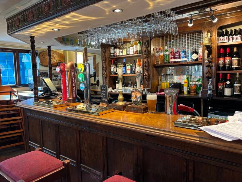
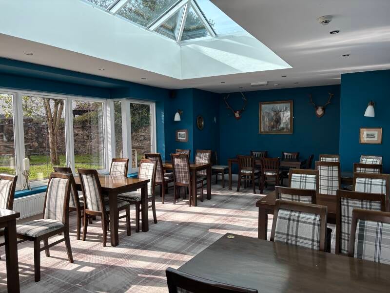
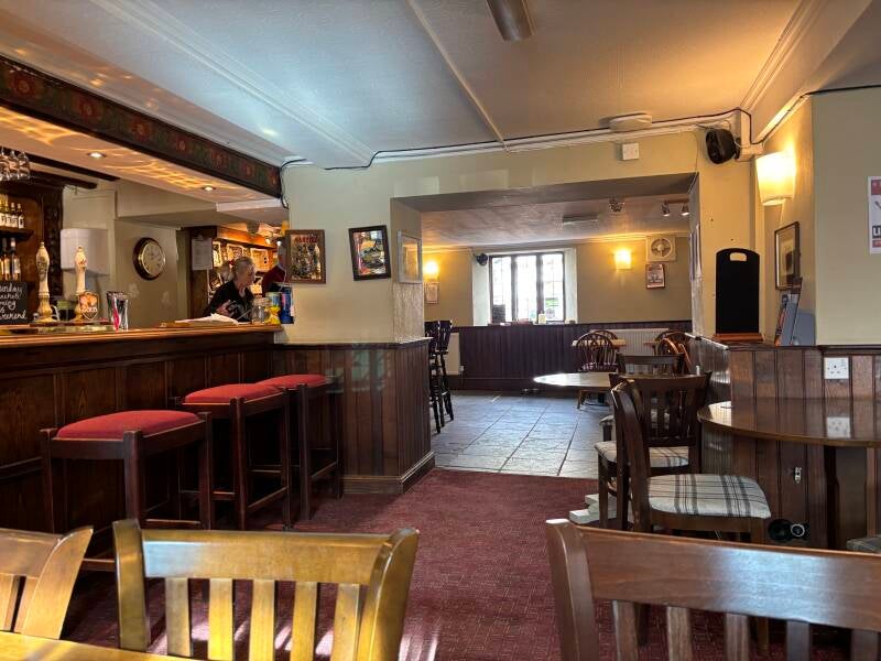
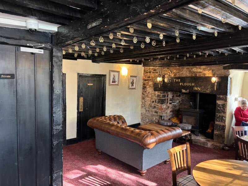
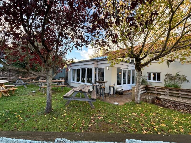
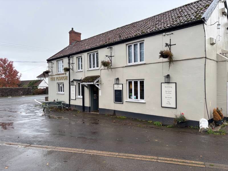
Last visit: October 2026
The Plough is a traditional country inn at the foot of the Quantocks, with a character and history that go well beyond its apparent 'roadside pub' position beside the A39. Inside, its beams and old-fashioned country-pub charm provide a sense of continuity with the past, while the conservatory offers a lighter, more spacious setting for dining.
It is certainly a prime spot for walkers exploring the Quantocks and following the Coleridge Way.
The pub has some remarkable stories to tell. Virginia and Leonard Woolf stayed here during their honeymoon in 1912, returning the following summer. A display inside reproduces Leonard's recollections of Holford and the welcome he received from the innkeepers. His affectionate account of the food — from Somersetshire breakfasts to home-cured hams — is a wonderful glimpse of country hospitality a century ago.
There's a darker tale, too. Local folklore tells of a Spanish traveller murdered for the gold he was believed to carry, whose ghost is said to linger around the site of an old staircase. It's exactly the sort of legend that gives an old inn an extra layer of character.
My own visit got off to an awkward start while a problem with the card machine was being sorted out. Once that was resolved, the welcome became more relaxed. The beer was good and the food perfectly acceptable. Get the fire lit and this would be a super place.
This is the kind of pub that needs supporting, and one I'd like to see thrive under the new licensee. I was there on a Wednesday lunchtime, and country pubs have a difficult balance to strike between quiet midweek trade and the demands of a busy weekend. All the ingredients are here — the location, the history and the potential for a brilliant pub-and-walk day out — to make me hope it gets things right.
Pub Key Information
| WEBSITE | https://www.facebook.com/p/The-Plough-Inn-Holford-61562802304060/ |
| ADDRESS | The Plough Inn, Holford, TA5 1RY |
| PHONE | 01278 574329 |
| WHAT3WORDS | ///cone.jaundice.names |
| PARKING | Pub car park |
| LOCATION | Coastal West Somerset - on the A39 Bridgewater to Minehead road. |
| HANDY FOR | The Quantocks is on the doorstep. King Charles III Coast Path near by. Porlocl, Lynmouth, Lynton and Exmoor along the coast. |
Walk Overview
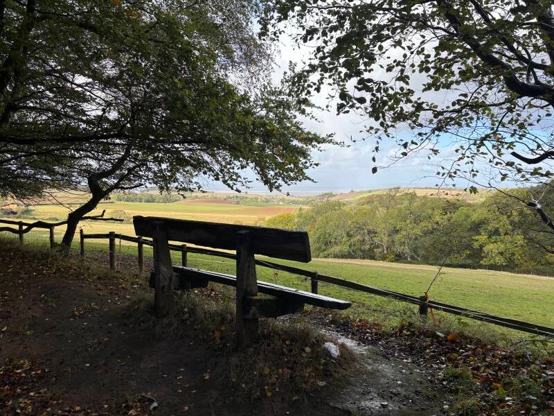
A 4.5-mile circuit from Holford into the wooded combes of the Quantock Hills, following a mixture of lanes, gravel tracks, woodland paths and grassy trails. The route begins on the Coleridge Way, passing through Alfoxton Woods before climbing steadily towards the higher ground around Longstone Hill. Here, the trees give way to more open terrain, with views across the surrounding hills and woodland.
The route then descends into Hodder Combe, crossing streams before climbing out through the neighbouring combes and returning towards Holford. The landscape alternates between enclosed woodland, steep-sided valleys and more open ground, with uneven paths and some steep ascents.
The circuit also passes Alfoxton House, historically associated with Wordsworth and Coleridge, and presents a landscape that showcases classic Quantocks' red deer habitat.
Allow around 2.5 hours, with suitable footwear recommended, particularly after wet weather when stream crossings may be more challenging.




Walk Key Information
| START/FINISH | Plough Inn, Holford, TA5 1RY |
| PARKING | Car park at the pub. |
| GRID REFERENCE | ST 155 411 |
| WHAT3WORDS | ///cone.jaundice.names |
| DISTANCE/TIME | 4.5 miles / 7.2 km; approx 2.5 hours |
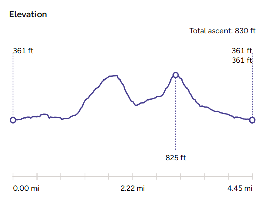
| ASCENT | 830 feet / 255 metres |
| PATHS/TERRAIN | Lanes, gravel tracks, streams, woodland |
| DIFFICULTY | Moderate. Some steep ascents. |
| PUBLIC TRANSPORT | On Bridgwater to Minehead bus route 15 |
| TOILETS | At The Plough; Combe House Hotel |
| OTHER PUBS TO VISIT | The Hood Arms, Kilve is a little further West on the A39. Also try The Bicknoller Inn in the village of Bicknoller, and the Carew Arms, Crowcombe are superb Quantocks pubs. |
Walk Instructions: Choose what works for you
There are multiple ways to consume the route described below.
- Either follow the online Walk Directions below, or download and print a copy of the route.
- If you have the OS Maps App, you can follow a saved route directly in the OS App.
- Or download the GPX file for use with your chosen GPS-based tracker App, like Strava. Upload the file when you Create a New Route in the App.

Walk Directions
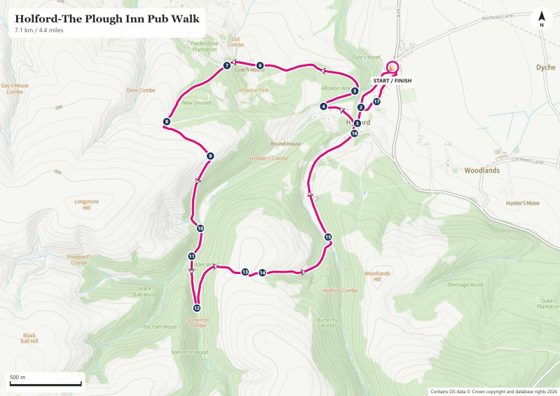
- Turn right out of the pub car park to follow a narrow tarmac lane away from the main road. Join the ‘main’ village road that arrives from your left (Map Reference #2) then continue ahead to a small junction to Holford Combe. Follow the lane round the corner to the right, in the direction of the Car Park. (#3)
- We’re now following the Coleridge Way, a long-distance trail associated with the poet Samuel Taylor Coleridge. Follow the lane, passing the stone memorial of the old ‘dog pound’ on your left. (#4) Dog pounds were a common sight in parishes of old - simply the village enclosure where stray or troublesome dogs were kept until their owners reclaimed them — a small, practical feature of parish life. There used to be a deer park here a few hundred years ago, so I wondered if this particular pound had rather more significance.
- From here, the route rises gently on a track through Alfoxton Woods. Later, fields appear on the right, with distant views of the Bristol Channel. This is red deer country, so stay quiet and keep your eyes open for movement in the woods!
- Then pass Alfoxton House on your left. (#6) It’s currently being renewed by a Buddhist community. It may look unassuming today, but this was once the St Albyns’ Georgian seat, and later the house where Wordsworth and Coleridge lived during their Quantock year — the place where poems like Kubla Khan and The Rime of the Ancient Mariner first stirred into life. I was thrilled to see the house being renovated.
- The lane becomes steeper beyond the house. At a sharp right-hand bend, carry straight ahead to leave the lane and pass through a wooden bar gate into the woods, following the bridleway signs. (#7)
- Follow the fence line on your left all the way to the top of these woods. (When the beech leaves are off the trees the path will be obscured, but it’s clear where you need to go). Breaking clear of the trees at the top of the slope, the path meets a junction of footpaths, an area referred to as ‘New Ground’ on OS Maps. (#8)
- The route is to the left, but it’s ‘2nd left’ – look for a blue public bridleway sign on a track that also displays a ‘No Vehicles’ sign. (1st left is back down the hill, and we’re not ready for that yet!). Follow this easy route on a clear track gently uphill, following the contours around Longstone Hill, and avoiding the need to go up and over it. (During the day, red deer tend to be grazing on higher ground, often in areas that provide a clear view of any possible disturbance. They drop down into the combes as the light fades).
- Continue straight over a grassy top to join a path that starts to curve right and downhill into the combe below. (#9) Before you drop into the combe there are some superb views of Quantocks landscape, showing the extent of the woodland and moorland you’re exploring.
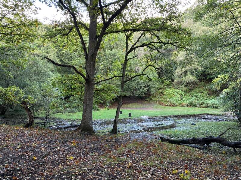
- Follow the stony track as it descends into Hodder Combe. At the bottom of the hill, cross the small stream that is flowing from the right. There are a few streams to cross on this section of the walk – you might need your ingenuity to find a suitable crossing point after heavy rain, but suitable footwear is best at any time. !f you time your walk at dawn or dusk, you might be lucky enough to find a stag in this area.
- Note the narrow meadow to your left. Once across the stream, head over a slight rise in the path and continue to drop down further to cross another stream. (Note that our goal is to locate a path that climbs out of the combe on the opposite hillside to the one we dropped down on). The path forks here, head to the left (#10).
- Continue ahead for 150m where the path splits again (#11) Take the left-hand fork, and identify that the route is starting to head gently up the hillside on your left-hand side. The OS Map calls this Somerton Combe. Cross another stream to start the steeper section of the climb on a gravel track ahead through the trees. After this initial steep section (c.100m), the path switches back sharply to the left, (#12) to continue its advance uphill, slightly less steeply but still an effort! Here the OS Map refers to Lower Hare Knap.
- Steadily climb out of the combe. You’ll start to see the density of trees starting to thin as you reach the tree line. The track becomes quite stony and uneven here, likely a result of water pouring into the combe during heavy rain. Eventually progress to a grassy track between ferns and gorse. Continue straight ahead.
- The path soon levels out onto a grass track, meeting informal footpath crossroads of grass tracks as it crosses this open plateau. (#13) Carry straight on, until the path starts to drop downhill again towards another combe. As a landmark, look for some fire beating poles at a distinct path to the left. (#14) Continue straight ahead to drop down into the next combe (Holford Combe), and to begin the return to Holford.
- Follow the route down through the trees until you reach a stream at the bottom. (#15) Again, pick your way across at a suitable spot and go left through a wooden farm gate to follow a level bridleway aside a field hedge, in the direction of Holford.
- Soon join a tarmac lane past Combe cottages, and then the Combe House Hotel. (A hidden gem. They serve lunches and teas here, everybody welcome).
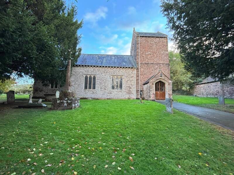
- Leave Holford Combe to rejoin the road through the village, continuing straight ahead to the Holford Combe/Car Park junction that you passed earlier (#3). Continue ahead, but stick to the lane as it curves to the right, following Bridgwater signs. Take a moment to visit The Church of St Mary The Virgin (#17). St Mary the Virgin doesn’t really have a story of grand additions, chapels, new towers or wealthy patrons. It’s remarkable precisely because nothing much seems to have happened to it. The church was built early, built plainly, and then simply left to do its job — an unadorned medieval tower that has quietly outlasted every family, fashion and era around it.
- Return to the lane and continue through the village. The Plough will appear on the left as you reach the A39.
Additional Notes
Alfoxton: An Estate and a Literary Legacy
Alfoxton House, which you pass early in the walk, has a history that reaches well beyond its association with two of England's most celebrated Romantic poets. The estate was held for centuries by the St Albyns, a prominent Somerset landed family whose influence extended across the surrounding countryside and the village of Holford. Their long association with Alfoxton makes the house part of the area's social history as well as its literary story.
In July 1797, William Wordsworth and his sister Dorothy took a lease on the house, settling close to their friend Samuel Taylor Coleridge, who lived at Nether Stowey. Their time here was remarkably productive. The three spent long hours walking the Quantocks, talking, observing the landscape and sharing ideas that helped shape a new direction for English poetry.
The influence of the countryside was not merely atmospheric. Wordsworth later recalled how a thorn tree on a ridge of the Quantocks caught his attention during a storm, inspiring his poem The Thorn. Dorothy's journal, meanwhile, records their walks through the wooded valleys and alongside clear streams, with views towards the sea. These are landscapes that you might recognise today on the walk, even if the precise locations of individual encounters are not always known.
Coleridge's creative relationship with the Wordsworths was equally important. Their walks and conversations contributed to Lyrical Ballads, a landmark in English poetry. One memorable excursion took them over the hills to Watchet, where the harbour's maritime setting has long been associated with The Rime of the Ancient Mariner. Today, lines from the poem adorn the harbour, alongside a statue commemorating the Ancient Mariner — a fitting reminder of the literary legacy that grew from these hills and their surroundings.
Alfoxton's own story is still unfolding. After decades of neglect, the estate was taken on in 2020 by a Buddhist community with a vision of creating a land-based retreat centre combining meditation, the arts and care for nature. Since then, volunteers have helped restore the walled garden and outbuildings, while the community has established retreats, creative events and links with local conservation and wellbeing initiatives.
There is still much to do, particularly to restore the main house, but the work is ongoing and the ambition is considerable. It is heartening to see this remarkable place being brought back to life, not simply as a monument to its literary past, but as a living community with a future of its own.
Try these Pubs & Walks

Discover the Quantocks on this fine circular walk from Bicknoller.
7 miles
Dunster to Watchet walk along the King Charles III Coast Path on a cider hunt.
5.7 miles
Above the Bristol Channel – Countisbury Moor to the Foreland Headland.
4.7 miles