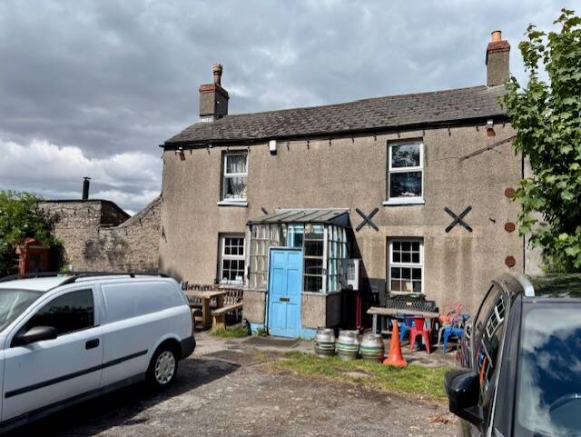
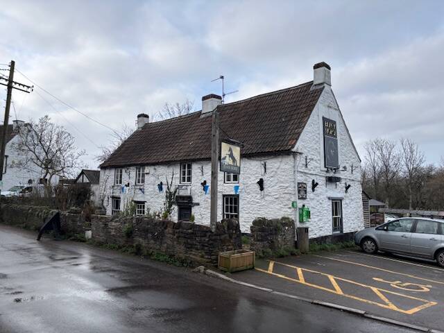
The George at Backwell
Backwell Pub Walk: Hidden Histories, Jubilee Stones & Village Stories, 5.4 miles

Try this Pub & Walk
Look beyond the busy roads and modern housing and another Backwell begins to emerge. This circular walk starts at The George at Backwell, in a part of the village called Farleigh, one of the historic settlements from which today's Backwell grew. From here, the route takes you through quiet lanes, woodland, farmland and historic Church Town, revealing a landscape of old houses, ancient settlements, memorials and stories that are remarkably easy to miss.
There are plenty of reasons to walk this one: a Victorian Jubilee Stone with a remarkable story, the old landscape around Backwell Hill, the grand houses of Chelvey Batch, a nationally important farmhouse, and St Andrew's Church, at the heart of Backwell's community for centuries.
And then there are the details you might otherwise walk straight past — an old village school, a bubbling spring traditionally associated with the name Backwell, a remarkable memorial sculpture and buildings whose importance is far greater than their modest appearance suggests.
It's Backwell beyond the A370: a village where history really does hide in plain sight.
About The George at Backwell
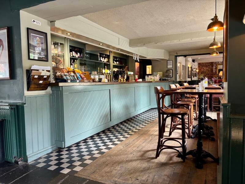
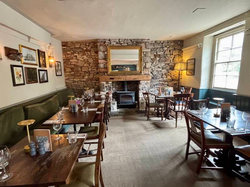

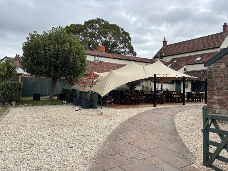


Last visit: September 2026
Today, The George at Backwell is a smart, comfortable village pub offering food, accommodation and the sort of modern hospitality you'd expect in a thriving North Somerset community. It's lovely inside, whether dining or not, has a super garden 'tent' unseen from the road, and both the beer and food are excellent.
But step outside and its history becomes rather more interesting.
The pub stands in Farleigh, one of the historic settlements that helped form modern Backwell, and was formerly known as the Farleigh Inn. It was a 'posting inn', where mail horses could be changed as the post travelled along the road — an early reminder that this was once an important stopping place in a very different Backwell.
But perhaps its most intriguing connection is with something that happened right outside.
Backwell Fair
Backwell was granted a charter in 1270, during the reign of King Henry III, allowing it to hold a Thursday market and an annual fair around the feast of St Matthew, from 20–22 September. The fair survived for an extraordinary 700 years, continuing until 1968. A field close to The George became known as the fair field, and its name survives today in Fairfield Close, Fairfield Way and the now closed Fairfield School.
So imagine Farleigh at fair time: livestock, traders, visitors and villagers gathering around the very place where today's customers arrive for a pint or a meal. For centuries, The George was part of the machinery of village life.
And there's an intriguing possibility for the future.
The charter still exists.
So while Backwell Fair may have ended in 1968, the right to hold it has not simply vanished. Perhaps one day the fair could return — not as a reconstruction of the past, but as a new Backwell tradition.
The end of an aristocratic chapter
The George had another important chapter in 1939 — and it connects this modest village pub with one of Britain's most famous country estates.
Backwell Manor had been in the hands of the Rodney family until 1657, before passing to the Churchill family. Then, in 1709, the manor was bought for £12,000 by Thomas, Lord Weymouth, the 1st Viscount Weymouth. The family already had its great Wiltshire estate at Longleat, and in 1789 the 3rd Viscount Weymouth became the 1st Marquess of Bath.
So the Marquess of Bath — the same aristocratic family associated with Longleat and, in more recent times, its famous safari park — was also a landowner here in Backwell. The family's extensive archives at Longleat still contain historic documents relating to the Manor of Backwell.
Over the following centuries, the Backwell estate was gradually broken up. Land on the eastern side of the parish passed to the Tyntesfield Estate in the late 19th century, leaving the final substantial manorial holdings to be sold in June 1939.
And where was the auction held?
Here, at The George.
The sale comprised 610 acres (248 hectares) of farms, quarries and other land, with an annual value of £1,067 13s 10d.
After more than two centuries of Thynne ownership, the auction at The George marked the end of the family's remaining manorial landholding in Backwell.
It is a wonderful piece of hidden history: the village pub where you can have a coffee today was once the place where the last remnants of an aristocratic estate — connected to the Marquesses of Bath and Longleat — were put under the hammer.
Today, the role has changed again. The George has adapted to the expectations of the modern village: good food, comfortable accommodation and a welcoming place for local people and visitors.
And that makes it a particularly appropriate starting point for this walk.
Because within a few minutes of leaving the pub, you begin walking through the Backwell that came before it.
Pub Key Information
| WEBSITE | https://www.thegeorgeatbackwell.co.uk/ |
| ADDRESS | The George, 125 Farleigh Road, Backwell, BS48 3PG. |
| PHONE | 01275 400095 |
| WHAT3WORDS | ///gossip.rates.grades |
| PARKING | Good sized car park at the pub. |
| LOCATION | 7 miles SW of Bristol, on the A370. |
| HANDY FOR | The Mendips; Bristol; Chew Valley |
Walk Overview
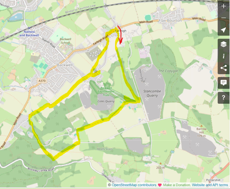
Starting at The George in Farleigh, look across the road for the old village school before leaving the village behind and climbing towards Backwell Hill. Here, a Victorian Jubilee Stone commemorates Queen Victoria's Diamond Jubilee, with later inscriptions recording subsequent royal jubilees. The route continues along the hillside above the old Coles Quarry, passing the setting of Backwell Hill House before descending through to Chelvey Batch, and across open farmland.
Then comes one of the walk's best examples of history hiding in plain sight: Sores Court.
The walk then reaches Church Town, the oldest of Backwell's historic settlements, and St Andrew's Church. Take time here. The church and churchyard have been at the heart of the community for centuries, and there is plenty to discover inside and out. Just beyond the church is Backwell Court and its bubbling spring, traditionally associated with the origin of the village's name, before returning towards Farleigh and The George.
What makes this walk special is not one spectacular landmark, but the accumulation of small discoveries. Together they reveal a Backwell that is still here — a rural landscape hiding in plain sight beneath a fast-evolving village.




Walk Key Information
| START/FINISH | The George, 125 Farleigh Road, Backwell, BS48 3PG. 01275 400095 |
| PARKING | At The George |
| GRID REFERENCE | ST 497 692 |
| WHAT3WORDS | ///gossip.rates.grades |
| DISTANCE/TIME | 5.4 miles / 8.6 km; approx 2.5 hours |
| ASCENT | 520 feet / 160 metres |
| PATHS/TERRAIN | Lanes, field paths, farm and woodland tracks. |
| DIFFICULTY | Easy, although a lengthy uphill stretch to the top of Backwell Hill to the Jubilee Stone. |
| PUBLIC TRANSPORT | Bristol to Weston-super-Mare train stops at Nailsea and Backwell station, c1.5 miles away. Buses run along the A370 and stop outside The George. |
| TOILETS | At The George. |
| OTHER PUBS TO VISIT | The Rising Sun in Backwell’s West Town; Old Farmhouse in Nailsea; Princes Motto at Barrow Gurney; The Blue Flame at West End, Nailsea. |
Walk Instructions: Choose what works for you
There are multiple ways to consume the route described below.
- Either follow the online Walk Directions below, or download and print a copy of the route.
- If you have the OS Maps App, you can follow a saved route directly in the OS App.
- Or download the GPX file for use with your chosen GPS-based tracker App, like Strava. Upload the file when you Create a New Route in the App.

Walk Directions
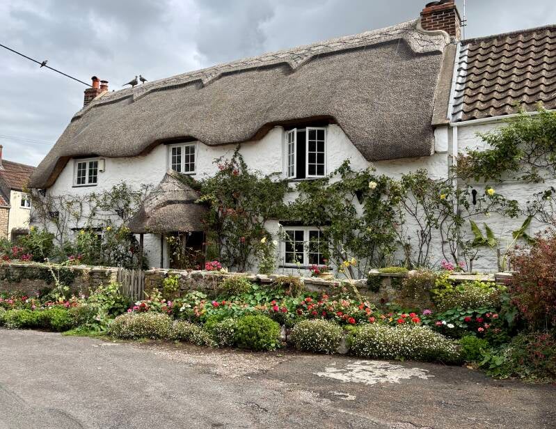
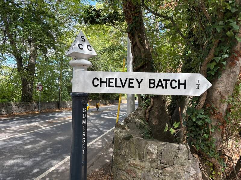
As you prepare to cross the A370 in front of The George to join Backwell Hill Road, there’s history evident immediately. Firstly, as you look to the right, to the heart of what is today’s Backwell, imagine that everything was farmland, which is how it was. Station road led to Nailsea Station, rather than Nailsea and Backwell Station as it is today. The cluster of houses in front of you – Farleigh – was the original village, with Church Town on the hill to the right, the oldest settlement. As you look across the road, the thatched house on the left was once The Bush at Farleigh. For more information on the evolution of the village, see Notes below.
- Cross over the A370 Farleigh Road to take the fork on the right-hand side and pass the old National School. Backwell Village Hall will soon be revealed on the right. Take the Bridleway that leads to the right adjacent to the driveway of the Hall. Make your way up ‘Gnome Lane’!
- In the residential area, in front of Number 35 Uncombe Close, bear right and then at the junction, follow the Bridleway sign to the left, along the road that says ‘Private Road Authorise Vehicles Only’. The residential road curves around to the right, and as it does, you’ll see a footpath heading slightly uphill to the right, initially into light woodland, and a field beyond.
- Follow the distinct path uphill. The route crosses the field diagonally, and then enters woodland via a gate at the top right-hand side. The route continues on a stony path up through the woods. This route is the alternative to following Backwell Hill Road. Continue uphill through the woods, straight ahead all the way. The path opens out – continue all the way until you reach a road at the top.
- The next stop is a deviation to Backwell’s Jubilee Stone, before returning to the main route. At the road, bear right and follow it until you reach a gate leading onto a managed gravel footpath, signposted ‘Jubilee Stone Wood Nature Reserve’.
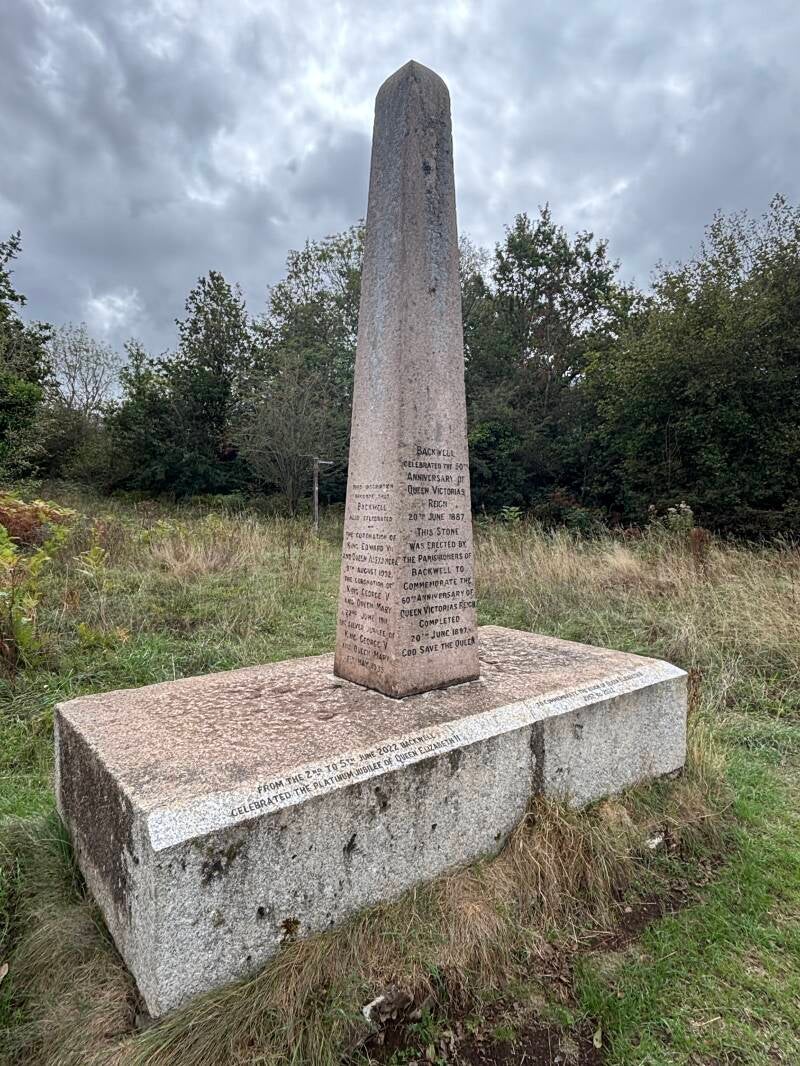
- Follow the track, which passes the site of a former 18th Century Warrener’s House, to the Jubilee Stone. The Jubilee Stone in Backwell is a granite obelisk erected on 20 June 1897 to commemorate Queen Victoria’s Diamond Jubilee. Standing on the hillside above the village, it was deliberately placed as a viewpoint marker, offering wide, open prospects across the North Somerset landscape. Over the decades it has become a living historical ledger: the coronation dates of Edward VII, George V, George VI and Elizabeth II, along with the Silver, Golden and Diamond Jubilees of later monarchs, have all been added to its faces, turning the monument into a quiet chronicle of more than a century of royal milestones.
- Return to the road by retracing your steps past the Warrener’s Cottage. At the road, turn right along the road. You’ll see a ‘sharp deviation’ sign ahead as the road bears right. Ignore this and continue straight ahead onto the byway. Follow this route straight ahead on Backwell Hill, above the old Coles Quarry on the right. Continue ahead until the lane splits, and continue to follow the route slightly to the right.
- Eventually arrive in front of a long wall and ‘private no entry’ on a metal gate in front of Backwell Hill House, hidden in the woodland. The house began life as a shooting lodge in 1788, later doing time as a health resort before becoming a private estate again. In the 1930s its grounds hosted an altogether different pursuit: between 1935 and 1939, the Bristol Motor Cycle & Light Car Club ran an annual hill-climb here, with cars and motorbikes tackling a 550-yard course on gradients as steep as 1 in 7.
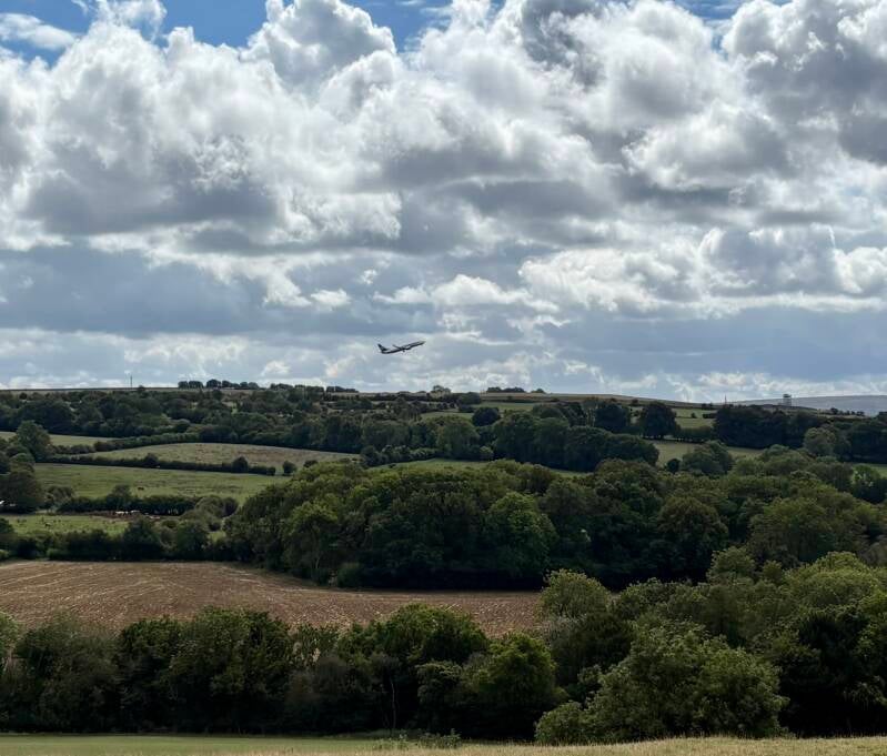
- Turn left, passing Home Farm on the right, and continue to the end of the farm lane. Turn right here onto a stony track running downhill, with woodland on the right and fields to the left. There are views to the left towards Bristol Airport at Lulsgate. Continue all the way on this route to a T Junction of paths, in front of woodland, and turn right.
- At a bridleway crossroads, continue straight ahead and eventually join a tarmac road. It’s a Private Drive that leads down to Chelvey Batch. At the end of this drive, turn right and c.25 metres ahead look for a metal gate on the right-hand side. It’s a Bristol Water site, but also a public footpath.
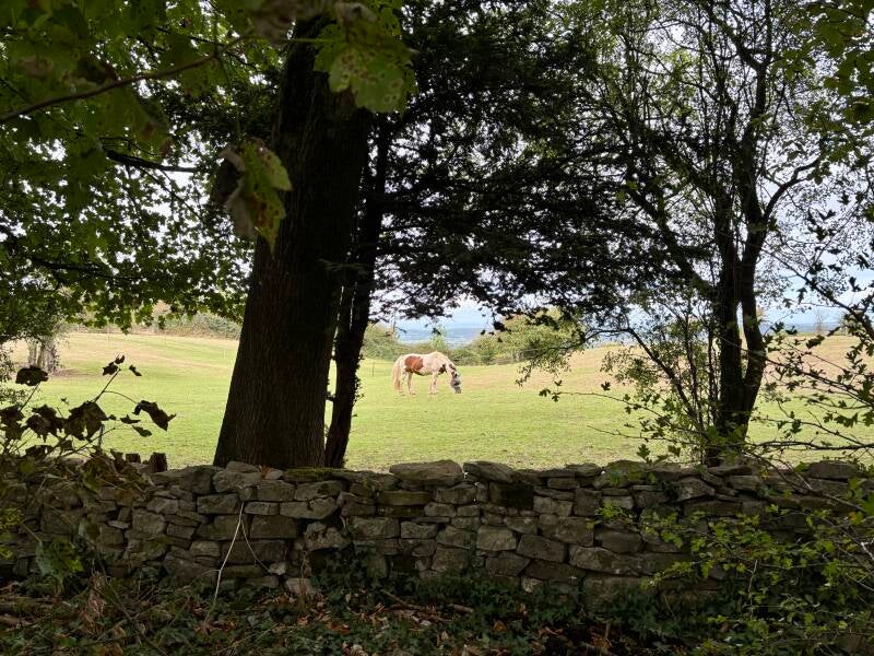
- Pass through the gate, and head to the left. The route is heading in the direction of Backwell Church, which you’ll soon see on the horizon. It’s largely a level and straight route from here. The path starts out on a gravel path, and then passes into fields, likely to be shared with grazing sheep. The route is clear and waymarked.
- You soon approach Chelvey Farm. Pass through a wooden gate that exits the field in front of the building that sits to the left of the main farmhouse. The path routes around this building and arrives on a driveway at the entrance to Chelvey Farm.
- Continue along the lane, passing some lovely cottages, still heading towards the church. The quiet lane curves around in front of Sores Court. This handsome old farmhouse has a remarkable history — and a higher level of national heritage protection than you might expect. See the Notes for the story of Sores Court and why this apparently ordinary farmhouse is a Grade II listed building.*
- As you round the corner, within a few metres, join a footpath to the right that runs along the wall of Sores Court. It’s a well-worn village footpath that continues into the next field and up to a gate onto a road. This is an area of Backwell known as Church Town.
- Cross the road carefully – this is the road to Backwell’s Recycling Centre. Make your way onto Church Lane, and continue on the pavement past the village Primary School. The pavement soon ends, and the road narrows on the approach to the church. Take care here.
- You’ll soon see a large wall immediately in front of you, where Church Lane starts to bend to the right. Look for the footpath sign pointing to the left up a residential driveway. Before continuing, I strongly recommend the short detour to St Andrew’s Church. Follow Church Lane around to the right to the church entrance, and take a look at Backwell Court along the road beyond too, then return to this point. See the Notes for more about the church and the remarkable memorial in its churchyard.
- Back at the footpath sign on Church Lane, head to the left up a residential driveway. Immediately pass a wooden gate of Coombe House. The footpath leads off to the right just beyond this gate along the line of a low wooden fence on your left, and passing the Church graveyard to the right.
- Pass through a metal kissing gate into a field. Notice there are two route options here: continue straight ahead across the field on a distinct path. At the lower part of the field the grass is quite long, uncut or ungrazed – you’d get wet trousers and shoes passing through this section if it was wet. Continue into the corner of the field.
- Leave this field through a wooden kissing gate with a sign marker for Backwell Round. The route passes between hedges and wooden residential fences to join a driveway, and then arrives onto Church Lane. Turn left.
- Soon arrive at the main road (A370) and cross to the right to make your way to The George.
Additional Notes
What Is Backwell? A Parish Looking for Its Village
Drive through Backwell today and, sooner or later, you'll pass a sign in someone's front garden: Stop the this, Save our that.
They've been a fixture of the place for some time now, as much a part of the scenery as the church tower or the Jubilee Stone. But the sign-owners are arguing about something that has never quite had a fixed shape to defend — because Backwell, in any meaningful sense, was never really one village at all.
It began as a name on a charter, not a place on the ground.
In the 1260s, Henry III granted the Manor of Backwell — held then by the Rodney family — a weekly market and an annual fair on the feast of St Matthew, to be held "in perpetuity." A few decades later, in 1318, Edward II licensed the same family to keep a rabbit warren on the hillside, close to today's Jubilee Stone; by 1323 they held a deer park of 140 acres besides.
All of this was granted to a manor called Backwell — a name the Domesday Book had already recorded two centuries earlier as Bacoile, "the spring behind the ridge" — and yet none of it required, or created, a settlement called Backwell.
What existed on the ground was Farleigh, Church Town, West Town, and the smaller Downside and Moorside: working hamlets, scattered across the parish, each with its own fields, its own farms, its own identity. "Backwell" was the administrative roof over them, not a place you could stand in.
For five centuries that arrangement barely needed testing. The fair was held in the field by Farleigh's own inn — later renamed The George — and Church Town held the church, the manor house, and, in time, the school. Each hamlet went on being itself.
The pressure that eventually reshaped all of it didn't come from the manor at all — it came from the road and the railway, and it arrived from opposite directions for different reasons.
The turnpike through Farleigh, already old by the 1820s, only became a proper route to the coast once Weston-super-Mare's growth as a resort gave Bristol traffic somewhere worth driving to; that road is today's A370.
The railway arrived independently in 1841, slicing through the parish on its way from Bristol to Exeter, with a station whose sole job, at first, seems to have been serving the desired growth of Nailsea — the station was simply called "Nailsea" for over sixty years, and wasn't renamed "Nailsea and Backwell" until 1905, by which point Backwell's own population had grown enough to demand equal billing on the sign.
That station, and a new Station Road required to reach it, did more to reshape Backwell than any charter had in the previous six hundred years. Houses were raised along its length.
A crossroads formed where it met the A370, and the four quadrants that crossroads created are still how residents mentally divide the village today. Infill spread outward from there, thickest nearest the railway line. Strip development connected the cross roads to the old hamlets at Farleigh and West Town. Church Town held its shape rather better, partly because its ecclesiastical and manorial buildings left less room to build between them, and partly by accident: the quarries at Coles and, across the way, at Flax Bourton, boxed the hamlet in on ground nobody could build on anyway.
By the 2011 census the parish that once numbered perhaps a thousand people held 4,589 — a village-sized population spread across what had been five separate small places, now largely grown together. And the growth hasn't stopped: current proposals under discussion would add substantially more, on land many residents regard as the last green gap left. Hence the signs in the gardens.
It's a reasonable question to ask what, exactly, those signs are trying to save — a charter-era rural landscape that never had a single village to lose, or the mid-20th-century infill that first closed the gaps between Farleigh, West Town and the crossroads, and which is itself now old enough to feel like the 'character of Backwell' worth defending?
Backwell has been redefining its own edges for seven hundred years, a field and a hamlet at a time. The genuinely open question, on the evidence of everything this walk passes, isn't whether that will continue. It's simply where it stops?
A Church Worth Stopping For
St Andrew’s sits at the heart of Backwell’s story — a church that is both deeply old and unmistakably alive, carrying its medieval fabric forward into a modern, outward‑looking parish. The building itself has roots in the 12th and 13th centuries, with later Perpendicular work giving it the tall, light interior that still defines it today.
Its memorials read like a quiet ledger of village life: farming families, rectors, benefactors, and the names of those who left Backwell for wider worlds and never returned.
Among them, the Garnetts recur more than once, a reminder that the family who later shaped Backwell Hill House had already woven themselves into the parish’s memory long before the Victorian and Edwardian expansions on the hill.
St Andrew’s today is a busy, welcoming church — concerts, community events, children’s groups, and a congregation that fills the building with the kind of energy that makes its long history feel continuous rather than distant.
In the churchyard stands one of Backwell’s most arresting memorials: a tall crucifix carved by Arthur George Walker, the sculptor behind the Emmeline Pankhurst statue near Parliament and the Florence Nightingale memorial in Waterloo Place.
Walker created it for William Garnett, in memory of his eldest son Pat, a young Royal Flying Corps pilot killed on the Western Front in 1917. For decades the crucifix stood in the grounds of Backwell Hill House, weathering in the open until rust and ivy began to claim it. In 1997 it was moved to St Andrew’s, cleaned, stabilised, and set among a small cluster of later names — a new gathering of remembrance around an older grief.
Its presence gives the churchyard a striking focal point: a piece of national‑level sculpture rooted in a very local story, linking Backwell’s hillside houses, its parish church, and the long shadow of the First World War in a single, eloquent monument.
Sores Court – a nationally important house hiding in plain sight
It would be easy to walk past Sores Court without realising quite how important it is.
The farmhouse traces its origins to the mid-to-late 17th century, when prosperous yeoman farmers were consolidating land on the Backwell hillside. But Sores Court is considerably more than a handsome old farmhouse: Historic England has designated it Grade II*, a category reserved for buildings of “more than special interest”.
First listed in 1984, Historic England describes Sores Court as a “superior vernacular farmhouse”. Much of its historic character survives. Its exterior includes mullioned windows, a substantial projecting porch and historic leadwork, while inside are moulded beams, panelling, a substantial fireplace and an early dog-leg staircase with turned balusters. A rainwater hopper carries the date 1710, providing a tangible reminder of the building's continuing history.
Grade II* is the middle of England's three statutory listing grades and is reserved for particularly important buildings. It represents a small minority of all listed buildings, placing Sores Court in a very different category from the many ordinary historic buildings that walkers encounter in the countryside.
And that is perhaps the most interesting thing about Sores Court. This is national heritage hiding in plain sight.
There is no grand parkland entrance, visitor centre or imposing estate announcing its importance. For much of the time, it is simply a house beside a quiet lane in Backwell — somewhere you might pass while walking the dog.
Next time you do, look a little more closely. Behind those walls is a remarkably well-preserved survivor of the agricultural world that shaped Backwell more than three centuries ago.
Sources and Local History
This story has been pieced together from local research rather than the usual online pub directories, or discussions with long serving landlords raised in the village.
Particular thanks are due to Lilian Christine Pearce, whose The Story of Backwell records much of the village's history and traditions. Pearce's love for Backwell was plain to see, and her work is an invaluable reminder of how much local knowledge can disappear unless somebody takes the trouble to write it down.
I have also drawn on Richard Ivens' Backwell Common – Uncommonly Interesting, a wonderfully detailed piece of local research which brings together the history, buildings, landscape and people of Backwell.
Further information has come from the local history collection at Nailsea Library, including material relating to Backwell's former inns, schools, farming communities, mines and village life.
These sources are particularly valuable because this walk is about the Backwell that can be easily missed. Much of its history isn't signposted or displayed — it survives in old buildings, field names, lanes, memories and the landscape itself.
With thanks to all those who have recorded, preserved and participated in Backwell's local history for those of us discovering it today.