

The Quarrymans Arms, Box Hill
The Walk: Hollow Mountain & Secret Skies: The Box Hill, By Brook & Brunel Circular, 6.4 miles
Try this Pub & Walk
Pull up a chair at The Quarrymans Arms for a moment, and look out over the valley. The best view in Wiltshire.
On the surface, this is a cracking pub walk: you get grand views from Box Hill Common, a scenic drop down to the quiet water-meadows along the By Brook, and a wander through Box village—where you can spot everything from an 18th-century "Blind House" lock-up to the childhood home of the creator of Thomas the Tank Engine.
But here’s the thing. If you glance at an OS map of this route, your eye is immediately drawn to a pair of straight, parallel dotted lines stretching for nearly two miles between Corsham and Bath. That’s Brunel’s Box Tunnel. But a plan-view map of this tunnel only gives you half the story.
Lean in a bit closer, and you realise this landscape, this hill is practically hollow. Beneath your boots lies an unseen, multi-storey subterranean world: miles of hand-cut Victorian stone quarries, WWII bomb proof munitions factories, underground railway platforms, and Cold War command bunkers that even earned RAF Rudloe Manor the local nickname of "Britain's Area 51."
It’s a cracking pint and a proper slice of countryside, with an underworld most walkers tread straight over without ever knowing it's there. Lace your boots up—we've got some exploring to do.
About The Quarrymans Arms, Box Hill

Last visit: October 2026
When I first realised The Quarrymans Arms was part of the Butcombe Brewery portfolio, I’ll admit to a brief moment of hesitation. Corporate ownership often brings a predictable formula: uniform menus, standard decor, and a slick, cookie-cutter aesthetic planned by interior designers back at head office. It didn't feel like the right association I'd imagined for the gritty, dust-dusted pub you'd expect to represent the hard-working stone-cutters of Box Hill, even if that's all historical context now.
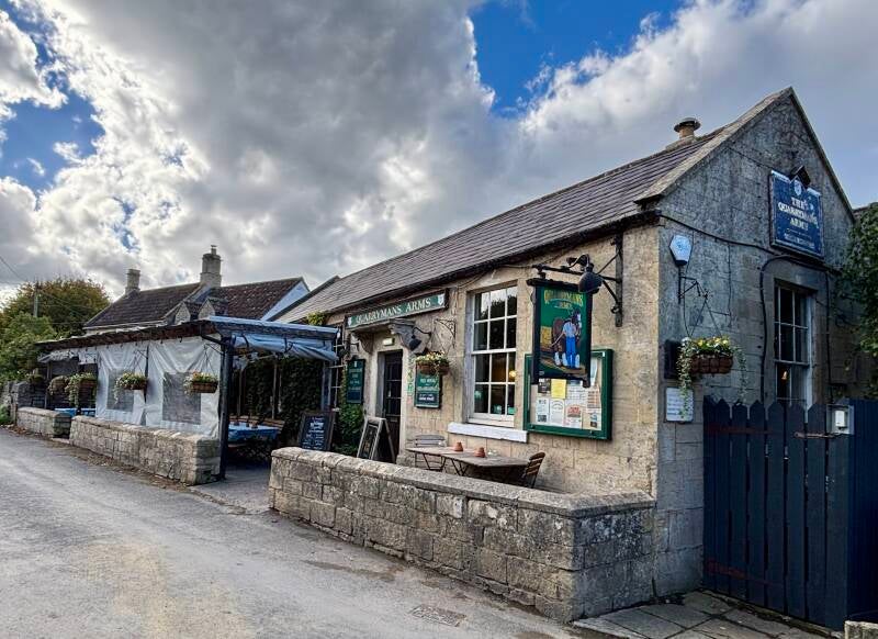
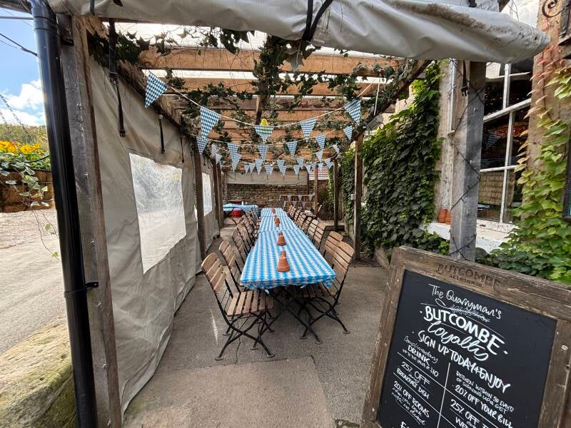
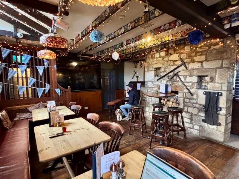
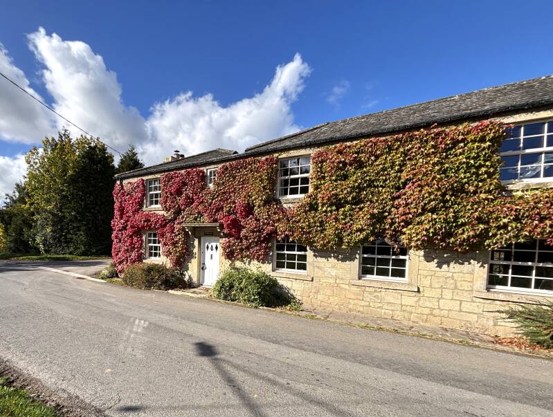
The building has the understated look of a single-storey village hall, fronted by a heated pergola terrace decorated for outdoor Oktoberfesting. Step through the front door, and my corporate skepticism vanished.
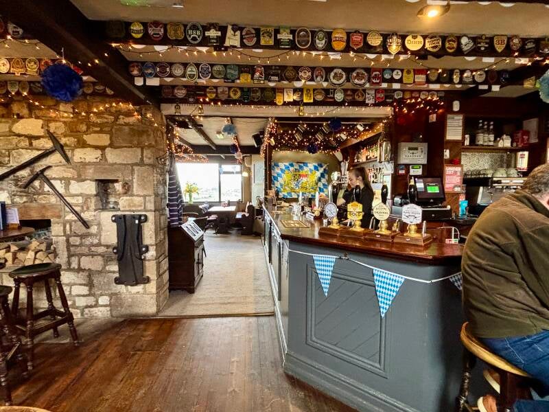
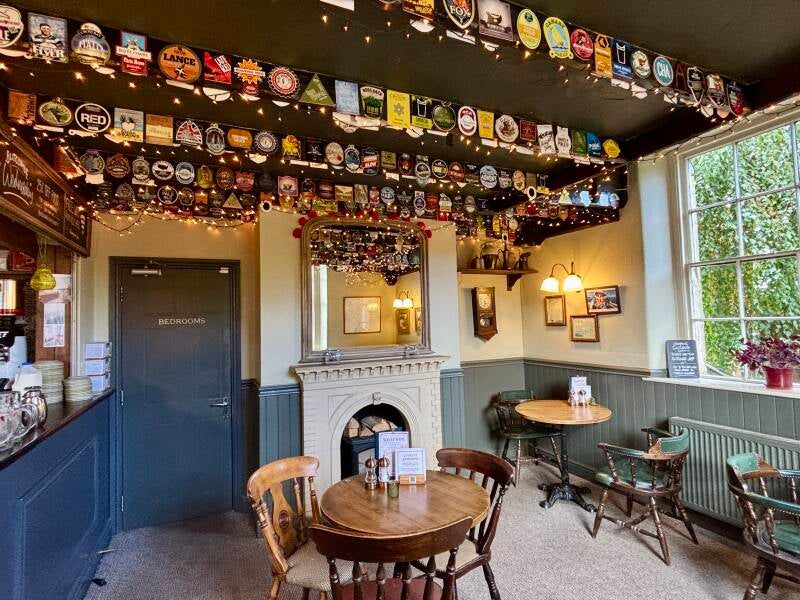
First, there's a genuine, warm welcome at the bar—something no brand guideline can mandate. To the right sits a cosy side room, its ceiling completely carpeted in hundreds of colourful ale pump clips: a testament to the pub's independent days before the tied-house era. And credit where it's due: the pint of Butcombe Original was kept impeccably well, and paired with a menu that was more good grub than gastro, reasonably priced, and beautifully served.
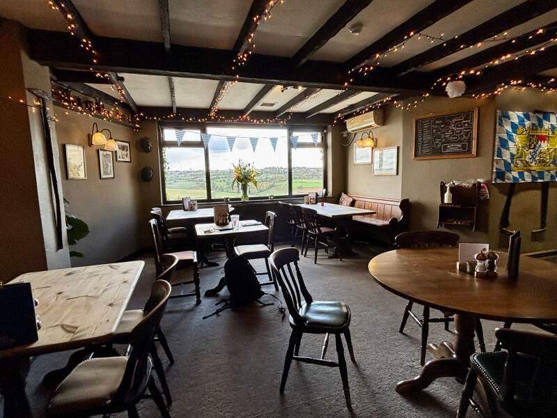
The real magic, however, lies at the back of the building. As you step into the rear dining space, you suddenly realise the hillside falls away dramatically beneath you. A massive picture window frames a jaw-dropping view straight down into the lush By Brook valley with Colerne on the hill side opposite—a window seat that must surely be the most heavily requested booking in the parish.
All around the walls are reminders of the hill's true identity: rusted stone-saws, iron picks, old photographs, and news clippings documenting the families who lived and died by the stone. There's a hand drawn map of the chambers underneath us, cut in the 130 years of intense quarrying following Brunel's arrival here in 1838.
But this building began its life earlier, in the late 18th century, as a humble row of three stone-workers’ cottages. Following the Beerhouse Act of 1830 and the sudden arrival of (eventually) thousands of navvies digging Brunel's tunnel shafts in the late 1830s, the cottages began selling ale to the thirsty workforce. The 1851 census, resident Joseph Head was officially recorded as a 'Beer-House Keeper'.
Twenty years later, landlord Thomas Bunting formally named the premises The Carpenter’s Arms — which seems a curious choice for a trained shoemaker! But its true identity was forged in 1889 under Thomas Dovey Hancock (a local stone labourer) and his wife Sarah, which is when it became known as The Quarrymans Arms.
Sarah famously locked her children inside in the small hours of the morning, hoisting two barrels of beer on a shoulder yoke (a shaped wooden beam contoured to rest across a person's shoulders that allowed two barrels to be balanced) to walk out into the dark of Box Hill common to feed the quarrymen before their shifts. Her husband, Thomas, tenanted local farms - Salt Box Farm was one, passed on this walk - specifically to grow hay and straw for the pit horses kept underground for months at a time to haul multi-ton blocks of Bath stone.
Box Common itself remains today what it always was—a quiet scattering of cottages, but without the massive local trade working up a thirst beneath the surface. Yet this pub thrives, drawing in walkers & cyclists, curious travellers, and locals from nearby Rudloe, Westwells and up Quarry Hill from Box village.
So it turns out The Quarrymans Arms offers the best of both worlds: the consistency and quality of a great regional brewery, without ever losing sight of the hard-working quarrymen whose sweat carved out the very ground beneath your chair. Raise a glass to them.
Pub Key Information
| WEBSITE | https://butcombe.com/the-quarrymans-arms-wiltshire |
| ADDRESS | The Quarrymans Arms, Box Hill, Corsham, SN13 8HN |
| PHONE | 01225 743569 |
| WHAT3WORDS | ///chefs.inclines.nudge |
| PARKING | Car park to the side of the pub. |
| LOCATION | Box Hill is to the south of the A4 between Corsham and Box (Chippenham to Bath road). It's the southern end of the Cotswolds Area of Outstanding Natural Beauty. |
| HANDY FOR | Corsham; Castle Combe; Cotswolds; Bath |
Walk Overview
While the step-by-step instructions guide you turn-by-turn, it helps to understand that this route is a story told in three distinct 'acts'.
-
Act I: The Common & The Hollow Hill. Starting from the pub on Box Hill Common, you traverse a high limestone plateau where vertical air shafts (on the OS map) hint at the vast voids below. You'll drop toward the line of the GWR railway to cross the tunnel mouth, taking in sweeping views across the valley.
-
Act II: The Village in the Gap. Leaving the high ground, the trail descends into Box village. Here, history sits right beside the rails: Lorne House, where a young Wilbert Awdry listened to steam engines struggling up the 1-in-100 gradient in the tunnel and conceived Thomas the Tank Engine; the 18th-century "Blind House" jail; and St Thomas a Becket Church.
-
Act III: The Quiet Industrial Valley. Pass Peter Gabriel's Box Mill to cross the By Brook, where the route shifts into a peaceful, green paradise. You follow the winding stream past historic farms and watermills, before climbing back past Rudloe Manor, and Rudloe Firs—where stone pioneer William Brewer once operated—to return to the Quarrymans for a well-earned drink.


Walk Key Information
| START/FINISH | The Quarrymans Arms, Box Hill, Corsham, SN13 8HN |
| PARKING | To the side of the pub |
| GRID REFERENCE | ST 873 706 |
| WHAT3WORDS | ///chefs.inclines.nudge |
| DISTANCE/TIME | 6.4 miles / 10.2 km; approx 3 hours |
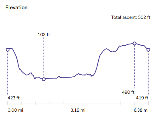
| ASCENT | 500 feet / 155 metres |
| PATHS/TERRAIN | Lanes, fields, farm tracks; pavements. Footpath gates. |
| DIFFICULTY | Moderate - only one steep section to climb out of the valley to the top of Box Hill. |
| PUBLIC TRANSPORT | Bus services between Chippenham and Bath stop on the A4 at Box and Rudloe. |
| TOILETS | At Selwyn Hall at the recreation ground in Box, although it was closed when I visited. |
| OTHER PUBS TO VISIT | The Queens Head in Box, community pub and music venue. Northey Arms, another Butcombe pub just outside the village on the A4, carries the name of an old Box family of 'unrestrained socialisers'. |
Walk Instructions: Choose what works for you
There are multiple ways to consume the route described below.
- Either follow the online Walk Directions below, or download and print a copy of the route.
- If you have the OS Maps App, you can follow a saved route directly in the OS App.
- Or download the GPX file for use with your chosen GPS-based tracker App, like Strava. Upload the file when you Create a New Route in the App.

Walk Directions
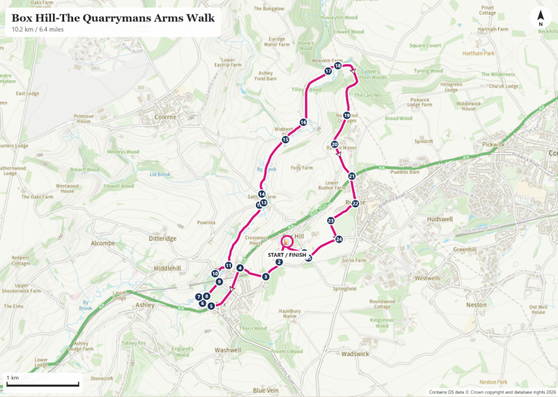
Looking at the pub, turn left on Box Hill to follow the lane that crosses Box Hill Common. Although perhaps used as if it was, this land was not always common land, having been owned by the Northey Family until 1923. Then, after a protracted legal battle, Box Parish Council bought the land from George Lacy of Grove Farm, securing it officially for the community who had kept livestock here for more than 100 years.
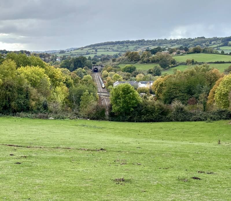
You’ll soon pass Grove Farm on the right and enjoy excellent views of the village below you, and the line of the railway as it passes through a cutting nearby. At the road junction, bear right downhill on Quarry Hill road in the direction of Box. (Waymark #2)
After 400 metres look for a Box Heritage Trail footpath sign into the field on your right. (#3) Pass through the wooden gate below you into the field, again with superb views as you descend towards the lower hedge boundary. Try to spot the remains of a WWII pillbox that was built to defend the tunnel!
Continue to the bottom right-hand corner of the field, directly above the West end of the tunnel, to pass through a metal footpath gate to the right, again following Box Heritage Trail signs. Continue on the path, dropping down to your left to another metal kissing gate that takes you into Lacy Woods, a small copse gifted to Box Parish Council by Mr Lacy. Follow the track through the woodland to reach the exit at the A4 where there’s a tunnel viewing platform and plaque. (#4) It’s a good spot, but the trees below need to be cut back to improve the view of this the more ornamental end of the tunnel. There was scaffolding over the tunnel mouth when I visited.
Take care when crossing the busy London Road – one of the original major artery routes radiating from London, initially as a coaching route, and the route to Bristol supplemented by Brunel’s railway. Go left over the road bridge and make your way to Box High Street. On your right, you’ll soon pass Lorne House, the former home of the Reverend W.Awdry, author of Thomas the Tank Engine and known as Journey’s End when he lived there. It was here, listening to the rise and fall of engines on the 1 in 100 slope of the tunnel, that he began to imagine the characters and stories that became The Railway Series — the soundscape of Box Tunnel turning into the voices of Thomas and his friends.
Take time to explore Box. An information board in ‘The Pound’ points out all of the places of interest in the village. As well as places to eat & drink – Birdhouse Café; Toast; Vine & Plate; and the Queens Head – there’s plenty to see, including The Blind House, a small, windowless village jail from the 1700s, built to hold drunks, petty offenders and wayward travellers overnight. Its thick stone walls, studded door and domed roof were designed to be escape‑proof, a visible reminder of parish authority in the days before a police force. It’s one of Wiltshire’s best‑preserved examples, a curious little monument to the village’s sterner past.
Continue along the High Street and turn right onto Church Lane (#5) towards St Thomas à Becket, Box’s Grade I listed parish church. It dates back to the 12th century. Built on the site of a Roman villa and later reshaped by medieval masons, it grew into a substantial pilgrimage church after a chapel was dedicated to Thomas Becket in 1190. The church was closed when I visited, but I spotted a curiosity in the graveyard: a pyramid-shaped gravestone, said to have been shaped so that a relative could not dance on the grave!
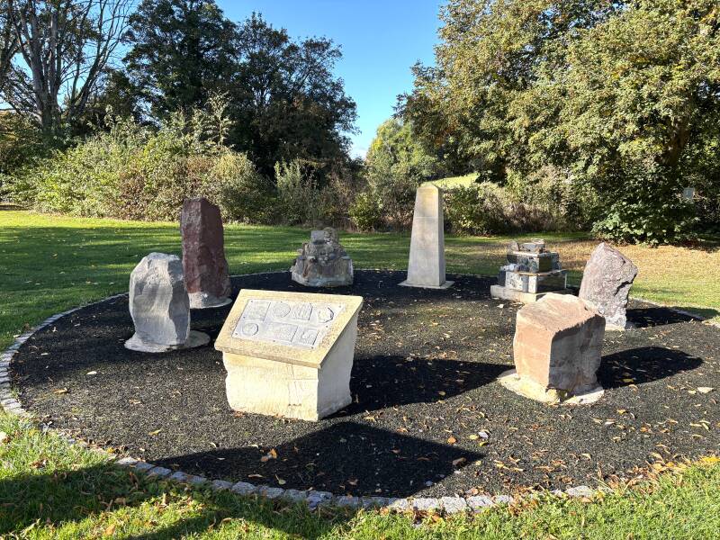
Continue on the lane to the side of the church (#6), then follow the footpath sign to the right, dropping down to a footbridge over the By Brook (#7). Turn right on a wooded footpath to follow the stream back towards Box, and exit at the recreation ground car park. To the right, back along the driveway up to the main road, is Selwyn Hall (library and toilets). Diagonally to the left is the ‘Box Rock Circus’, (#8) a community educational sculpture project to explain the age and history of rock and stone. From the Rock Circus, follow the tree line to the opposite end of the playing field, keeping the BMX track to your left.
Continue onto a gravel footpath to the left-hand side of a row of terrace houses, signposted for the Macmillan Way. At the railings (#9) turn left on Mill Lane to pass under the railway bridge.
Pass Box Mill on your right, famously owned by Peter Gabriel (lead singer during the better era of Genesis!). As you pass the mill entrance, immediately take the footpath to the right, signposted for the Box Heritage Trail and Macmillan Way. (#10)
This is the start of the section of the walk that traces the By Brook stream through the valley. The By Brook was once an industrious little river, powering a chain of mills that shifted with the needs of the valley — corn‑grinding in the medieval period, then fulling mills as Wiltshire’s wool trade boomed, and later paper and mixed industrial uses. Box Mill was a substantial operation: a three‑storey watermill working five pairs of stones, later supplemented by a steam engine when the By Brook’s flow proved unreliable. In the late 19th century grain was even brought in from a siding near Box Tunnel by aerial ropeway. Further along the valley, mills such as Drewetts Mill worked first for corn and later for fulling, part of the network that made Wiltshire one of the world’s great textile regions for several centuries.
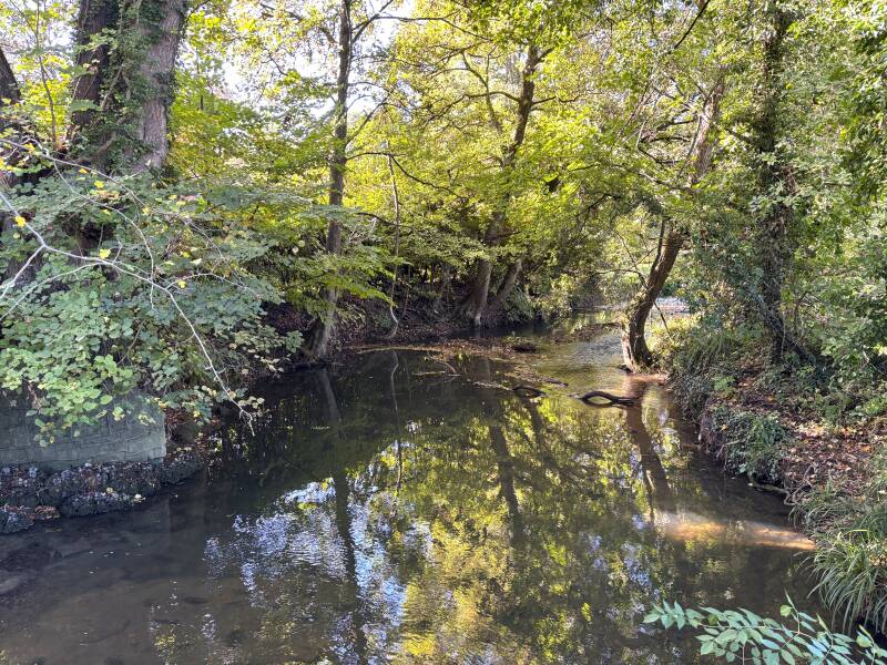
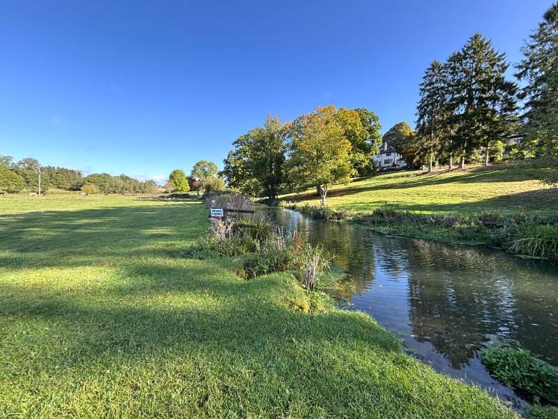
Continue initially along a well-made footpath to the side of the garden of Box Mill, passing over footbridges between willow trees before reaching a field. (#11) From here, the route through fields follows close to the bank of the stream as it winds up the valley. It’s shared with disinterested cattle in places. Sometimes the field path is clear, and at other places you have to seek out the footpath kissing gates.
As you approach the end of the second field break away from the riverbank slightly to continue on a less distinct grass path towards the hedge ahead. The exit is 10 metres below a metal farm gate. Pass through some wooden kissing gates to join a tarmac lane (#12). Turn right slightly downhill, and follow the road to the left at the junction.
At Salt Box Farm on your left take the stile opposite into the field (#14). The farm is a specialist Holstein farm, so likely there’ll be cows in the fields here. Continue straight ahead (not slightly left, as I initially did) to a corner point where the stream meets the hedge across the field. Here, pass through a metal footpath gate, and continue following Macmillan Way signs.
As you cross the next field, try to spot the tower of Colerne Church high above you, or pick out the Quarrymans Arms on the other side of the valley! Continue to stay close to the line of the By Brook, making a line for Widenham Farm ahead of you. Exit the field onto a lane, (#15) continue straight ahead to pass the farm on your left. Follow this lane until it meets a gate into a field immediately in front of you. Enter the field and follow the contour of the slope on a clear footpath track towards woodland. (#16)
At the other side of the field exit into Tilley’s Wood via a metal footpath gate, continuing to follow the Macmillan Way again. Continue to follow this woodland path, soon breaking out of the woods to follow a fence line, with a field to your right. Reach a junction of footpaths and continue ahead, slightly downhill, to follow the blue Bridleway signs towards a crossing of the By Brook stream. Linger here for a chance to catch sight of a kingfisher. (#17)
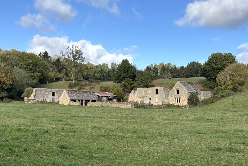
The abandoned buildings of Weavern Farm are to your left. It once formed one of the By Brook’s busiest mill sites. First recorded in the 14th century it worked for centuries as a fulling mill, beating and cleansing wool for the great clothiers of Castle Combe and Chippenham. By the 1700s it housed three mills under one roof; later it shifted to corn, then to paper‑making.
Stay on the path as it passes between two fields. Step across a stone slab on the path and bear right to follow the blue Bridleway signs on a farm track slightly uphill. (#18) Continue to climb upwards, more steeply now, to pass through a metal gate into Hungerford Wood. Stay on this farm track uphill. Eventually exit the woods, the track starts to level out finally. Continue on to ‘No Notion Cottages’ where the track becomes a tarmac lane. (#19)
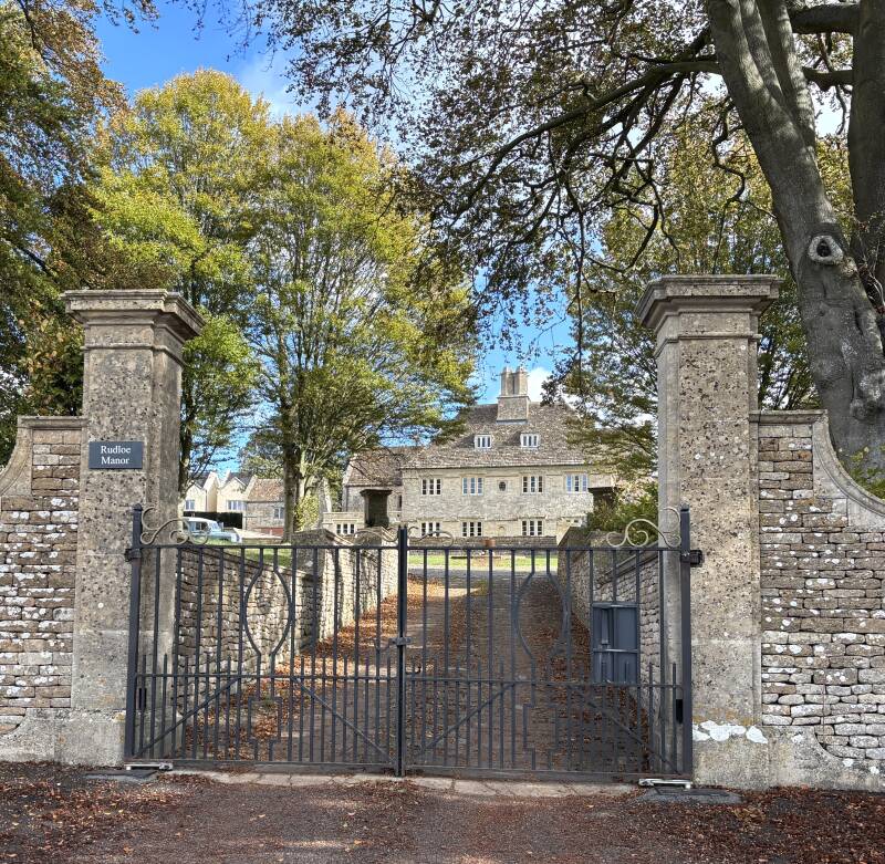
Continue on this lane as it passes above Rudloe Wood and curves to the left around a fabulous dry-stone wall. Views open out in the direction of Bath over the By Brook valley as you pass the entrance to Folly Farm, and then the fine gates of Rudloe Manor on your left. (#20) This fascinating estate has medieval origins but was more recently a top-secret military hub. In World War II, the estate became a RAF Box, later RAF Rudloe Manor, serving as HQ for No. 10 (Fighter) Group. Hidden beneath the surface in nearby disused Bath stone quarries was an extensive subterranean network of operations rooms and communications links that tied directly into Britain's wartime and Cold War defence infrastructure. Because of its high-security secrecy, underground facilities, and proximity to military intelligence networks, Rudloe Manor earned a legendary reputation in local and internet folklore as "Britain's Area 51", with declassified files later revealing it housed the Ministry of Defence's desk responsible for investigating UFO sightings.
Continue ahead on the lane all the way to the junction with the A4 at Rudloe Firs. Carefully cross over the A4 here to take Leafy Lane, signposted Neston. (#21) Underneath our feet here is a network of quarry chambers, including Brewer's Yard Quarry—a unique underground quarry at Rudloe Firs excavated by William Brewer that features a rare two-level design linked by a subterranean stone staircase.
Just beyond the entrance to the houses of Park Avenue on the right, pass the bus shelter, and then follow the footpath leading into into Leafy Lane Wood. (#22) Continue straight ahead on a woodland path ignoring routes off to the left. Just before reaching a field of horse enclosures, bear left to pass through a wooden footpath gate where the hedge meets the field. (#23) Join a public footpath with the enclosures on your right and sports fields on the left. This is the flat-top crest of Box Hill, with its labyrinth below.
Reach Boxfields Road, cross to the pavement and turn right along this quiet lane. (#24) Continue to a crossroads, with the old Tunnel Inn on your right, now a private house. We’re close to one of the shafts into Box Tunnel, just a few yards further on from here. The Inn was used as a make shift mortuary during the tunnel’s construction.
Turn right at the crossroads (#25) onto White Ennox Lane, and after 50m follow a footpath signposted to the left to the side of a cluster of houses.(#26) Continue straight ahead through the woods, soon passing the front door of Tisbutts Cottage to join a gravel driveway. Bear right and soon the Quarrymans Arms appears ahead.
Additional Notes
Box Hill - A Century of Stone, Steam and Secrecy
Imagine if you could pull back the turf of Box Hill Common like a rug, or slice straight down through the hillside to look inside. To look at an OS map is to see a 'plan' view from above: it shows a straight line for Brunel’s tunnel and a few cryptic references to ventilation shafts. But to really understand Box Hill, you have to look at its vertical architecture.
1. The Spark: Brunel Builds the Impossible (1836–1841)
While local stone had been prized for millennia—with the Romans carving Box stone to build their villas and grand baths long before Brunel ever set foot in Wiltshire—the vast, interconnected subterranean world we know today sitting under this hill was not built gradually over centuries. It was a 100-year explosion of intensity (1830s–1960s).
The catalyst was Isambard Kingdom Brunel's determination to complete his "grand design": the Great Western Railway.
By 1840, the GWR was being built from both ends, but it was split down the middle. Trains from London Paddington could only run as far as a temporary terminus in an Oxfordshire field near Faringdon, while trains from Bristol stopped at Bath. In between sat a frustrating "stagecoach gap"—where passengers had to climb off the train, haul their heavy luggage onto horse-drawn coaches, and bump along rough turnpike roads over the hills to bridge the divide.
The single remaining bottleneck standing between London and Bristol—and Brunel's ultimate dream of a seamless transatlantic link onward to New York—was the solid 1.8-mile wall of limestone at Box Hill. In 1836, critics called driving a tunnel through it 'an impossible, ruinous madness'.
To break the barrier, Brunel sank eight massive ventilation shafts (up to 300 feet deep and 25 feet wide) straight down from Box Hill Common along the railway line. Working in near-total darkness, 4,000 navvies worked 24-hour shifts using hand picks, gunpowder, and hand-cut timber. Every week, the workers consumed one ton of candles just to see, matched by one ton of explosives to blast the rock.
Flooding was a constant nightmare: underground springs breached the workings, requiring heavy steam pumps to prevent workers from drowning in the dark. Over 100 navvies lost their lives carving the tunnel. Yet when the two teams digging from the east and west finally met in April 1841, Brunel's alignment across nearly two miles of rock was off by less than two inches!
The Golden Key to the West
When the tunnel opened on June 30, 1841, the stagecoaches vanished overnight. London and Bristol were joined into a single continuous line, cutting travel time from an all-day ordeal to just over four hours. Decades later, this same GWR main line would extend straight under the estuary via the Severn Tunnel (opened 1886), connecting the industrial hearth of London directly to the rich mineral coalfields and steelworks of South Wales.
And right here at Box, in cutting through the mountain to complete his railway puzzle, Brunel unlocked a local goldmine: a 30-metre-thick seam of pristine Great Oolite Bath Stone. The tunnel didn't just carry trains—it proved the quality of the stone and provided the direct rail link needed to ship millions of tons of limestone to subsequently build Victorian London, Bath, and Bristol.
2. The Golden Century & The "Galley Slaves" (1840s–1930s)
Miners immediately followed Brunel’s spark, using his ventilation shafts and sinking new incline shafts from the common to carve outward using something called a "pillar and stall" method.
As captured in a framed 1934 Daily Sketch report hanging on the wall of The Quarrymans Arms:
-
The Manual Graft: Men worked in candlelit subterranean galleries driving 10-foot, double-handled saws into solid limestone like "galley slaves".
-
Tougher Than Coal: Welsh colliers brought over during boom periods quickly fled back to the Welsh valleys, "beaten by the hardness of the rock".
-
Pit Horses: Heavy draft horses wearing lamps on their harness were lowered underground to drag 10-ton blocks of stone through miles of dark tunnels. (Feeds grown at local farms by landlords like Thomas Hancock kept these horses alive deep in the darkness).
3. The Military Citadel: CAD Corsham, Burlington & Secret Skies (1936–1950s)
By the late 1930s, as commercial stone mining began to slow, the British War Office realized that these vast, hand-cut caverns were completely bomb-proof beneath 100 feet of solid limestone. The hill was quickly transformed into one of the most heavily fortified, top-secret military hubs in Western Europe.
-
Tunnel Quarry (CAD Corsham): Requisitioned in 1936, parts of the mines became the largest underground ammunition depot in Britain. Engineers cut two full-length underground railway platforms branching directly off Brunel's Box Tunnel deep inside the mountain, complete with subterranean locomotive sheds, a power station, and mile-long conveyor belts to move high explosives safely in the dark.
-
Spring Quarry ("Burlington"): Built at astronomical expense during the Cold War, this 35-acre subterranean city became Britain’s top-secret emergency seat of government (codenamed Burlington, Subterfuge, or Site 3). Designed to keep the Prime Minister, Cabinet, and 4,000 vital personnel safe during a nuclear attack, it contained its own underground lake, phone exchange, hospital, electric transport buggies, and a BBC studio ready to broadcast to a ruined nation.
The Secret Skies above Box Hill
While subterranean armies worked below, the ridge above became the nervous system for Britain's air defence:
-
RAF Rudloe Manor & The Fighter Command Operations Room: Perched on the hill just above the quarries, Rudloe Manor became Headquarters No. 10 Group Fighter Command during WWII, coordinating the air battle over Southwest England and South Wales during the Battle of Britain. Underground control rooms beneath the manor tracked radar plots of approaching Luftwaffe bombers across the night skies.
-
Cold War Radar & Space Tracking: In the Cold War, the hill evolved into the hub for the ROTOR radar network and secure satellite communications. Giant radio masts and radar dishes sprouted from nearby fields, linking ground control directly to high-altitude interceptor jets patrolling the skies above the Atlantic.
-
"Britain’s Area 51": Because RAF Rudloe Manor also housed the RAF Provost & Security Services—which officially logged, investigated, and archived every UFO sighting reported across the United Kingdom from the 1950s onwards—a mystique grew around the area. To locals and conspiracy theorists alike, the combination of windowless underground bunkers below and top-secret radar equipment probing the clouds above earned the Box Hill and Corsham ridge its reputation as Britain’s own "Area 51."
4. Parallel Worlds & The Silent Valley Floor
What makes Box Hill so extraordinary is that commercial stone mining continued right alongside these military sites until 1968.
Civilian stonemasons worked under candlelight with hand saws just hundreds of yards away from top-secret military zones, separated only by thick brick blast walls built deep in the rock.
And while men carved in the dark above, the By Brook valley floor below was the quiet engine that sustained it all. Its chain of old watermills shifted through time: grinding medieval corn, fulling woollen cloth to clothe the workforce, and later pounding pulp to produce fine paper. It is a fitting final thought that the land deeds for Fogleigh House, the mining indentures of stone barons, and the supply contracts for Brunel's railway were written on paper born from mills powered by the very water flowing through the valley below.
When commercial mining finally ended in 1968, the hand-saws went silent, leaving a century of incredible human effort sealed in the rock beneath your boots.
5. A Legacy in the Dark
When commercial stone mining finally ended in 1968, the hand-saws went silent, leaving a century of extraordinary human effort sealed in the silent rock beneath your boots.
The next time you travel the Great Western Railway between Bath and Chippenham, take a moment as the train approaches Box Hill. As the light in the carriage fades and you plunge into the deep darkness inside Brunel's tunnel—hundreds of feet beneath the quiet turf of Box Hill Common—picture the vast, unseen architecture wrapped in the earth all around you.
Imagine the miles of hand-cut galleries where quarrymen laboured by candlelight, the pristine stone that built some of Britain's finest cities, and the subterranean secrets that helped keep the nation safe through its darkest hours.
Other Pubs to Try in Wiltshire
Circular walk from Sherston to Easton Grey on the fringe of the Cotswolds.
6.3 miles
The Kennet & Avon Canal, from Bradford-on-Avon to Bath via The Hop Pole Inn.
11 miles